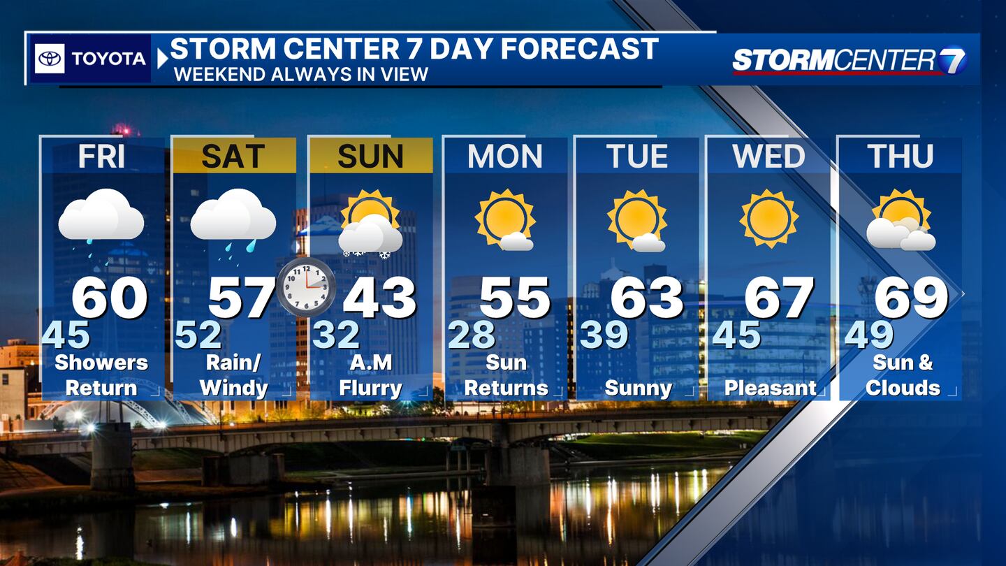
QUICK-LOOK FORECAST:
- Clouds sticking around
- More rain Friday and Saturday, ending as flurries
- Overall, staying mild
>> TRACK THE LATEST CONDITIONS: Live Doppler 7 Radar
DETAILED FORECAST:
TONIGHT: No weather issues this evening as clouds stick around and we remain dry, according to Storm Center 7 Weather Specialist Nick Dunn. Lows in the middle 40s.
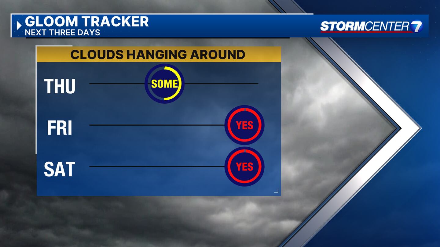
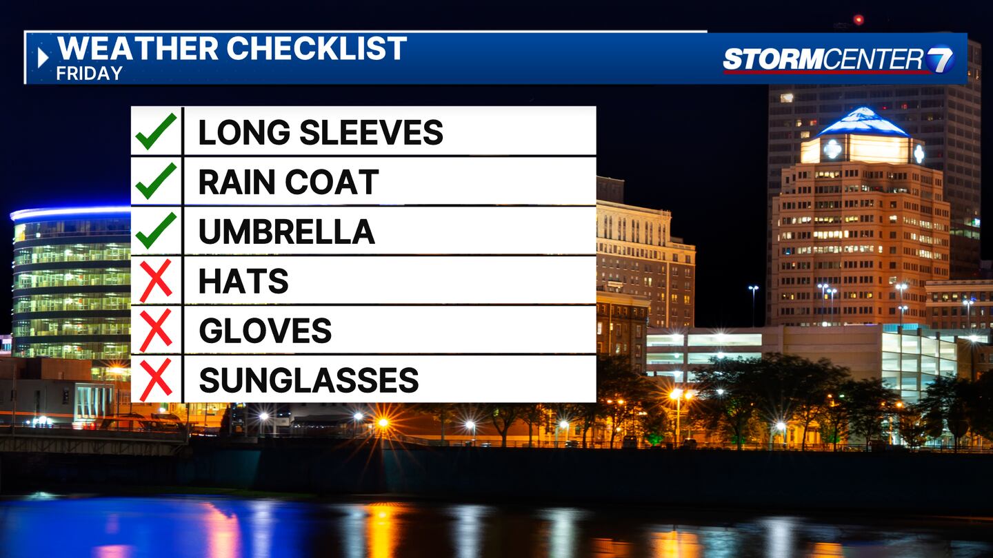
FRIDAY: Cloudy skies with light showers possible before noon. Steadier rain arrives into Friday evening and Friday night.
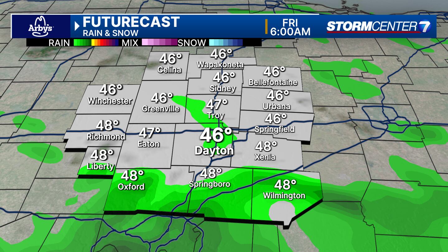
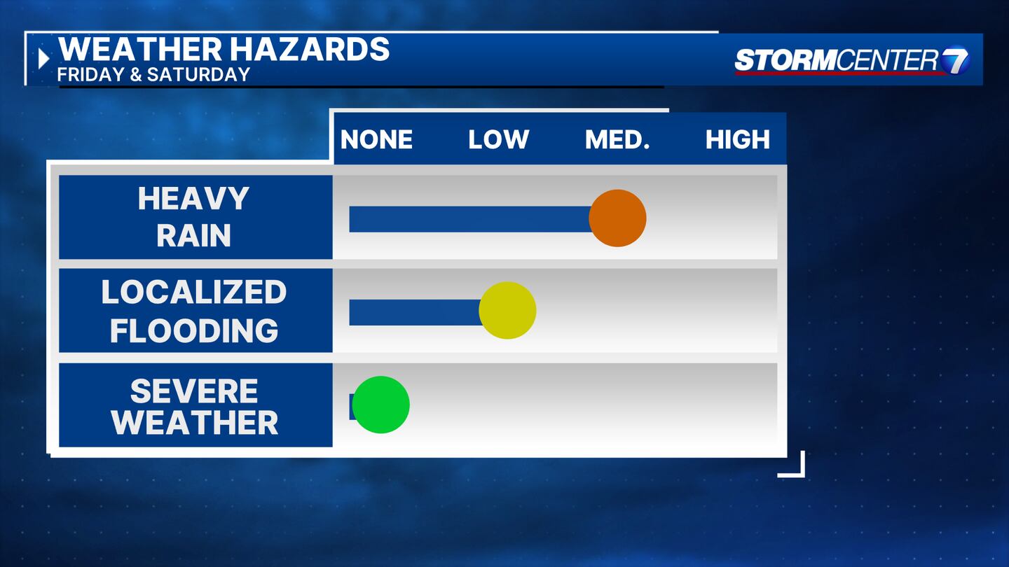
Mild with highs around 60. A rumble of thunder not impossible Friday night, but no severe weather.
SATURDAY: Cloudy skies hang around with rain showers and some could be steady at times. Breezy. Total rainfall amounts by Saturday night range from a half-inch to an-inch-and-a-half for most, with highs in the mid-50s. Colder air wraps in Saturday night into early Sunday, bringing a change to a brief period of mix or light snow. No accumulations really expected at this time, but we will update the forecast as needed.
SUNDAY: Mostly cloudy with a sprinkle or snow flurry possible before noon. Cooler and breezy with highs in the low to mid-40s.
MONDAY: Mainly sunny, with high temperatures in the mid-50s.
TUESDAY: Mostly sunny with highs in the mid-60s.
WEDNESDAY: Partly cloudy. Warm and breezy with highs in the mid-60s.
THURSDAY: Partly cloudy and warm, dry with highs in the upper 60s.
©2024 Cox Media Group


