QUICK-LOOK FORECAST:
- Not as cold tonight
- It is noticeably warmer starting tomorrow
- Rain train rolls in this weekend
>>TRACK THE LATEST CONDITIONS: Live Doppler 7 Radar
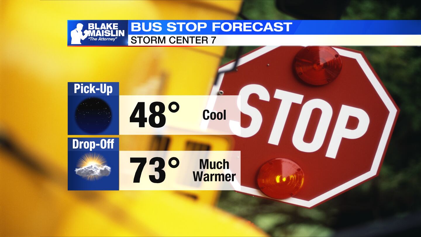
MONDAY: Storm Center 7 Chief Meteorologist Austin Chaney reports that this evening’s forecast will show mostly clear skies, but it will not be nearly as cold tonight. No frost or freeze concerns with low temperatures only making it to the low and mid-40s.
TUESDAY: Sunshine early, then clouds gradually filter in as the day progresses. Much warmer. Highs in the mid to upper 70s.
WEDNESDAY: Mostly cloudy with a stray shower possible. Highs in the lower to middle 70s.

THURSDAY: A mix of sun and clouds. Mainly dry. Temperatures continue to run much above normal in the low to mid-70s.
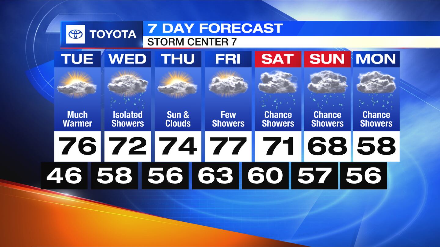
FRIDAY: A few rain showers are possible with highs in the mid to upper 70s.
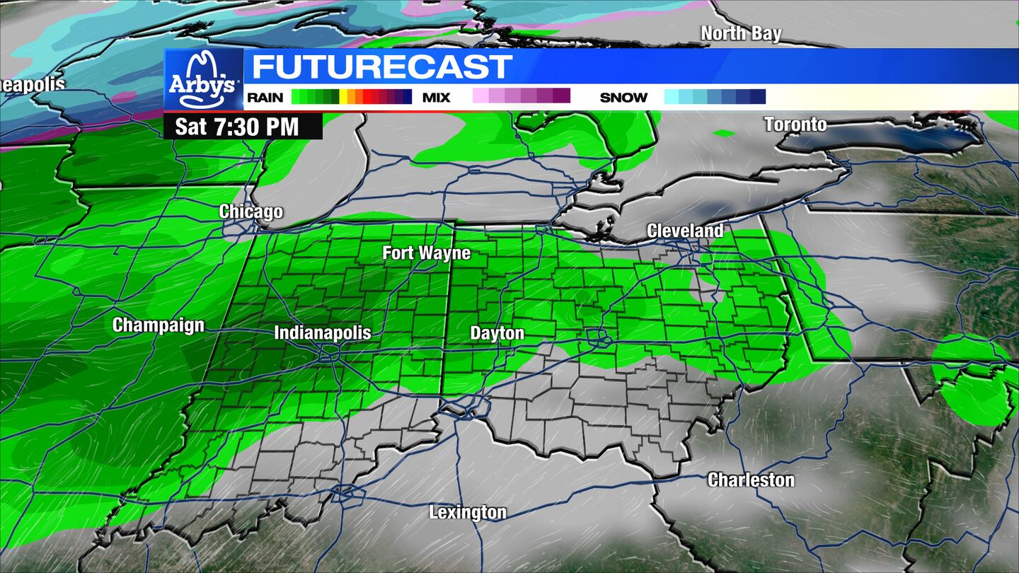
SATURDAY: Rain looking likely. Still warm with highs near 70.
SUNDAY: Mostly cloudy skies with continued chances for rain. Highs in the upper 60s.
MONDAY: Mostly cloudy with more showers. A cooling trend begins with highs only in the upper 50s.
©2023 Cox Media Group


