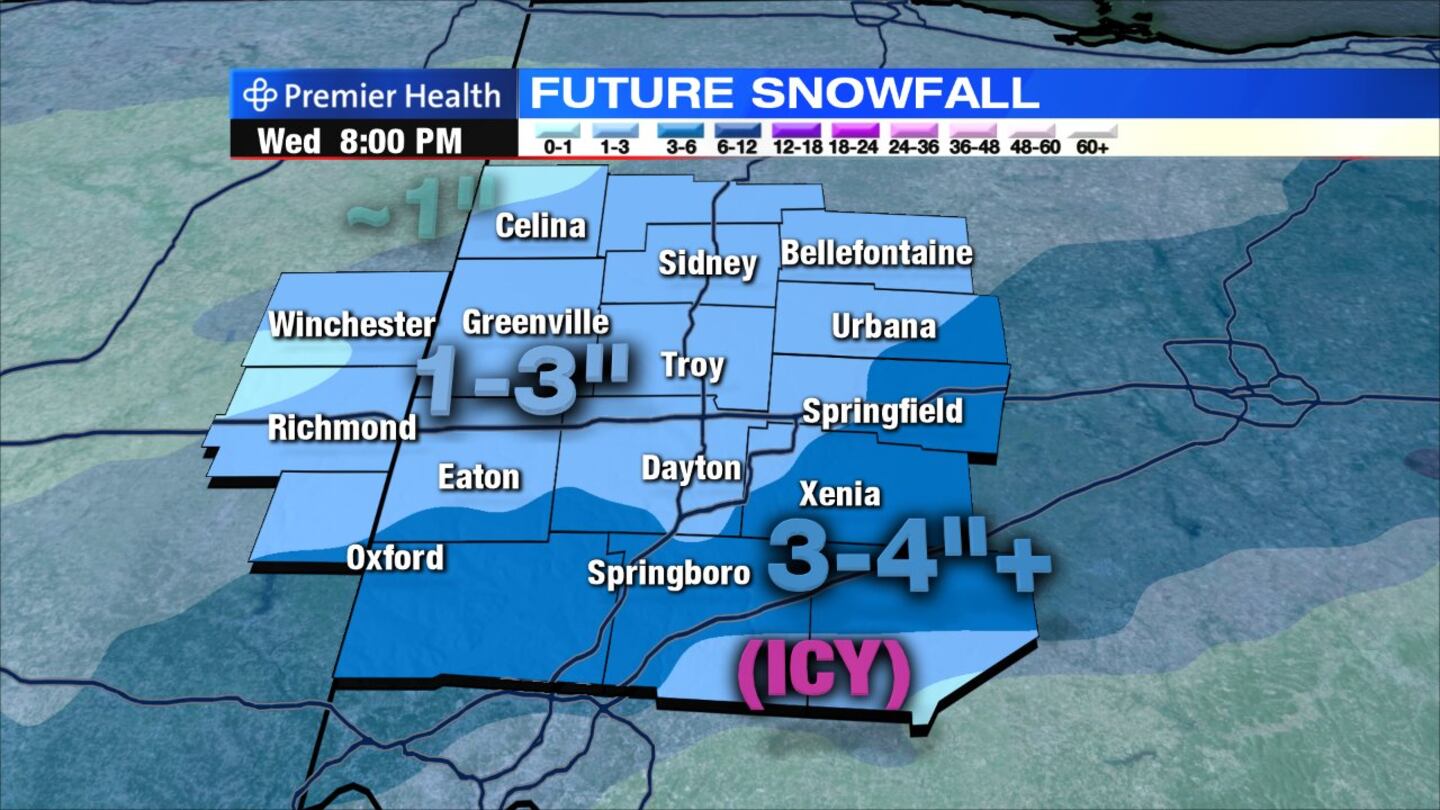
- Snow arriving overnight; Most will pick up 1 to 3 inches
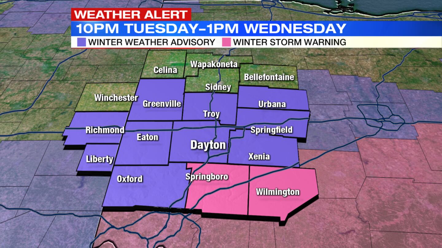
- UPDATE: Winter Storm Warning, 10 tonight through 1 p.m. Wednesday: Clinton, Warren
- UPDATE: Winter Weather Advisory, 10 tonight through 1 p.m. Wednesday: Butler, Champaign, Clark, Greene, Montgomery, Darke, Preble, Miami, Union (Indiana), Wayne (Indiana)
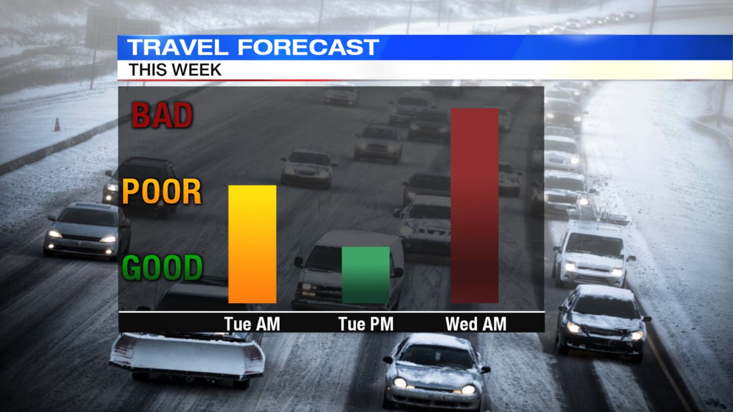
- Expect messy morning commute
Download the WHIO Weather App
DETAILED FORECAST
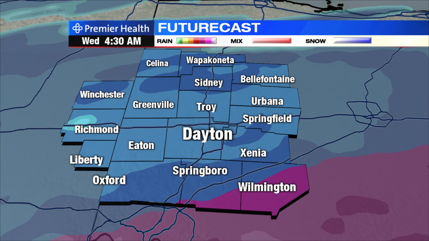
Tonight: Snow likely after midnight, continuing through the early morning. Snow may mix with freezing rain and sleet near I-71. Temperatures will hold in the 20s.
>> Snow returns this morning, more on the way
Today: Snow will taper in the morning. Accumulations of 1 to 3 inches expected for Dayton and areas north and west. Amounts as much as 4 to 5 inches possible southeast of Dayton to near I-71. Some ice accumulation, up to two-tenths of an inch possible in the far southern Miami Valley. Skies will remain mostly cloudy into the afternoon with a chance of flurries or light snow showers redeveloping in the early evening. Highs will hold in the upper 20s.
>> School business closings & delays
Thursday: Ready for some sun? Expect partly sunny skies and chilly temperatures with highs in the upper 20s.
>> Winter Weather Awareness: How does salt help melt ice on roads?
Friday: Mostly cloudy skies. Some flurries will be possible in the far northern Miami Valley. Highs will rebound into the upper 30s.
Saturday: Expect mostly cloudy skies with a chance for rain and/or snow showers late in the evening. Highs will be near 40 degrees.
Sunday: Rain or snow showers will be likely in the morning, changing to snow showers in the afternoon as temperatures fall through the 30s.


