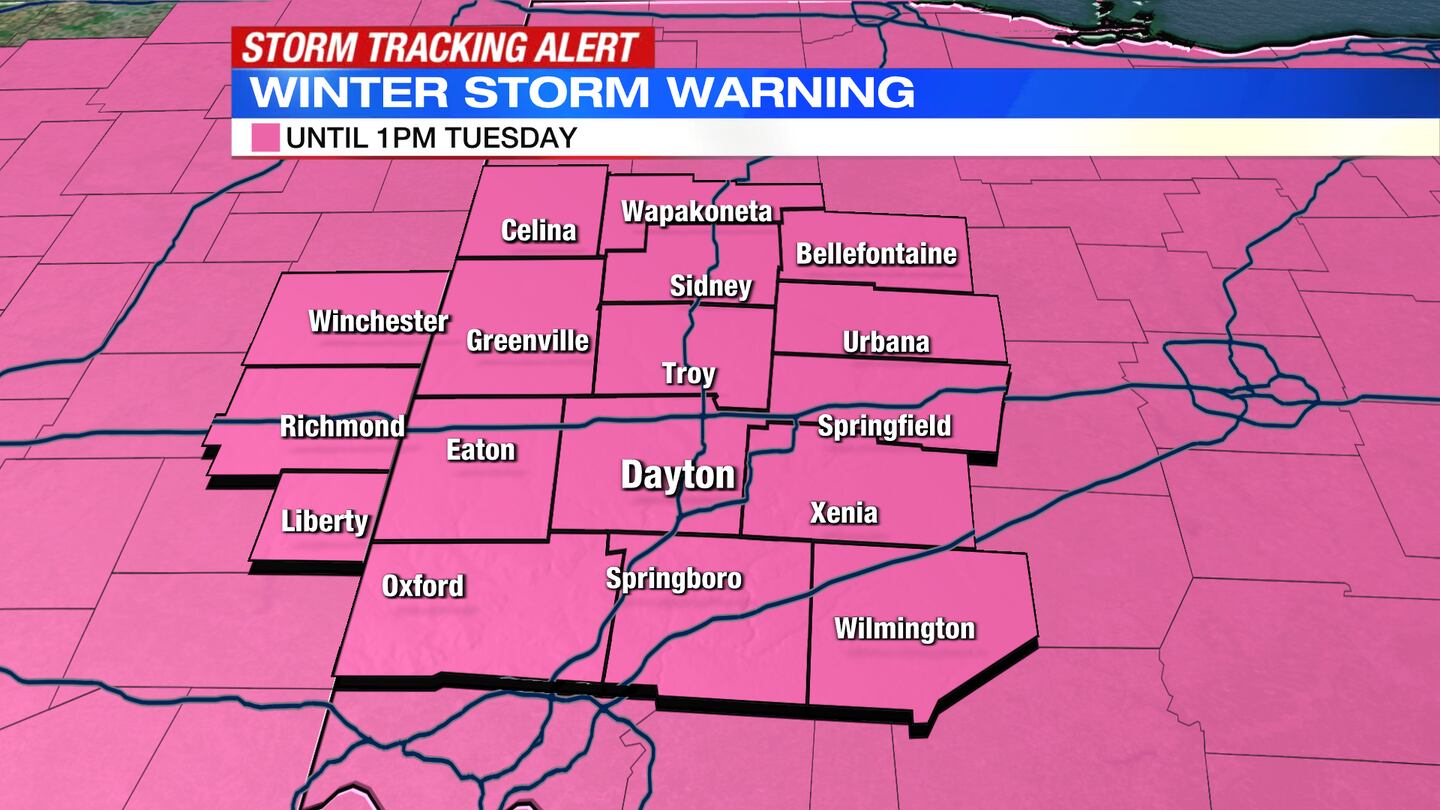
A Winter Storm Warning is in effect until 1 p.m. Tuesday.
QUICK-LOOK FORECAST:
- Winter Storm Warning
- Significant snow ending tonight
- Below zero wind chills
>>TRACK THE CONDITIONS: Live Doppler 7 Radar
DETAILED FORECAST:
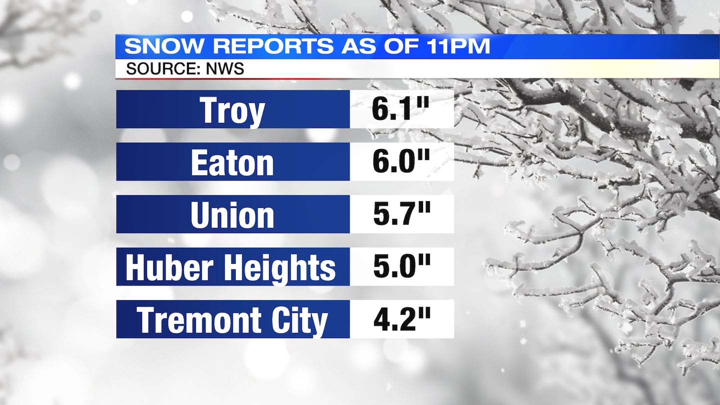
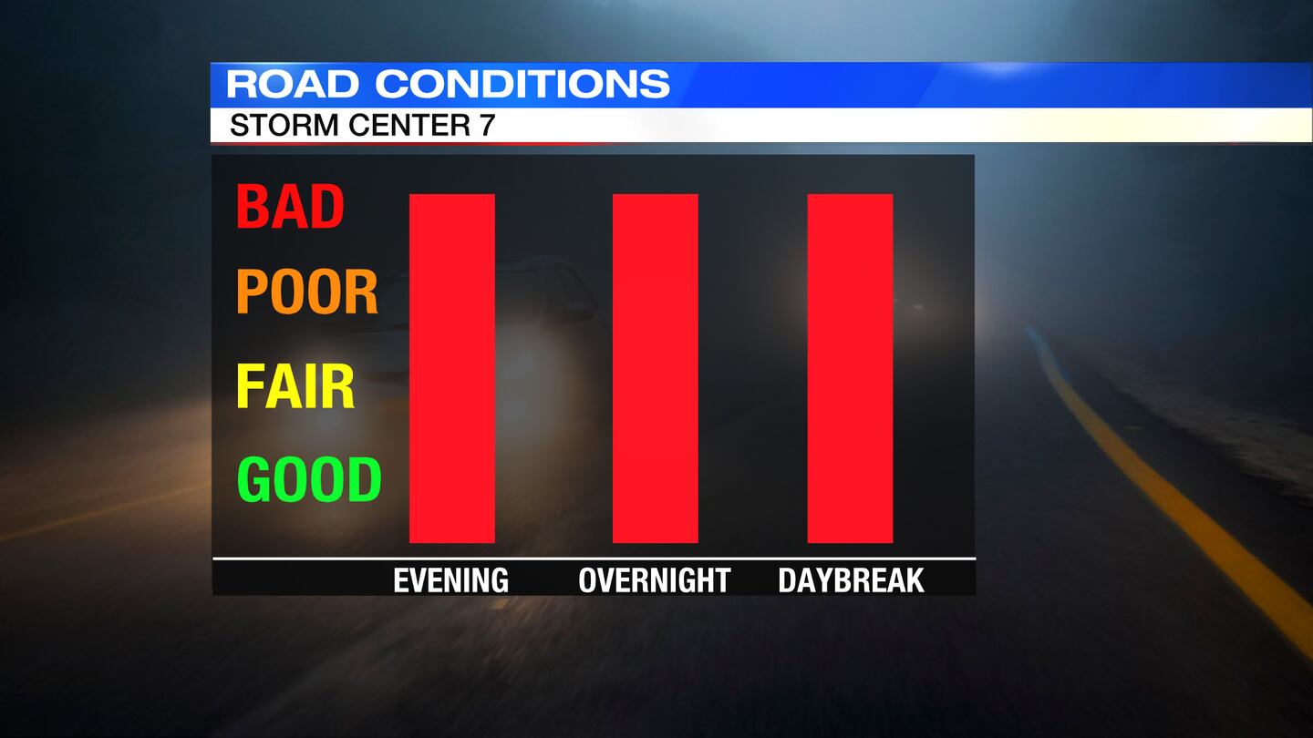
TODAY: Snow tapers late overnight after midnight, but blowing and drifting snow will cause roads to remain slick and snow covered. Storm snow totals expected between 6-10″, some areas could see up to 12″. Temperatures will drop into the lower teens with wind chills near or below zero by Tuesday morning.
>> PHOTOS: Winter weather hits the Miami Valley
>> ODOT, AAA urge drivers to stay home as winter storm hits area
>> Latest school and business closings


TUESDAY: Some light snow showers may linger into the start of Tuesday. Hazardous roads will remain through the morning. Wind chills will start out below zero again. Cloudy with a few flurries through the afternoon. Highs in the upper teens but wind chills will remain in the single digits if not below zero.
WEDNESDAY: Bitter cold with wind chills below zero to start. A mix of clouds and sun later with highs in the lower 20s. Light snow showers return late day into Wednesday night.
THURSDAY: Another storm will bring us snow showers with perhaps a wintry mix south. This storm has the potential to bring us a few inches of snow but too early to tell. It will be a windy and cold day with highs in the upper 20s.
FRIDAY: Mostly cloudy, windy and cold with a few passing flurries. Highs in the lower 20s.
SATURDAY: Partly to mostly cloudy skies, a bit of a breeze and highs in the lower 20s.

Cox Media Group