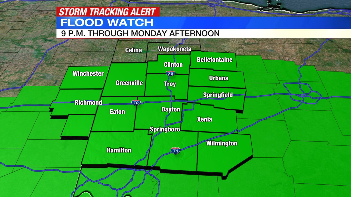
A Flood Watch will go into effect at 9 p.m. Sunday for all of the Miami Valley except Auglaize and Mercer counties.
QUICK-LOOK FORECAST:
- Wet overnight, heavy rain at times
- Stray severe storm possible overnight
- Flooding possible Monday
>> TRACK THE CONDITIONS: Live Doppler 7 Radar

DETAILED FORECAST:
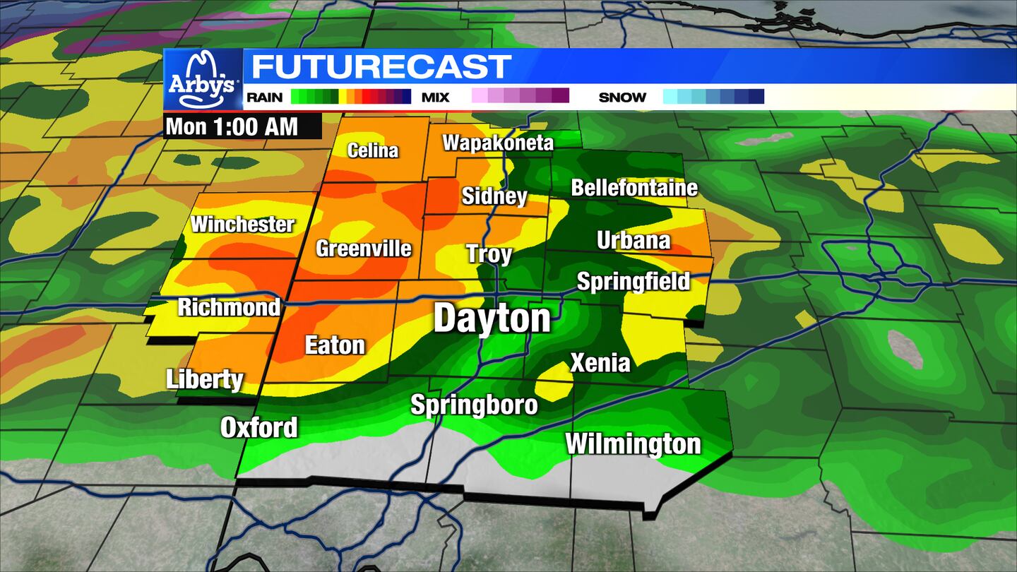
TONIGHT: A heavy round of rain moves in late Sunday night into early Monday morning.
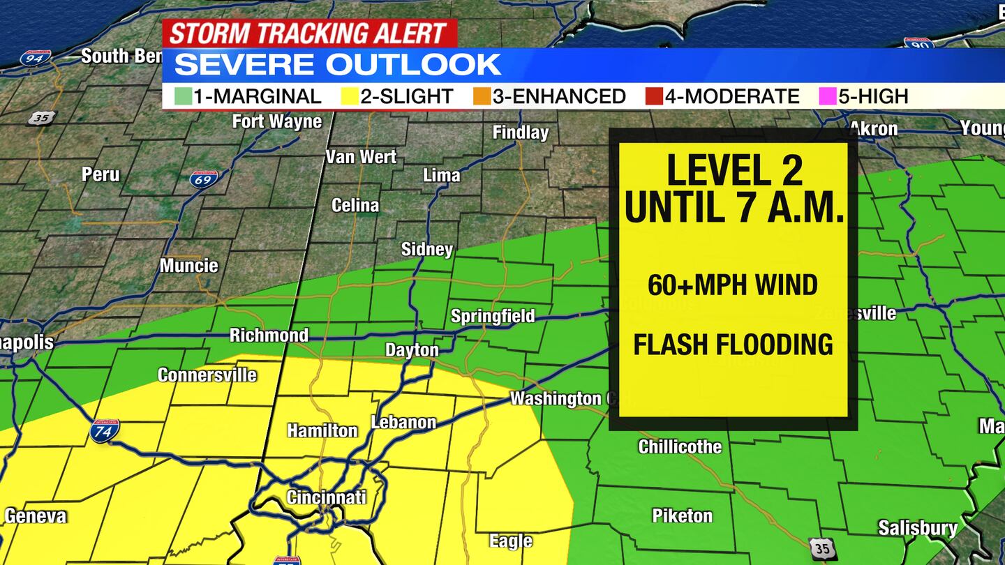
Getting breezy overnight into Monday morning. Thunderstorms are possible, possibly a stray severe storm generally south or southeast of Dayton.
MONDAY: Rounds of steady and occasionally heavy rain Monday. An embedded thunderstorm is possible as well during the early morning hours.

Rainfall Sunday morning through Monday night could amount to around 2″.
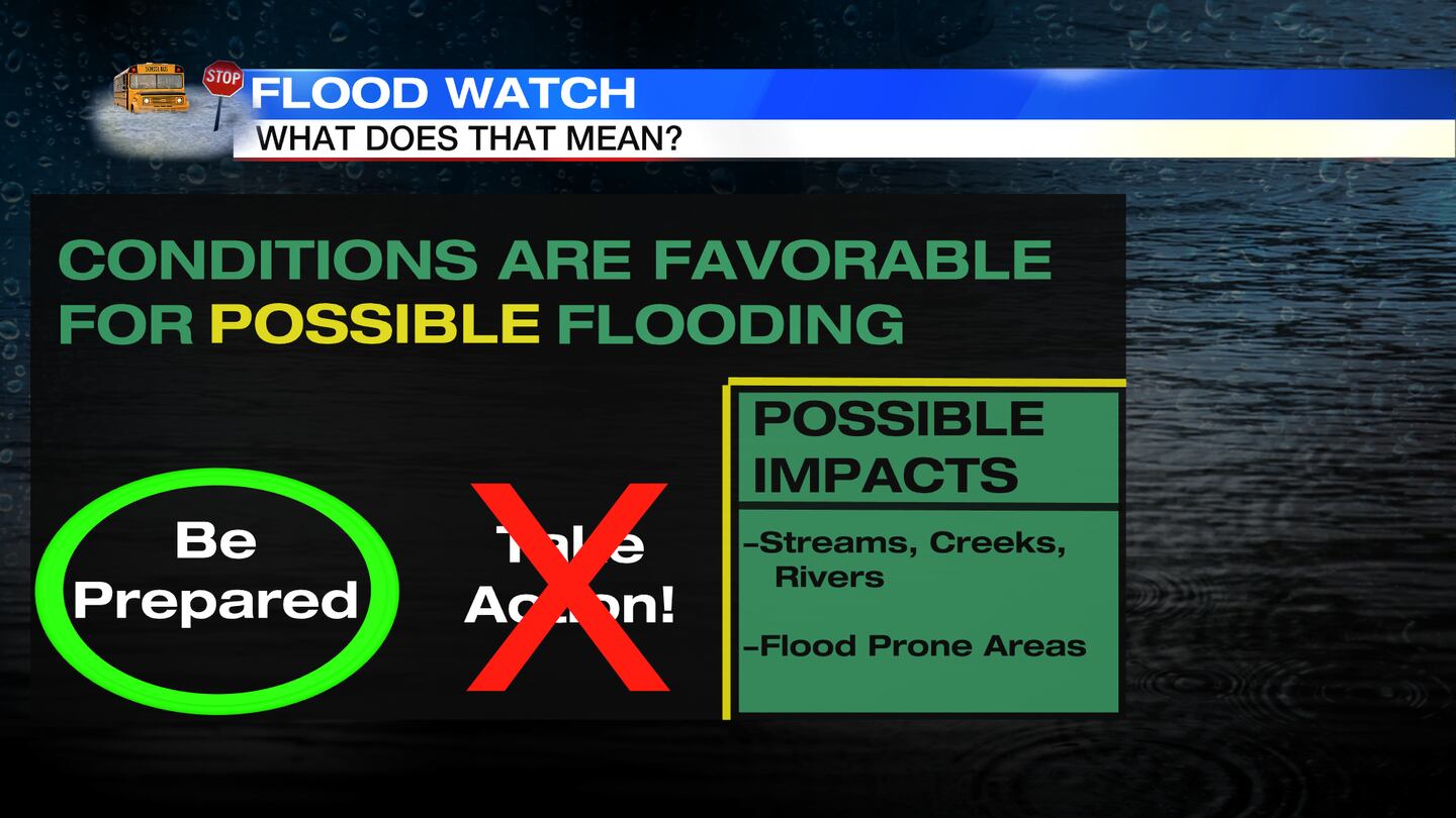
That amount of rain, on top of saturated grounds, may lead to some flooding issues. Mild with high temperatures in the mid to upper 50s before falling during the afternoon into the mid-40s.
TUESDAY: Clouds gradually decrease through the day, becoming partly sunny. It will be a colder day with afternoon temperatures in the middle 40s.
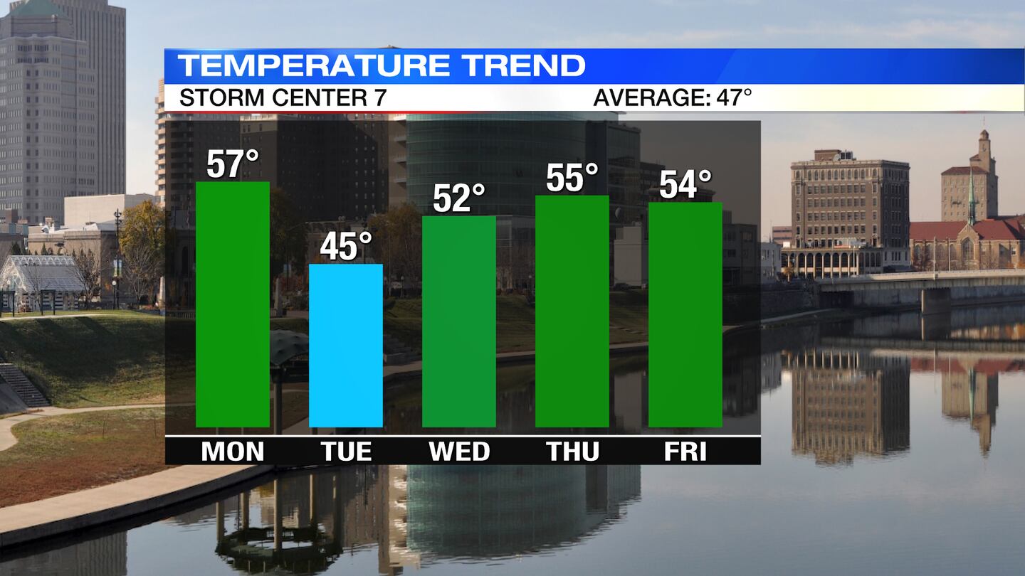
WEDNESDAY: Mostly sunny and milder on Wednesday with highs around 52 degrees.
THURSDAY: Mostly clear to partly cloudy and mild for Thursday. Highs in the upper 50s.
FRIDAY: Mostly cloudy and wind. Chance of rain. Highs in the lower 50s. Rain could change over to light snow overnight as temperatures cool down into the 20s.
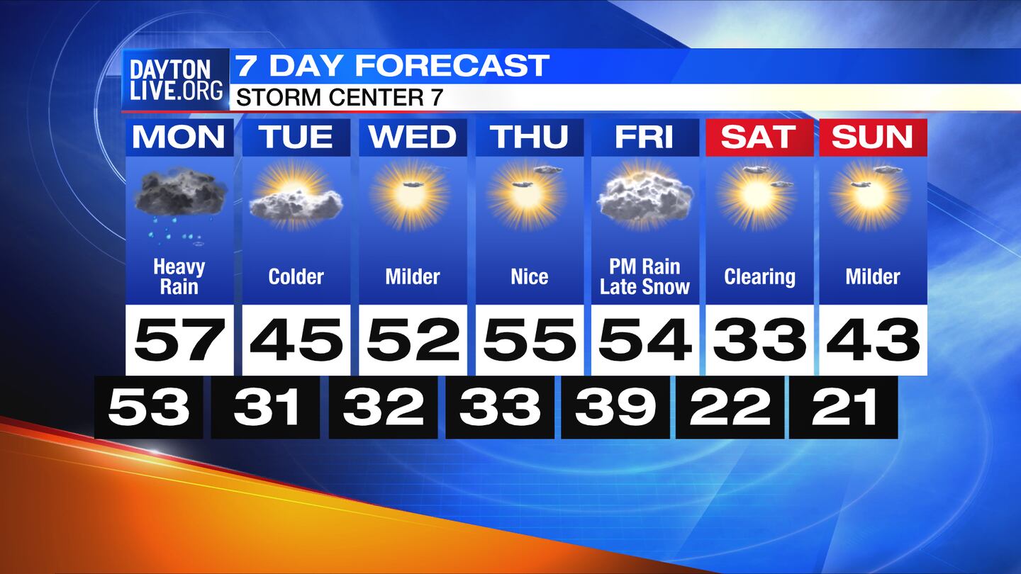
SATURDAY: Starting mostly cloudy, then clearing, cold. Highs in the lower 30s.
SUNDAY: Mostly sunny and milder. Highs will be in the lower 40s.
©2022 Cox Media Group