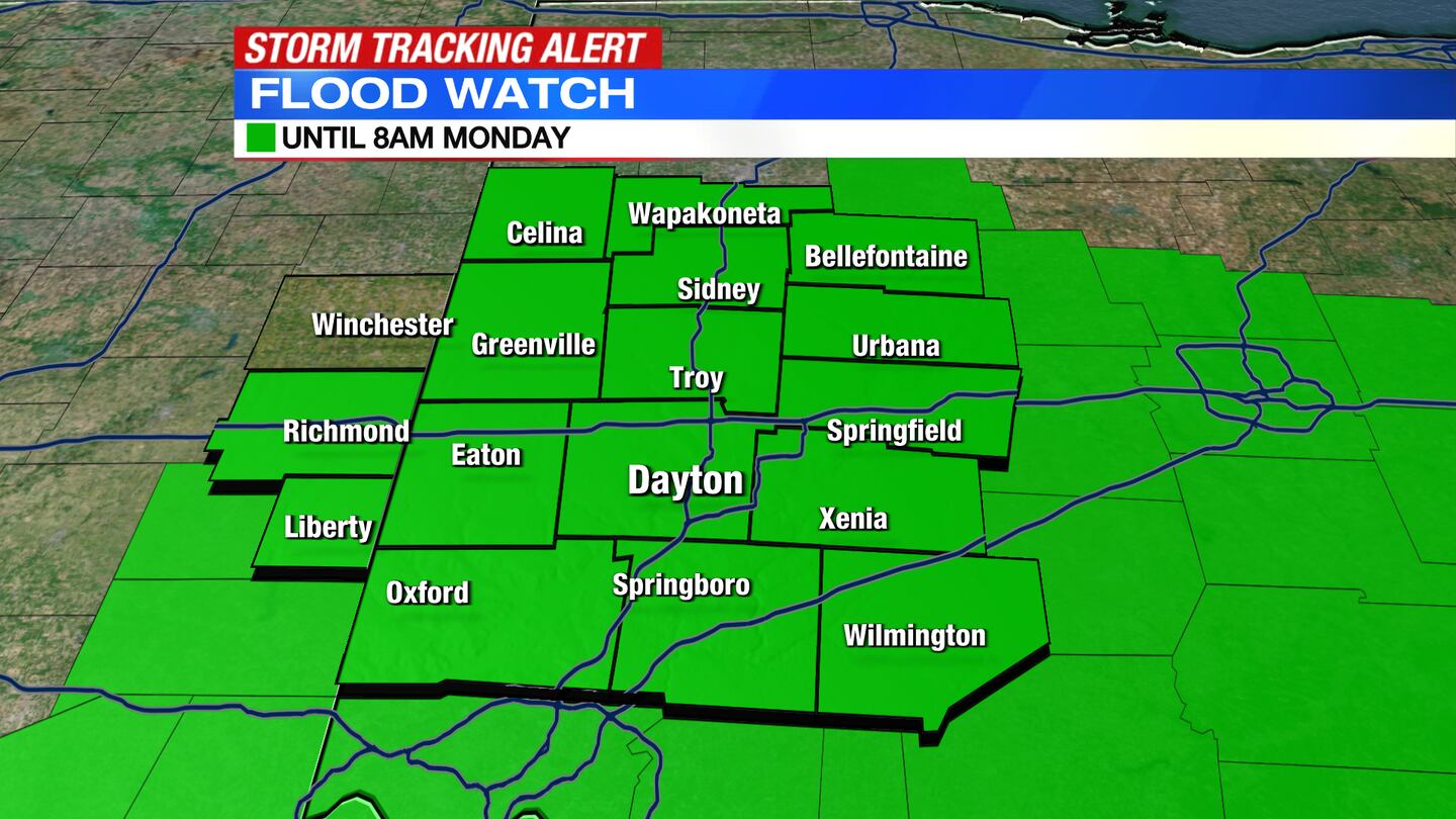
A Flood Watch has been issued for Butler, Clark, Greene. Logan, and Warren Counties until 8 a.m. Monday.
QUICK-LOOK FORECAST:
- Storms eventually fade overnight
- Flood issues still possible
- Hot and muggy week ahead
>> TRACK THE CONDITIONS WITH LIVE DOPPLER 7
DETAILED FORECAST:
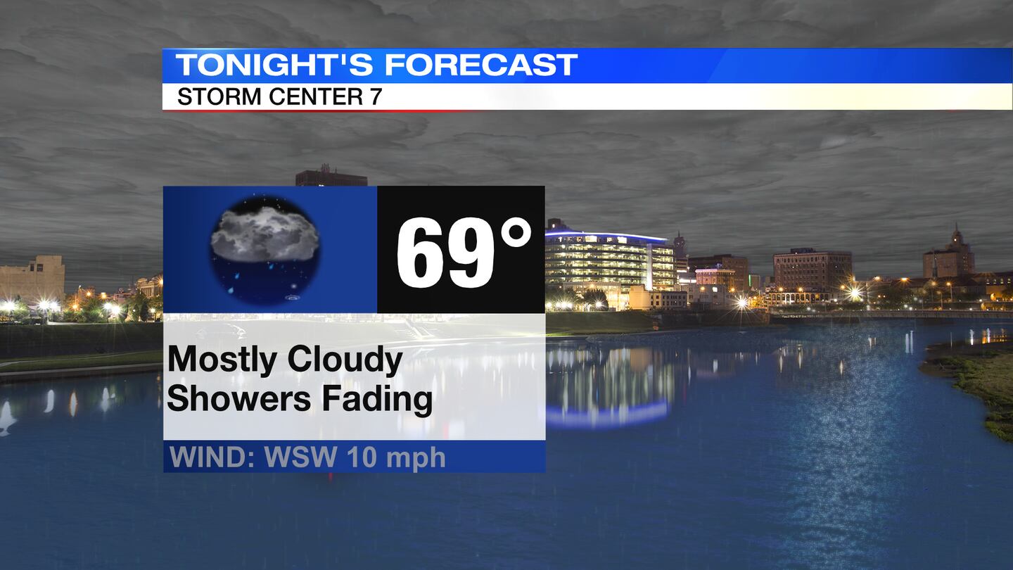
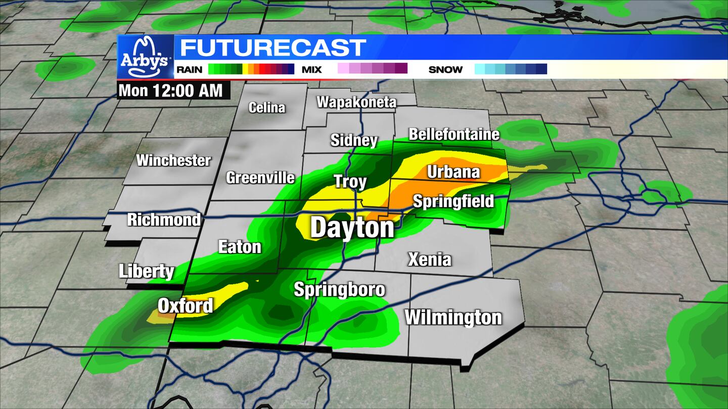
TONIGHT: Waves of showers eventually fade overnight with lows in the upper 60s. A thunderstorm is also possible. With additional rainfall on already saturated ground, flooding will still be a concern tonight — use caution while driving.
MONDAY: A few lingering showers possible early Monday morning, then clearing out for partly sunny skies Monday afternoon. An isolated storm may redevelop during the heat of the day. Highs reach the low 80s.
TUESDAY: Mostly sunny, hot and humid for Tuesday. Highs in the upper 80s to near 90 degrees. Heat index in the lower 90s
WEDNESDAY: Partly cloudy, hot, and humid with highs in the lower 90s. Feeling like the mid to upper 90s.
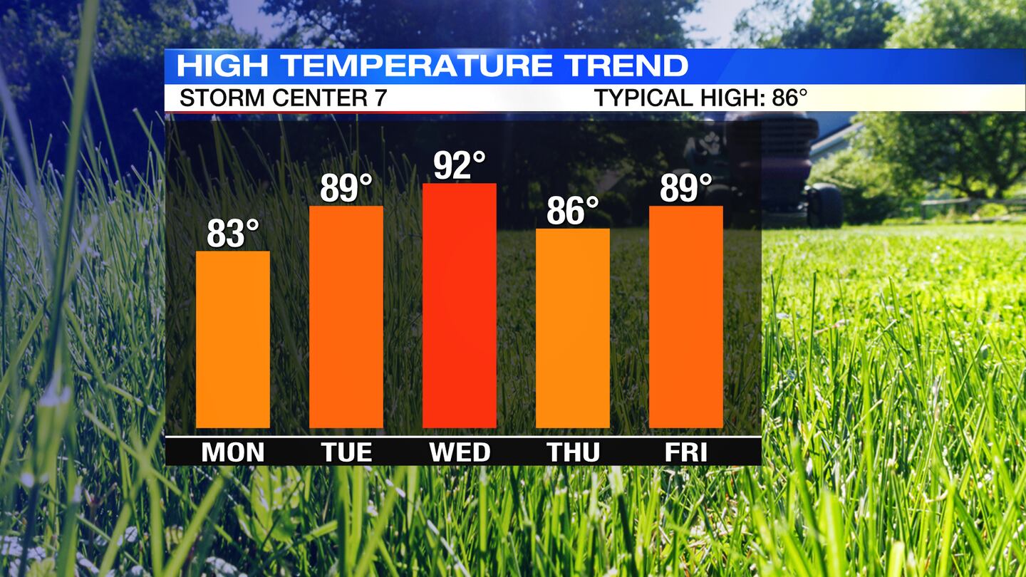
THURSDAY: Partly cloudy, warm on Thursday. Highs reach the middle 80s.
FRIDAY: Mostly sunny, a little hotter on Friday. Highs back in the upper 80s to near 90 degrees.
SATURDAY: Sunny, hot, and humid with highs in the lower 90s. A storm may be possible.
SUNDAY: Partly cloudy with a storm possible. Humid with highs in the lower 90s.
©2022 Cox Media Group


