DAYTON — Good Sunday evening to you across the Miami Valley. Meteorologist Nick Dunn here with you on what has been a fantastic day as the sunshine helped us make up for an overcast and wet day yesterday.
It was a bit cooler and breezy, but overall very nice.
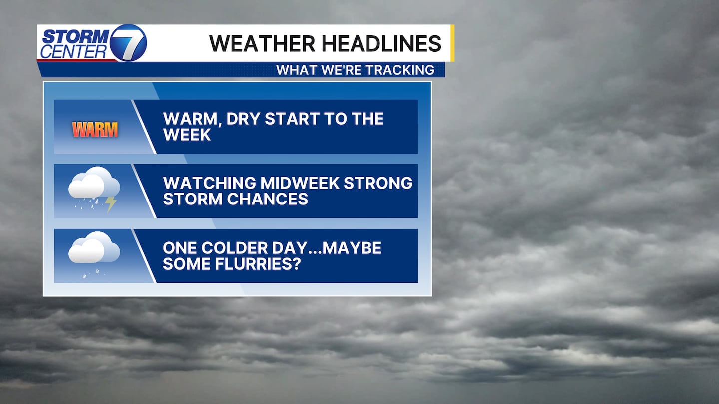
After a warm and dry start to the week, we are tracking showers and storms.
The best chance of storms looks to be Wednesday this week, but a couple of stray storms may occur Tuesday night.
The risk is there for a few stronger storms turning severe as well.
[DOWNLOAD: Free Storm Center 7 Weather app for alerts as news breaks]

Any storms overnight Tuesday look to bring an isolated wind damage threat.
However, the confidence in storms occurring is a bit lower until well after midnight when the cold front gets a little closer.
We have a Level 1 (Marginal) Risk of severe storms for Tuesday night into Wednesday morning right now.
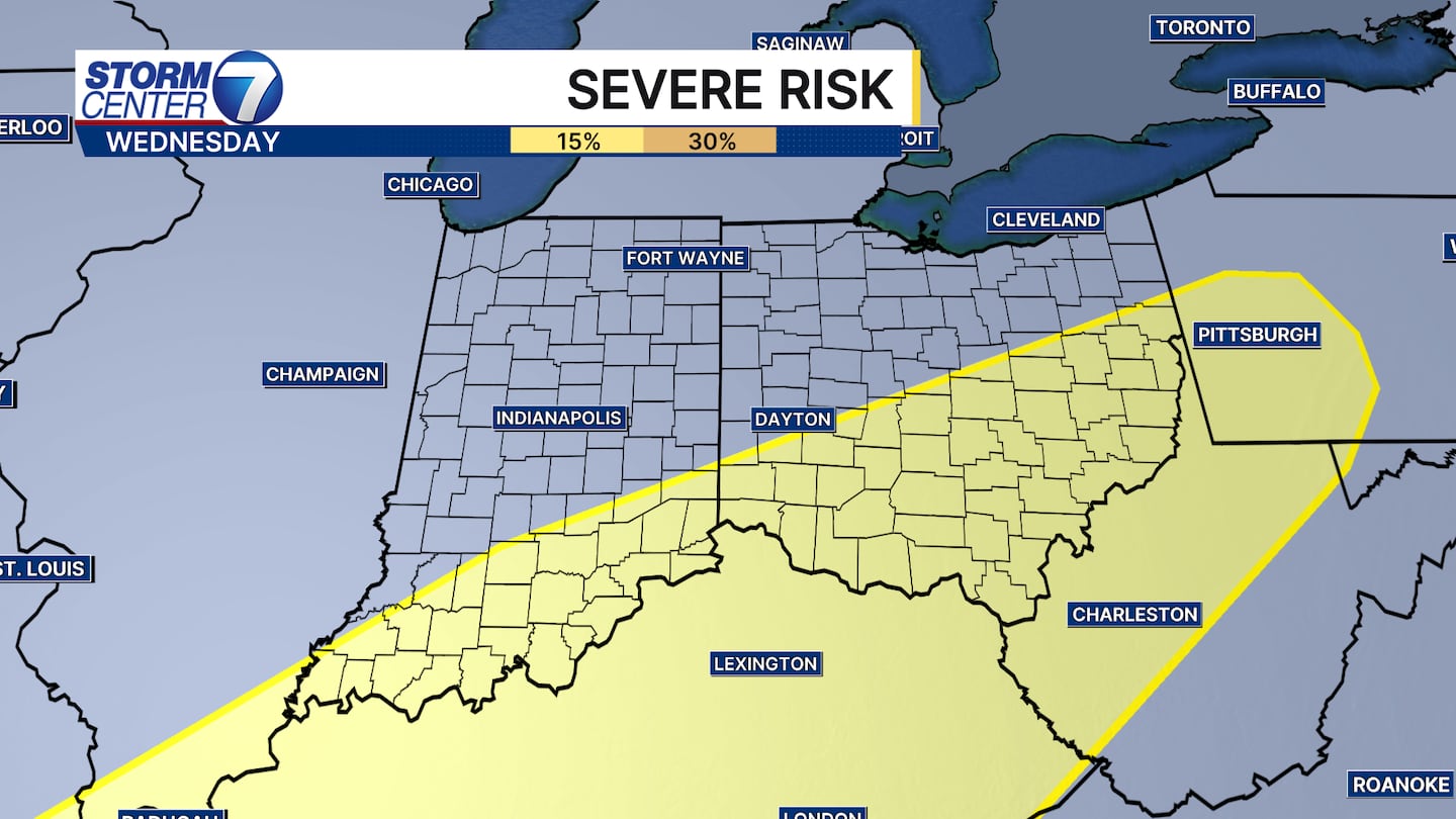
For Wednesday, that threat shifts a bit further southeast and will be highly dependent on the timing of the cold front passing through.
For now, be aware that strong to potentially severe thunderstorms are possible this week.
I would expect changes to the risk areas, timing, and placement of stronger storms this week as we gain confidence.
As we gain that higher confidence, we will be able to show you the finer details and how it will impact you.
As of right now, widespread or significant severe weather looks unlikely.
[WATCH Storm Center 7 Weather on the following devices]
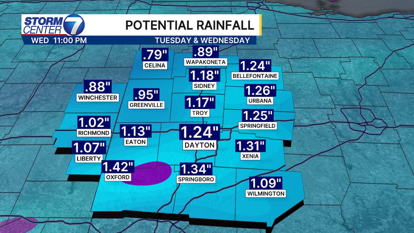
Heavy rainfall looks like another risk to contend with. For those who experience heavy rain on top of saturated grounds we could run into another flood threat. For those dealing with drought conditions north of I-70 this will be another round of needed rainfall.
©2026 Cox Media Group