
DAYTON — Good Friday afternoon, everyone! Meteorologist Nick Dunn here on what has been a blustery, wintry, and cold end to the work week. Have you finished your shopping or plans for Christmas week yet? If not, we have better weather in store this weekend before things really warm up by late week.
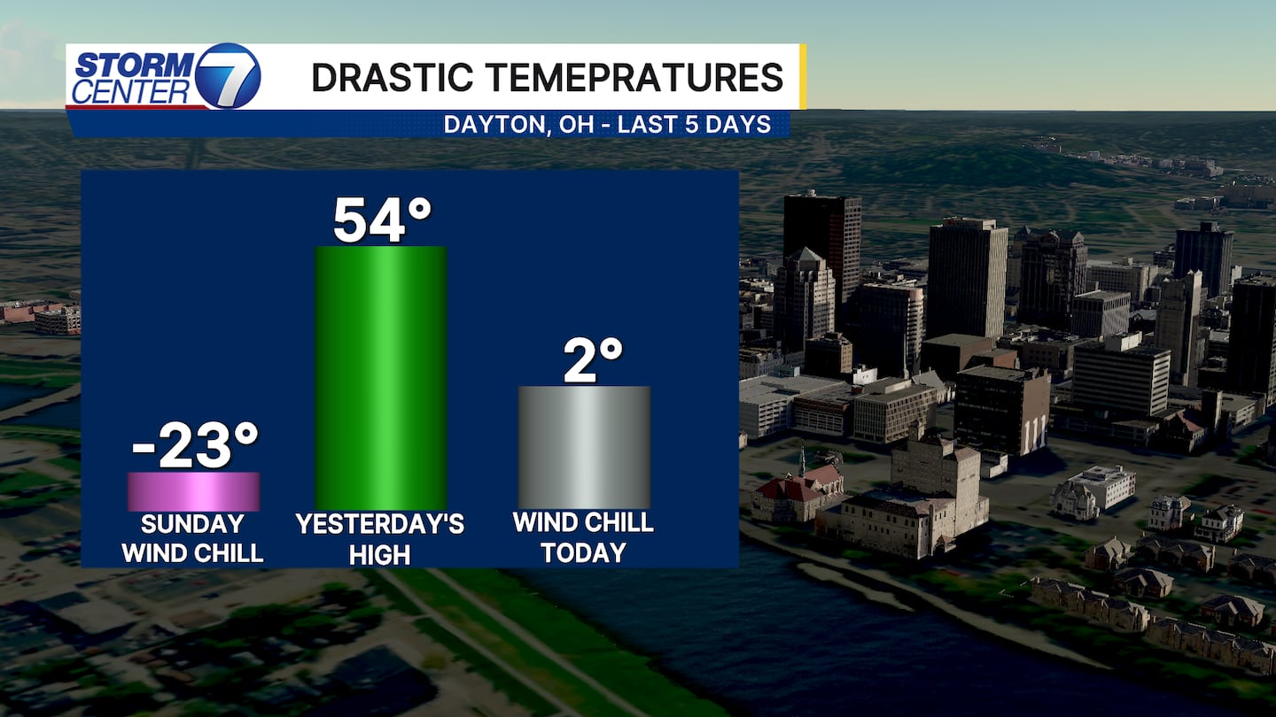
Many of you remember how brutally cold it was on Sunday morning last weekend. We had the coldest wind chill in Ohio at -23 degrees. Yesterday we climbed to a balmy 54 degrees before we woke up today with a wind chill of just 2 degrees. That is a total change of 129 degrees in total just in the last 5 days!
[DOWNLOAD: Free Storm Center 7 Weather app for alerts as news breaks]
So, what is this bigger warm up for next week? Let’s dive in!
We have to deal with a chilly start to next week with highs right on par for average near 40 degrees. Then, a warmer pattern takes control and brings a nice surge of milder air in our direction! Right now, we have a high of 60 degrees in store for Christmas Day. Some data shows temperatures even warmer than that!
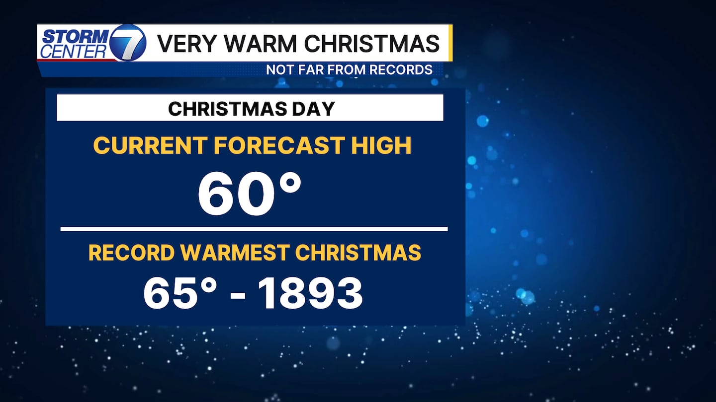
The record warmest Christmas in all of Dayton history took place back in 1893 when we hit 65 degrees. We will likely come close to that if we can stay dry, but right now we do have a few showers in the forecast.
[WATCH Storm Center 7 Weather on the following devices]
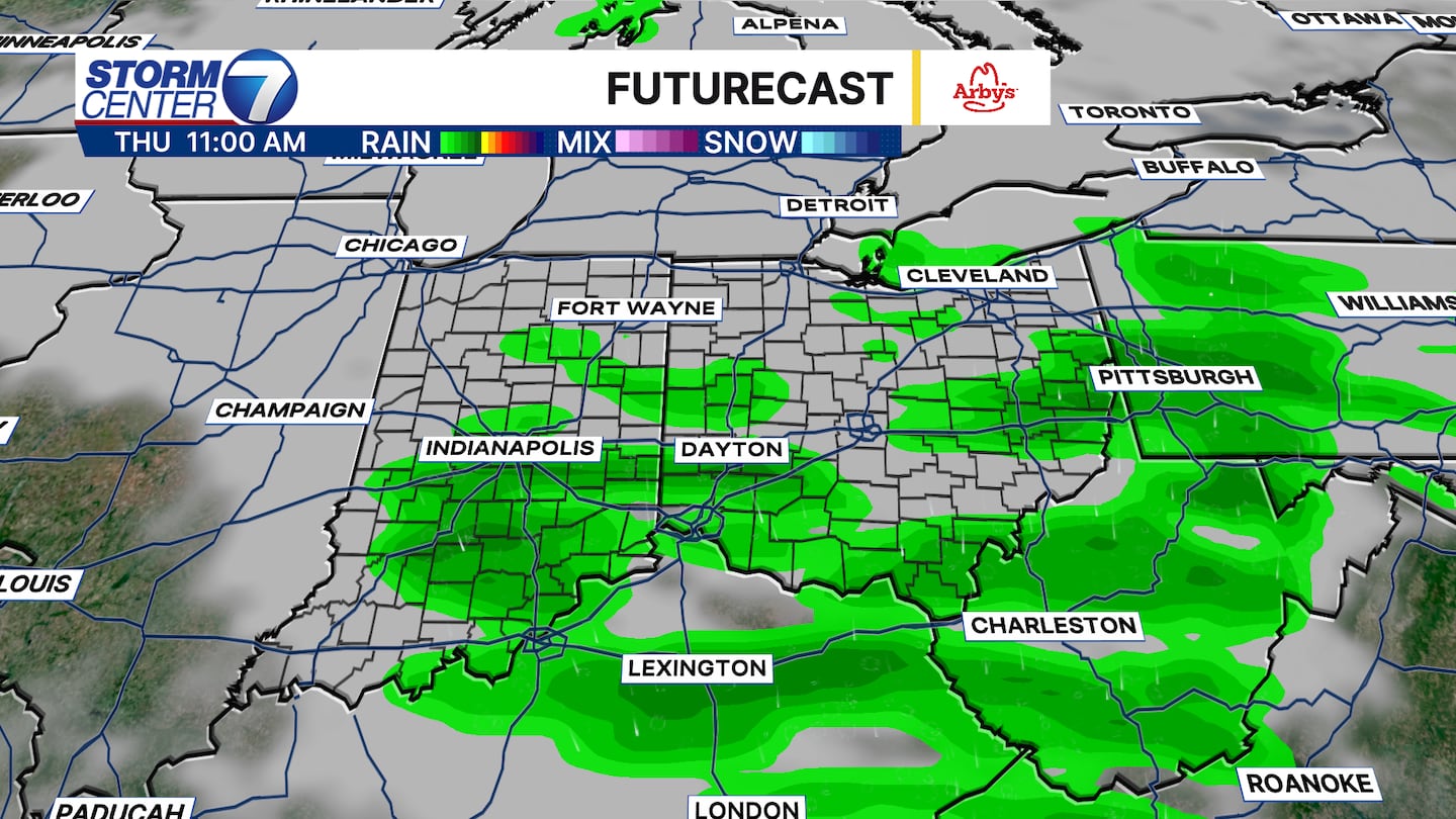
While no full washouts are in the forecast next week, we will likely navigate a few rain chances despite the warmer temperatures.


