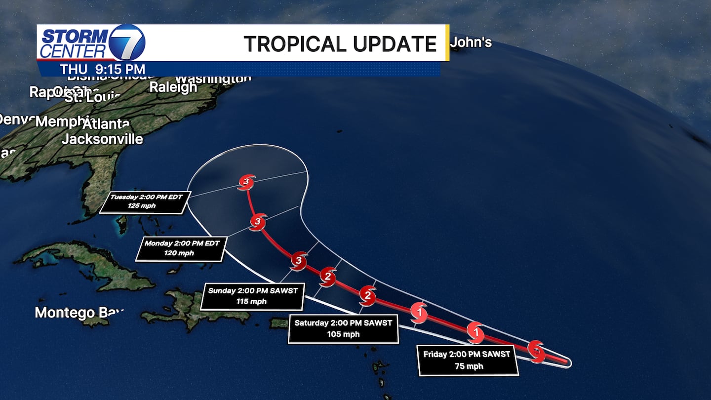
Tropical Storm Erin continues to churn in the Atlantic Ocean. As of the 8:00 PM Advisory this evening from the National Hurricane Center, Erin has winds of 70mph and is located about 745 miles east of the Northern Leeward Islands.
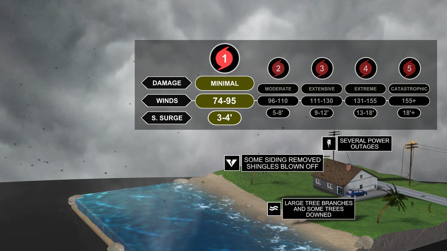
Hurricane status is likely to be achieved soon as Erin continues to organize and strengthen. Once winds reach 74mph it will be classified as a Category 1 hurricane. The Saffir-Simpson Scale helps us categorize the strength of tropical systems.
According to the latest track, Erin is expected to pass north of Puerto Rico and the Leeward Islands. However, some gusty winds and high waves are likely. Erin is forecast to continue gaining strength in an environment with warm ocean waters and minimal shear.
Those with interests along the east coast of the United States are not expected to observe any precipitation from Erin. However, some high waves and gusty winds are a good possibility as Erin curves between the United States and Bermuda.
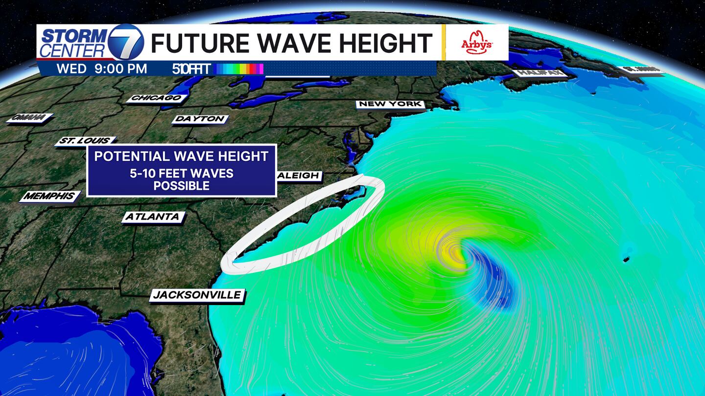
Some waves could be as tall as 5-10 feet just off the east coast of North Carolina and South Carolina by Wednesday evening. If Erin track further west or east these forecasts could change a bit.
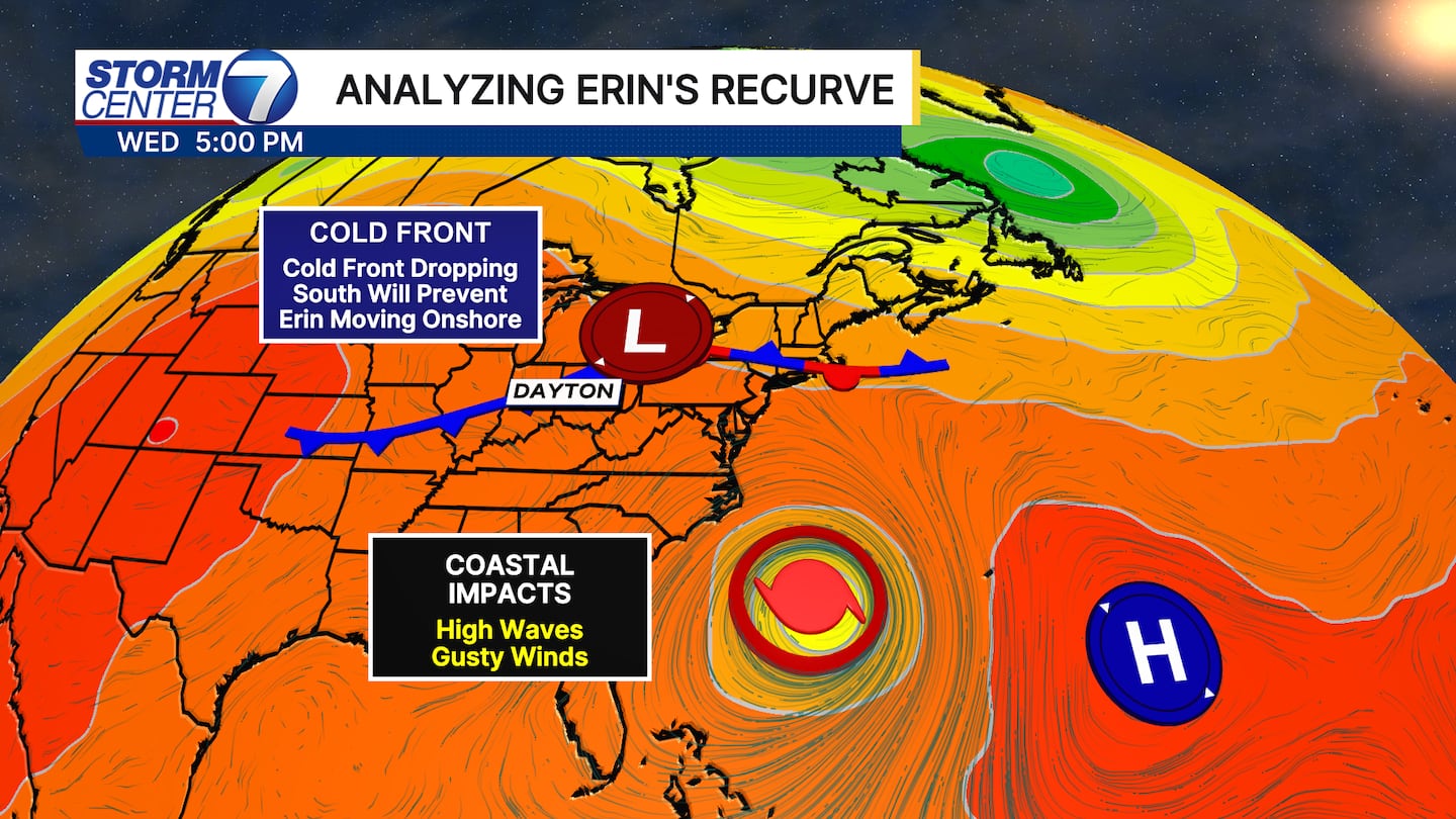
While there is not a direct tie to the Miami valley, we are tracking a cold front next week that will help Erin stay offshore. This combined with a high pressure system near Bermuda will give Erin a path to turn out to sea by late next week. Depending on the exact timing of that front passing through will depend how quickly a cooler air mass can try to settle in locally late next week!
©2025 Cox Media Group