QUICK-LOOK FORECAST:
- Thunderstorms possible today, some strong to severe
- Another strong storm chance on Monday
- Record heat possible this week
>> TRACK THE LATEST CONDITIONS: Live Doppler 7 Radar
DETAILED FORECAST:
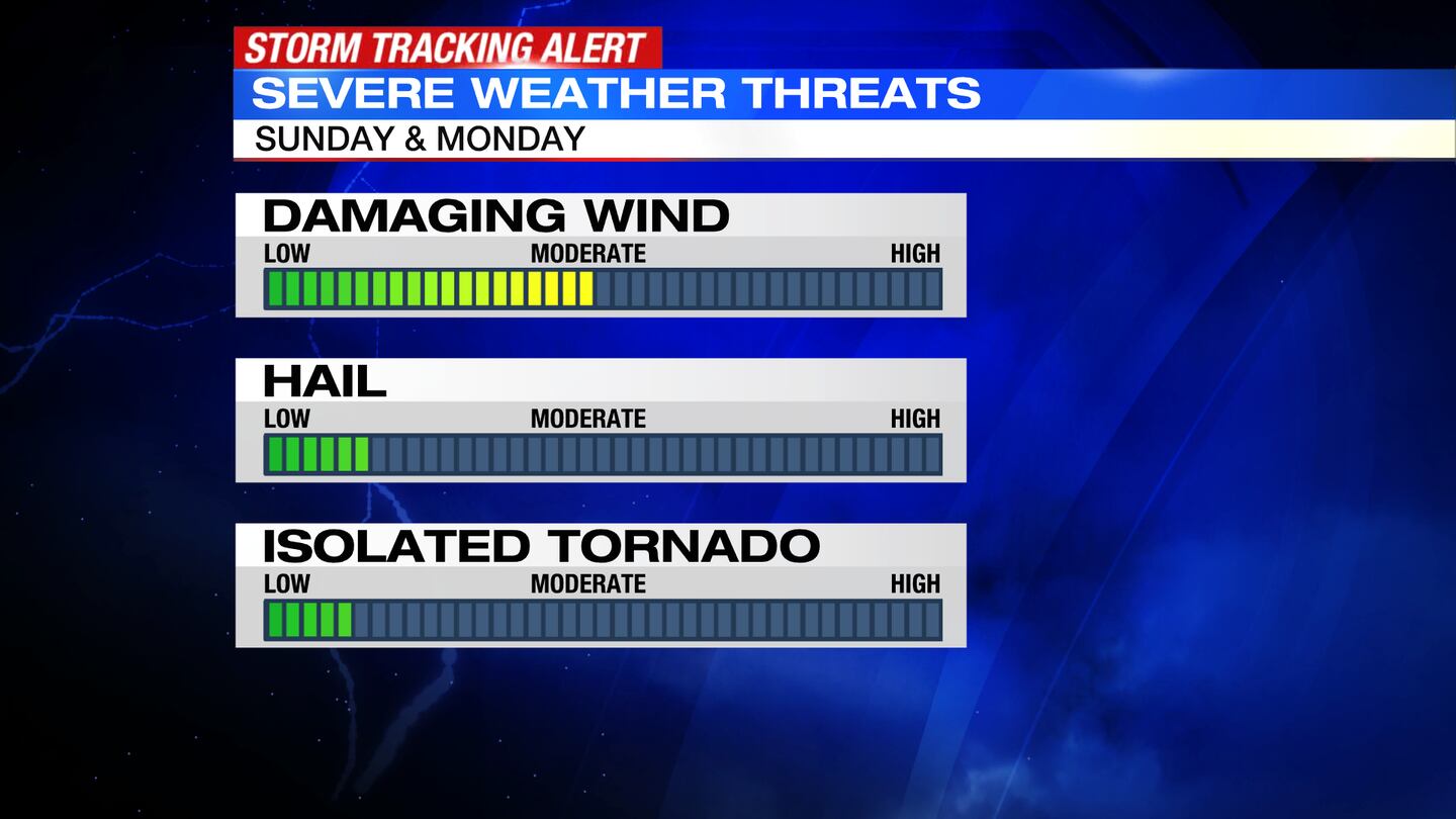
TODAY: SUNDAY: Partly sunny skies with showers and thunderstorms possible during the afternoon. A few storms may become strong to severe. Damaging wind gusts and heavy downpours will be the main hazards, but some hail and/or a brief tornado cannot be ruled out. Warmer today with highs in the lower 80s.
TONIGHT: A chance for some lingering showers and storms early, then drying out. Some patchy fog may develop overnight. Lows fall to the upper 60s.
MONDAY: Partly sunny with another chance for showers and thunderstorms. Models are currently struggling on exactly where storms may move through, but the potential is again there for a few strong to severe thunderstorms. Damaging wind gusts will be the main threat. Hotter with highs in the upper 80s and feels like temperatures in the low to mid 90s.
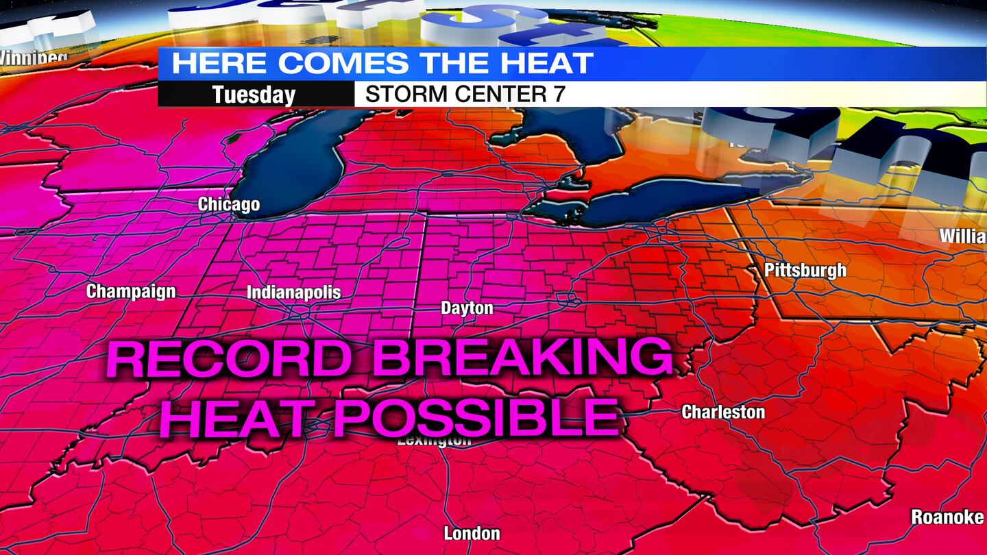
TUESDAY: Mostly sunny and hot. In fact, record setting heat is a good possibility with a high of 96 expected in Dayton. The record high for the day is 94 degrees set back in 1988. With humidity factored in, it could feel as hot as 106 degrees at times. Lows only fall to the middle 70s Tuesday night.
WEDNESDAY: WEDNESDAY: LEVEL 2 (Heat) Mostly sunny and hot again. Highs climb to the middle 90s, 95 in Dayton. The record high for the day is 96 degrees set back in 1994. “Feels like” temperatures around 105 during the afternoon.
THURSDAY: Partly sunny and hot again. Highs in the lower 90s with heat index values near 100. Temperatures should stay just shy of record territory. A stray shower or thunderstorm is possible.
FRIDAY: Looking sunny. Not quite as hot with highs in the upper 80s. A few showers or storms possible.
SATURDAY: Partly cloudy and mainly dry with highs in the lower 80s.
©2022 Cox Media Group


