QUICK-LOOK FORECAST:
- Cold and quiet tonight
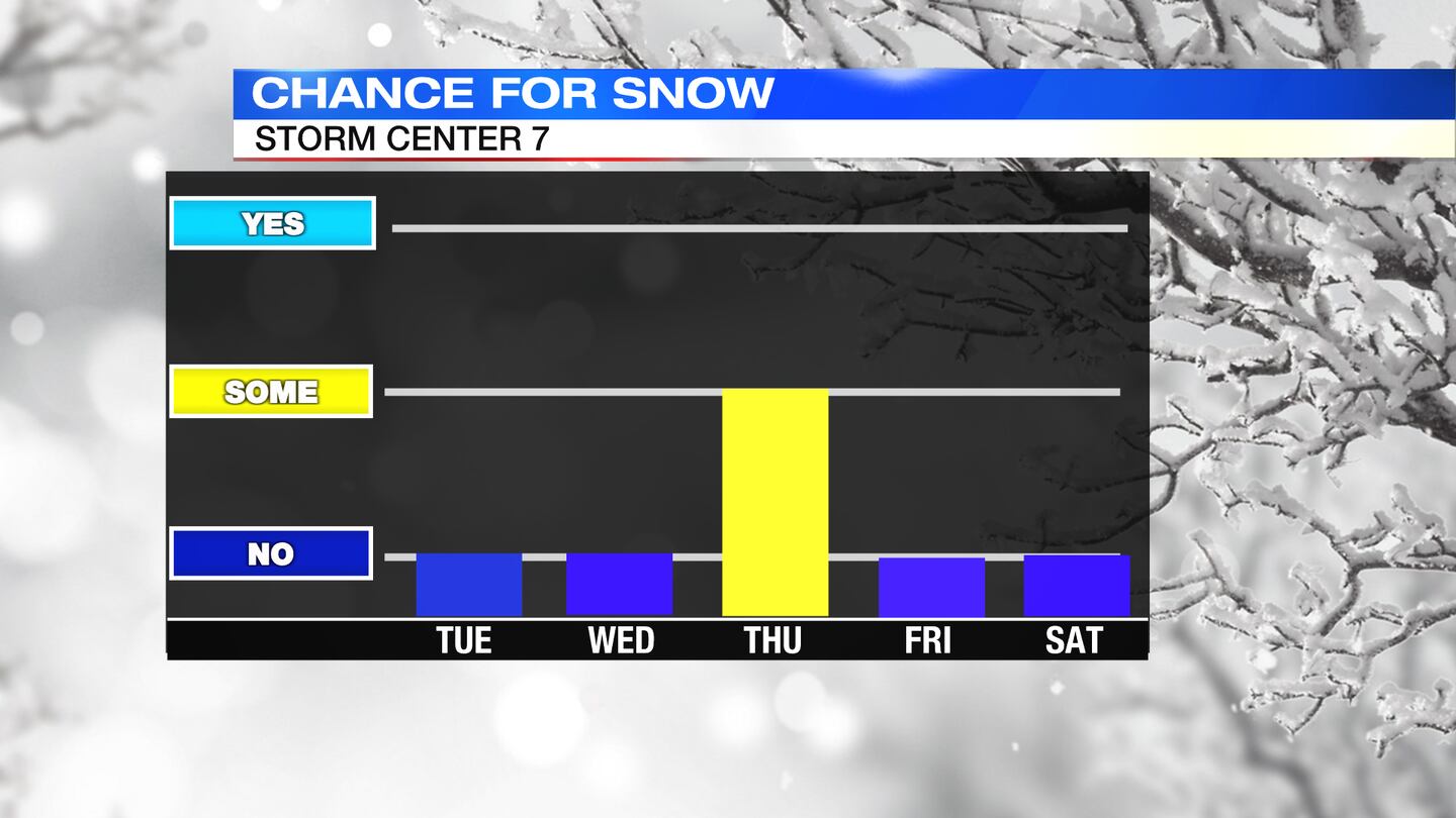
- Chance snow Thursday
- Very cold wind chills Friday
>> Live Doppler 7 Radar | Interactive
DETAILED FORECAST:
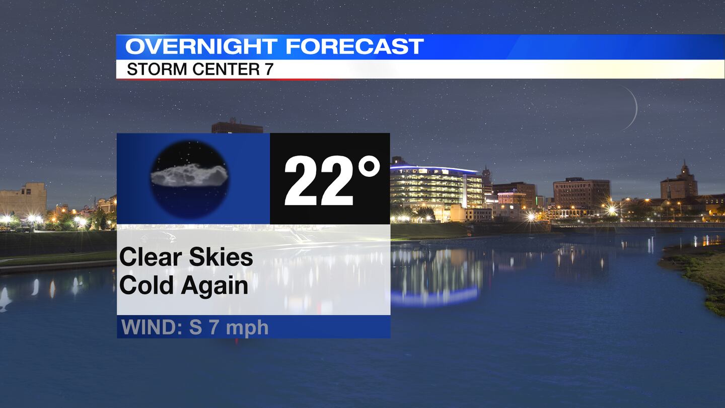
TONIGHT: Mainly clear and cold through the night with lows dipping into the lower 20s. A very light wind will create wind chills in the teens by morning.
TUESDAY: A cold start in the 20s with mostly sunny skies. A few more clouds arrive into the afternoon with highs slightly warmer than average in the lower 40s. Winds increase through the day into Tuesday night.
WEDNESDAY: Mostly cloudy and cool. It will be windy at times with gusts up to 30-35mp possible. Temperatures will reach a midday high in the lower 40s then drop once a weak cold front passes.
THURSDAY: Cloudy skies with a chance for snow showers into the afternoon. Cold with high temperatures in the mid 20s.
FRIDAY: Decreasing clouds, breezy, and cold. Highs in the lower 20s. Wind chills may start below zero in the morning then range in the single digits and teens throughout the day.

SATURDAY: After a very cold start, with readings in the single digits to lower teens for the morning, temperatures will climb above freezing to a high in the upper 30s. It will be a dry day with partly sunny to mostly cloudy skies. Rain will return Saturday night.
SUNDAY: Mostly cloudy, windy and cool. Chance of a few showers. Highs in the lower 40s.
MONDAY: Partly cloudy and much colder. Windy at times, too. Highs in the upper 20s. Chills in the single digits and teens.
©2022 Cox Media Group


