QUICK-LOOK FORECAST:
- Clouds increase Wednesday
- Cooler week
- Rain; Brief mix Thursday night - Friday
>> TRACK THE CONDITIONS WITH LIVE DOPPLER 7
DETAILED FORECAST:
TODAY: Clouds increase overnight, but stay dry with temperatures falling into the upper 20s.
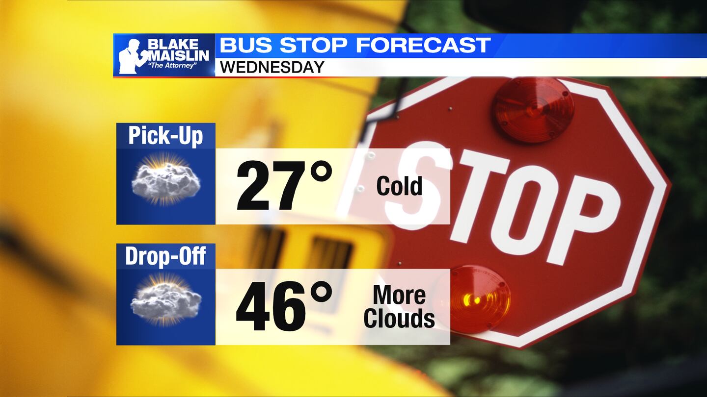
WEDNESDAY: Partly cloudy to mostly cloudy skies on Wednesday. It will be another cooler day, but not far from normal with a high in the middle 40s.
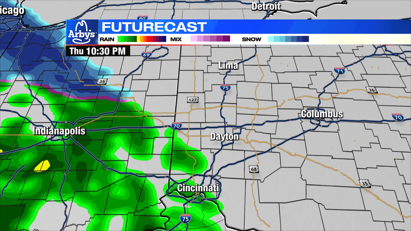
THURSDAY: Clouds increase through the day with some showers expected to arrive in the evening. Some areas north of Dayton may see a mix with snow. Highs during the day will reach nearly 50 degrees, cooler north.
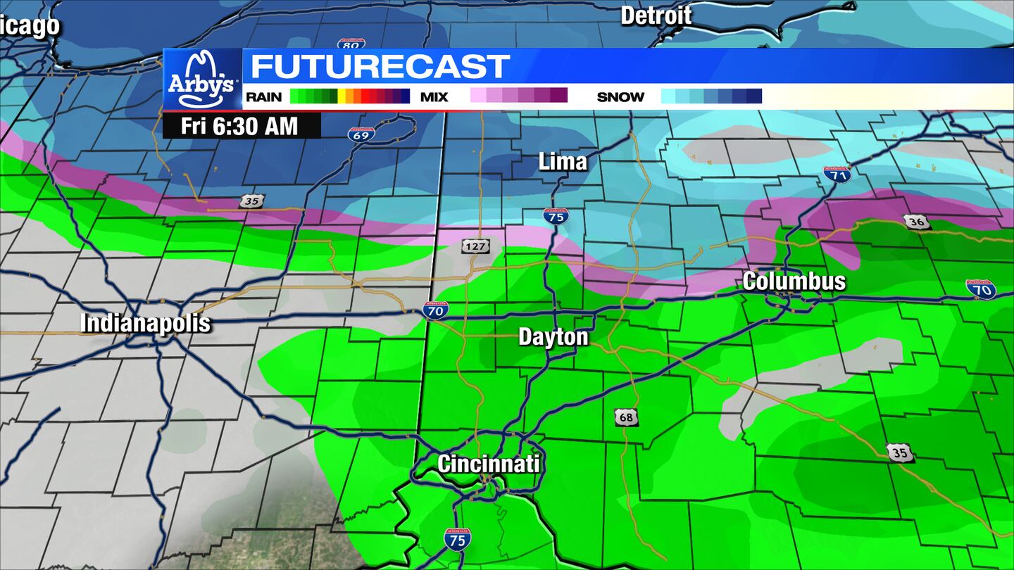
FRIDAY: Some light snow may mix with rain across the northern Miami Valley early Friday morning otherwise widespread rain showers are expected. Showers will taper into the afternoon but linger into the evening. As temperatures fall from the 40s during the day to below freezing at night, there will be a transition over to a few flurries or a passing snow shower. Snow accumulation is not expected.
SATURDAY: Perhaps a few flurries early on Saturday then mostly cloudy and chilly. Highs in the lower 40s.
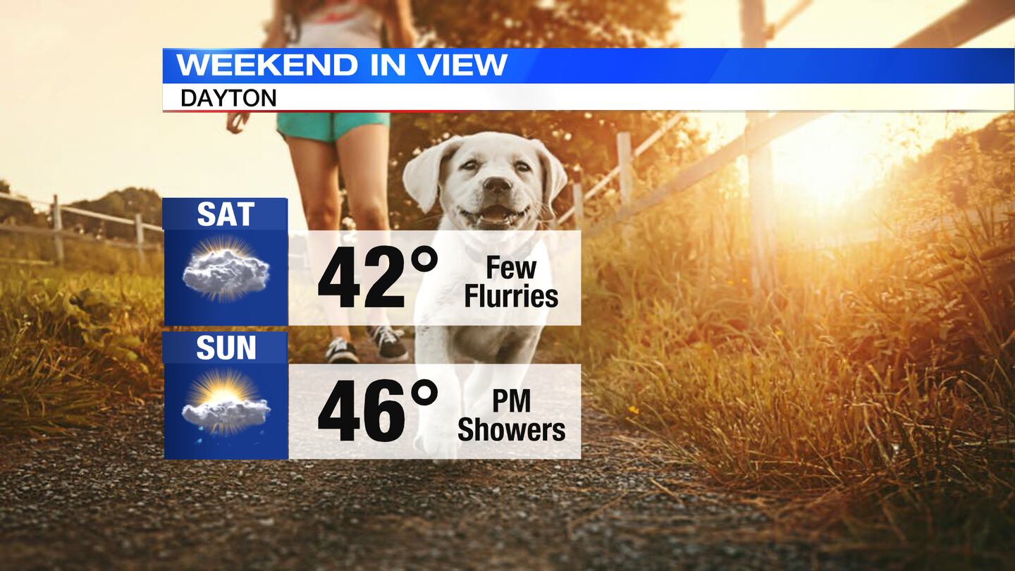
SUNDAY: Mostly cloudy to cloudy skies on Sunday with highs in the middle 40s. Some showers arrive by the end of the day.
MONDAY: Mostly cloudy and cool in the middle 40s again on Monday. Slight chance of a sprinkle or flurry.
TUESDAY: Mostly cloudy and cool with highs in the lower 40s.
©2023 Cox Media Group