RELATED: Dayton Traffic from the WHIO Traffic Center
RELATED: WHIO Interactive Radar
QUICK-LOOK FORECAST
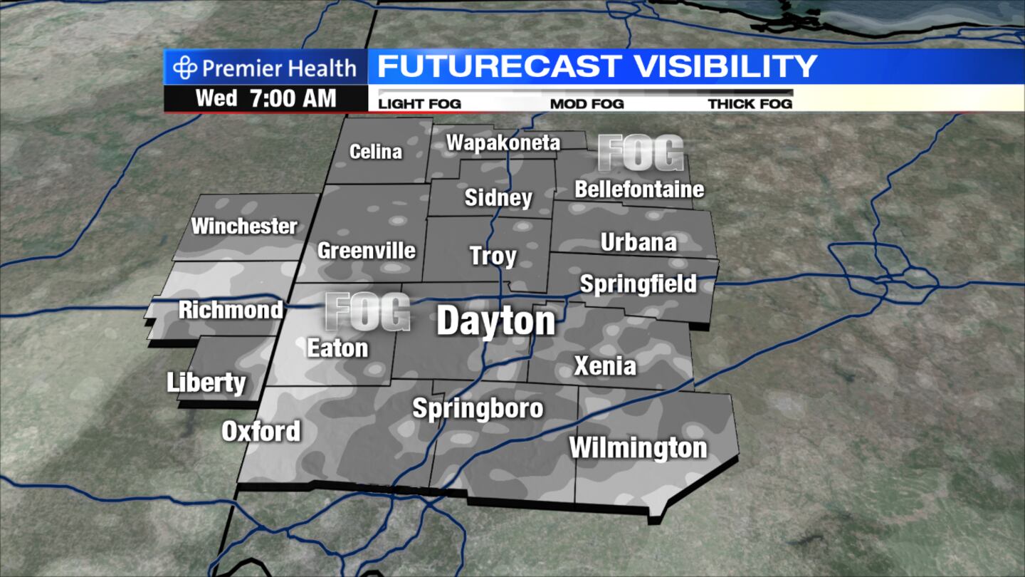
- Showers to end with patchy fog possible late tonight
- Mostly dry and seasonable weather for midweek.
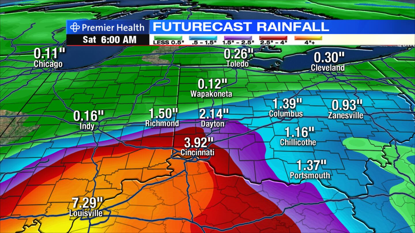
- Remnants of Harvey move into Miami Valley Friday night into Saturday
RELATED: County-by-County Weather
RELATED: 5-day Forecast
THIS EVENING: Scattered showers and storms will be possible through early evening. Some of the heavier showers could produce locally heavy rain, some gusty winds and even some small, pea-sized hail. Storms should begin to weaken and move out of the area near or after sunset. Temperatures will be in the 70s.
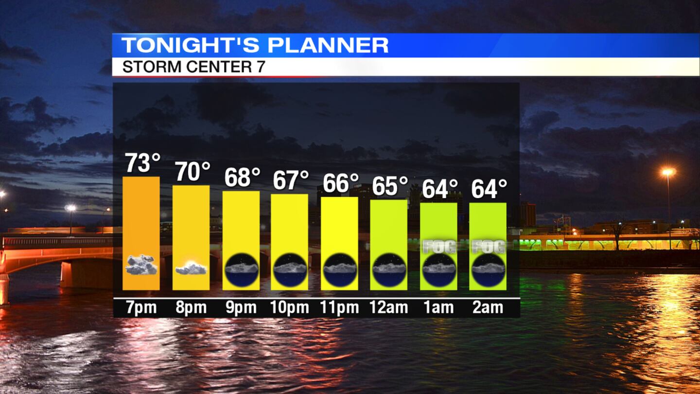
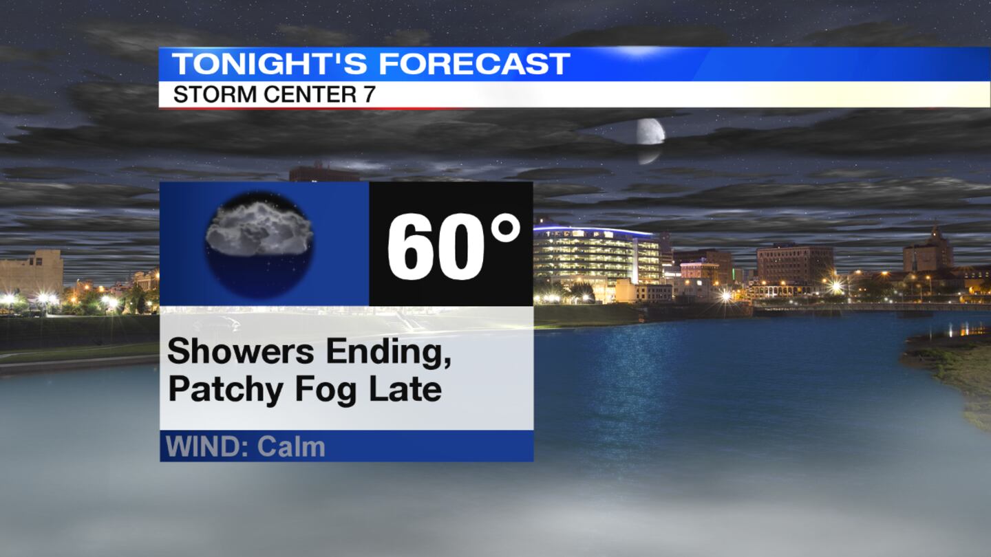
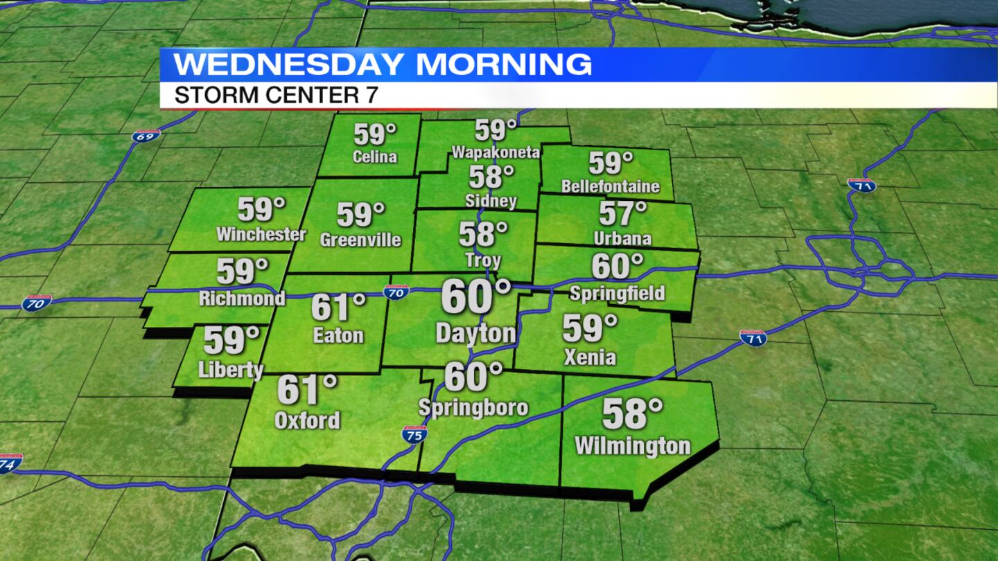
TONIGHT: Any leftover showers should taper off with some breaks in the clouds. Patchy fog will be possible after midnight and into the early morning Wednesday. Lows will be in the lower 60s.
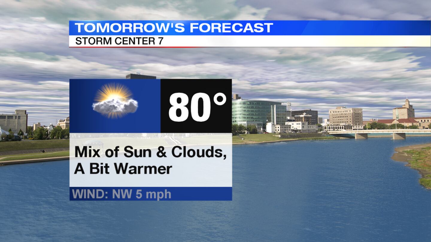
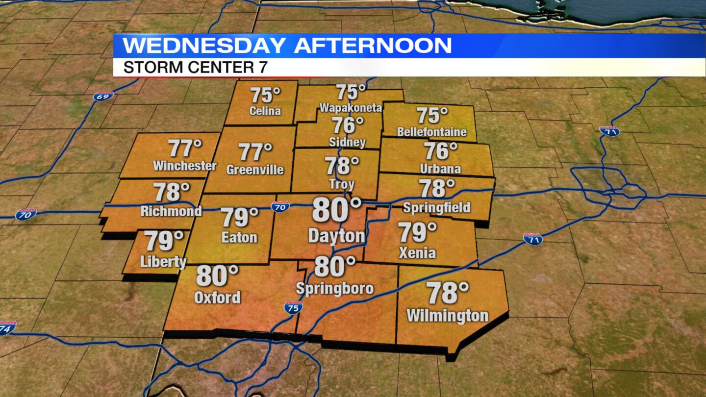
WEDNESDAY: Expect a mix of sun and clouds and warmer temperatures. Highs will be near 80 degrees.
THURSDAY: Skies will be partly cloudy with mild temperatures in the upper 70s. There is a slight chance of a shower late in the day or evening.
FRIDAY: The day will start with lots of sunshine but clouds will increase from south to north in the afternoon. It will be noticeably cooler and less humid with highs in the lower 70s. Showers will move in from south to north during the evening as the remnants of Harvey approach the region.
SATURDAY: Numerous showers and a few embedded thunderstorms will be likely, especially early in the day. Highs will be held in the lower to middle 70s.
SUNDAY: Skies will clear with warmer temperatures near 80 degrees.
LABOR DAY: Expect partly cloudy skies and seasonable temperatures in the lower 80s.


