
DAYTON — Good Sunday evening, everyone! Meteorologist Nick Dunn here with an updated look at your forecast. The big story is the cold, but we also have a round of snow to contend with.
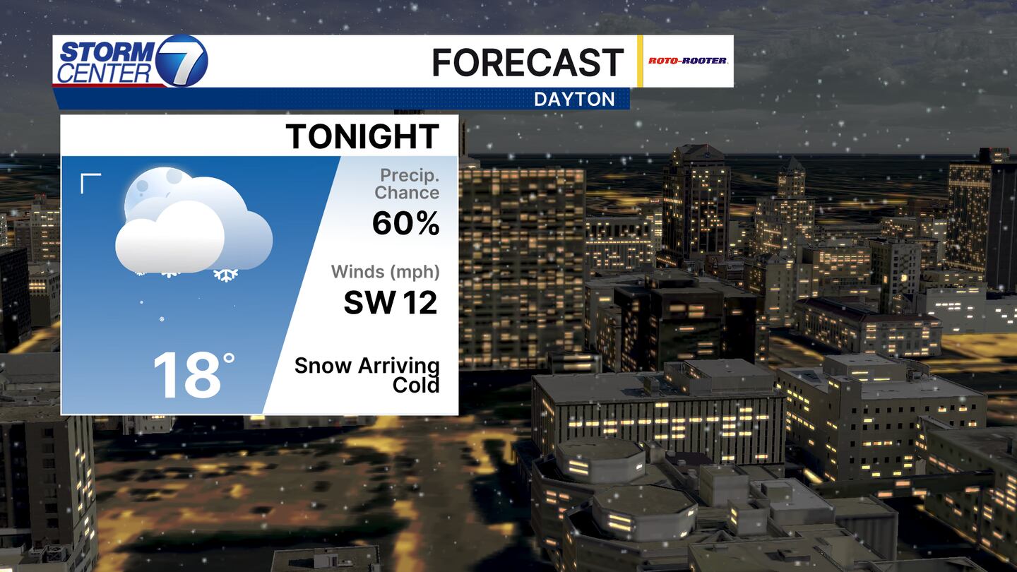
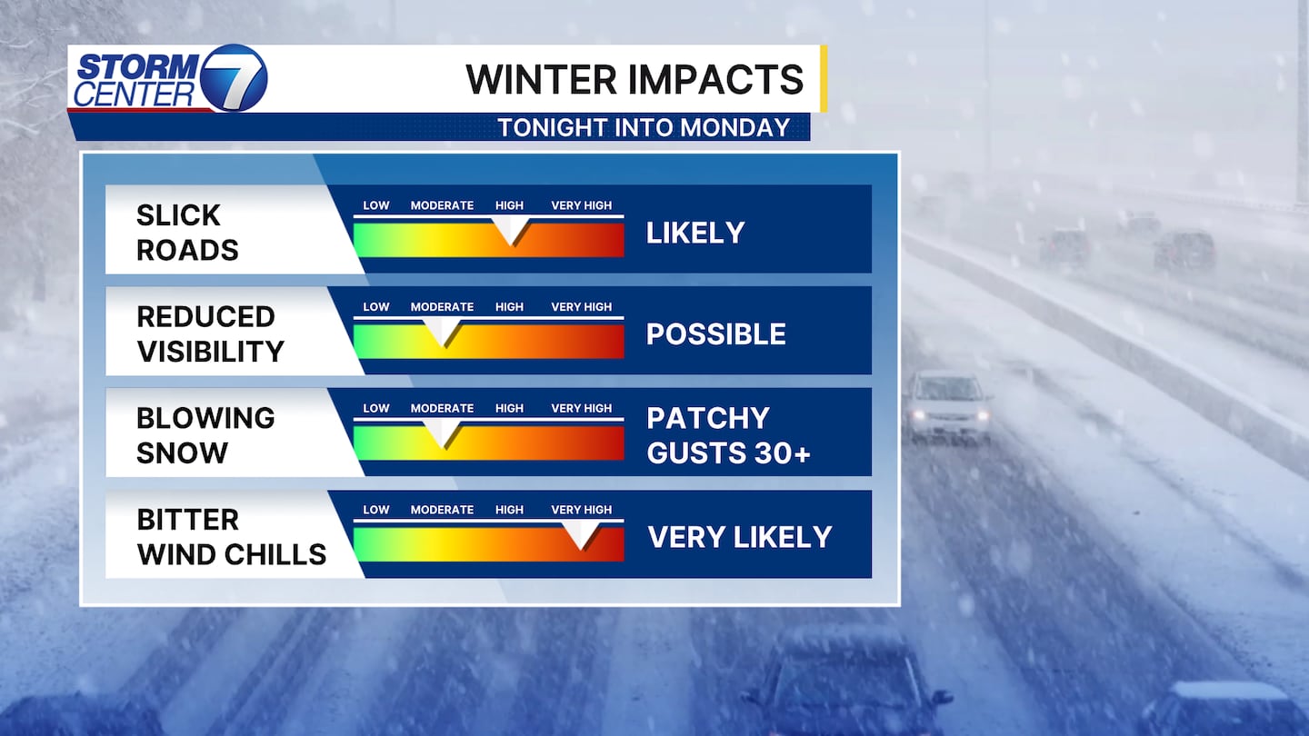
For tonight, snow arrives after 8PM and lingers into the overnight hours. The intensity is light in nature and should not pile up a ton. However, the morning commute could certainly be impacted.
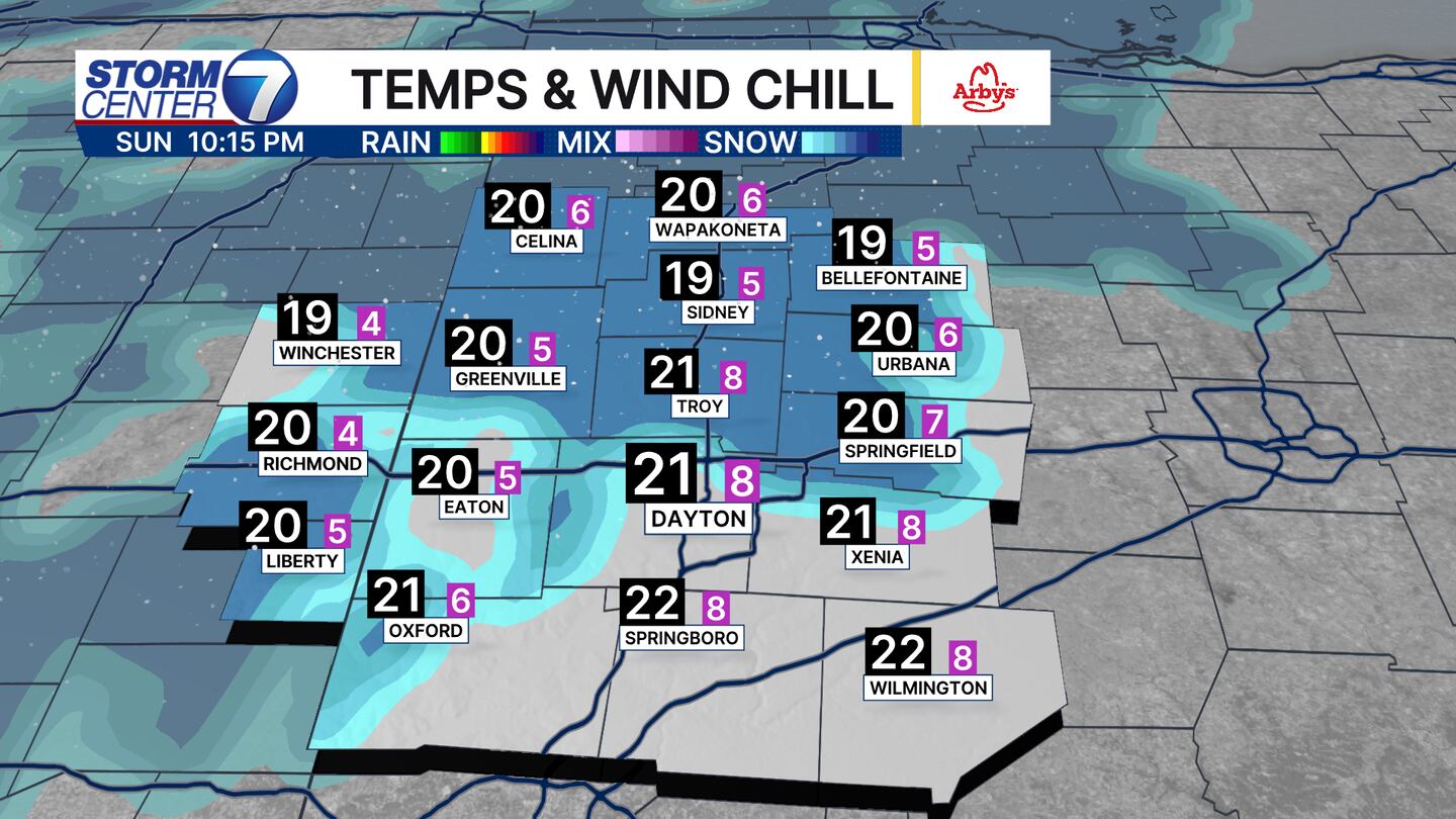
A reinforcing shot of cold air will follow the snow along with gusty winds. This will make for an unpleasant Monday with wind chills dropping to near -10 across much of the region.
[DOWNLOAD: Free Storm Center 7 Weather app for alerts as news breaks]
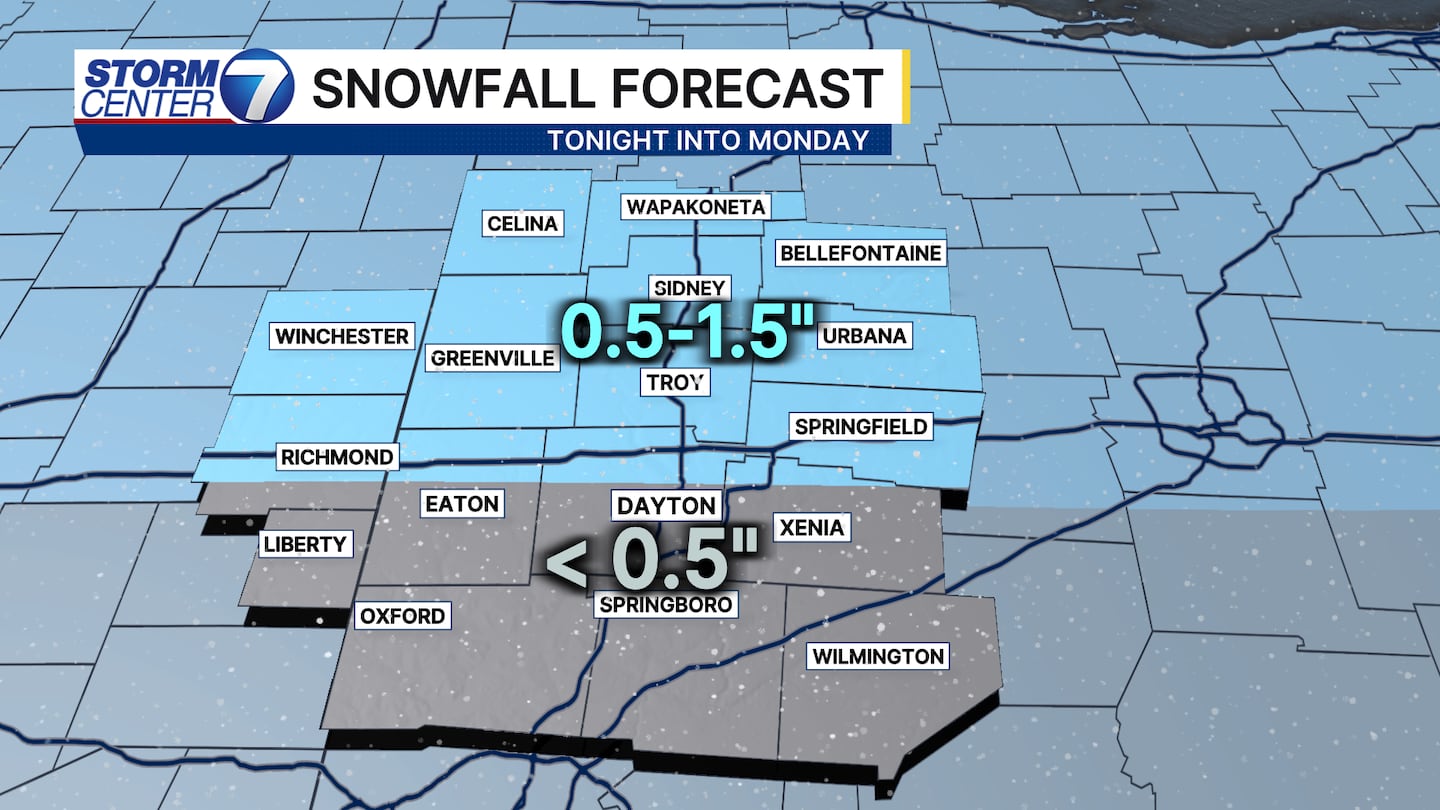
Snowfall amounts are far from impressive, but enough to be challenging at times. Less than 0.5″ of snow is likely south of Dayton, with the highest amounts falling near and north of I-70. The highest amounts will be 0.5″ to 1.5″, so nothing too crazy. Again, impacts of slick roads for the morning drive are the bigger concern.
[WATCH Storm Center 7 Weather on the following devices]
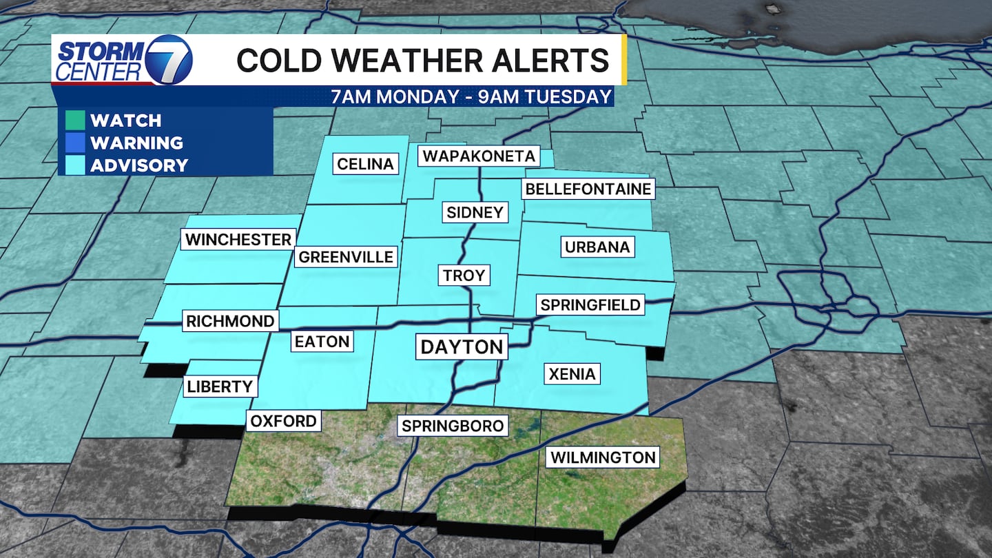
A Cold Weather Advisory is in effect for most of us from 7AM Monday to 9AM Tuesday. Wind chills of 0 to -10 are likely, but the advisory area has the best chance of seeing -10 degrees.
Dress warm and cover as much exposed skin as possible! We “thaw” a bit by Wednesday, so hang in there!
©2026 Cox Media Group


