
Skies will be mostly cloudy with a quick shower or some sprinkles possible. Some patchy fog can’t be ruled out, Storm Center 7 Chief Meteorologist Eric Elwell said. Temperatures will hold in the lower 60s.
QUICK-LOOK FORECAST:
- A few passing showers overnight, some fog possible
- Rain, some storms likely Saturday evening
- Remnants from Nate to bring more rain late Sunday
>>Rain, storms return this weekend
DETAILED FORECAST
Saturday: The day will start with some sunshine along with gusty south winds. It will be warm with highs reaching into the lower 80s. A cold front will bring a good chance for showers and storms during the evening. One or two storms could be strong with high winds being the main threat. Storms will exit the area late Saturday night.
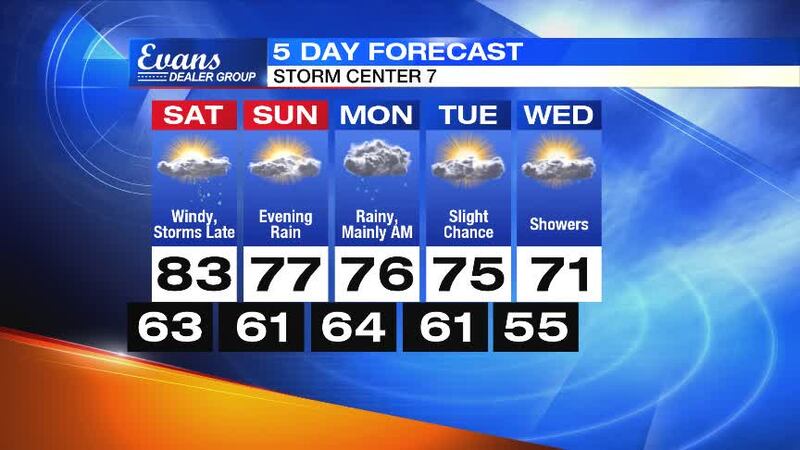
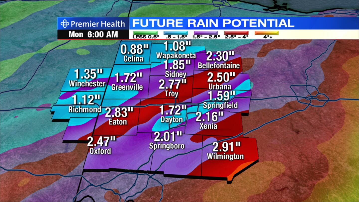
Sunday: The day will start with sunshine and mild temperatures. Highs will climb into the upper 70s before clouds move back in by late afternoon. Rain will develop late in the day and into the evening as the remnants of Nate move just to the southeast of the Miami Valley. The rain may be briefly heavy Sunday night.
>>Dayton Interactive Radar - WHIO Doppler 7
Monday: Rain will be likely, mainly in the morning. It may also be breezy at times. High temperatures will hold in the middle 70s.
Tuesday: Expect a mix of sun and clouds. A passing shower cannot be ruled out. Highs will be in the middle 70s.
Wednesday: More clouds will be around with a chance for some showers. Highs will be a bit more seasonably, holding to around 70 degrees.