QUICK-LOOK FORECAST:
- Overnight Rain/Thunder
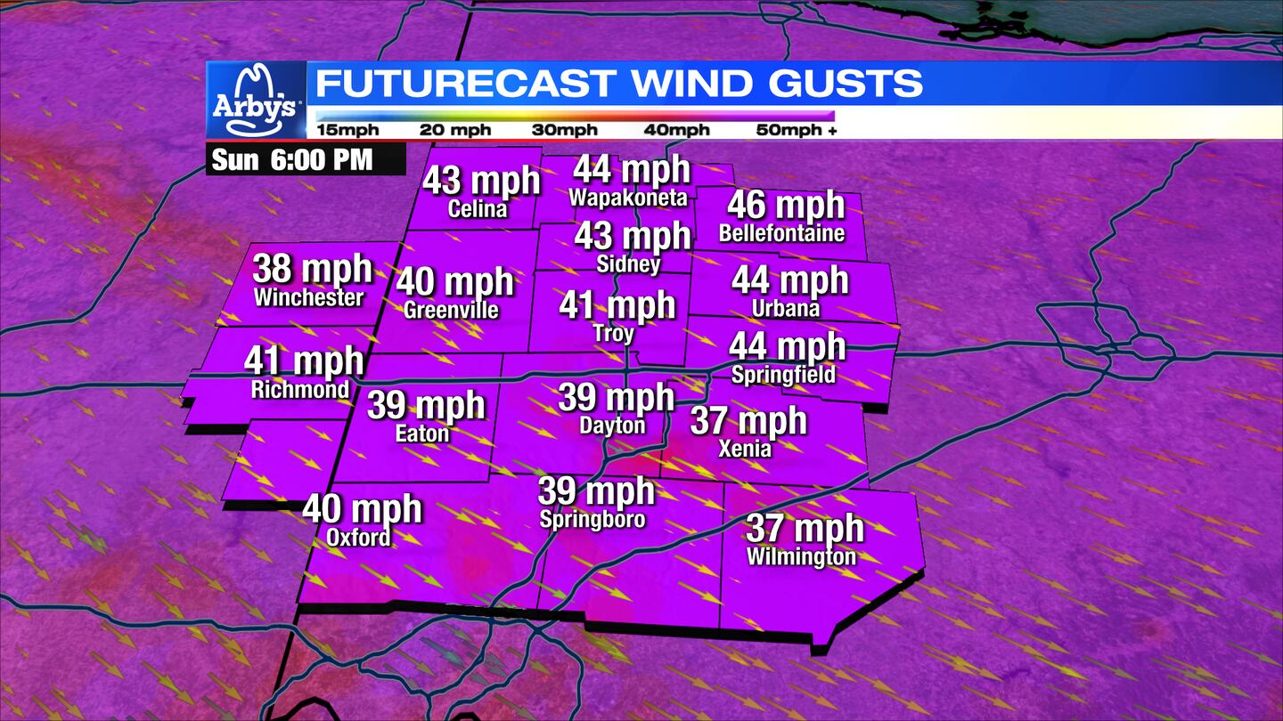
- Cool and Breezy Sunday
- Some sun next week
>TRACK THE CONDITIONS: Live Doppler 7 Radar
DETAILED FORECAST:
TODAY: Clouds increasing. Temps steady in the 60s with a light breeze. Rain with isolated thunderstorms after midnight. Severe storms unlikely, but brief, heavy rain, and gusty wind is possible.
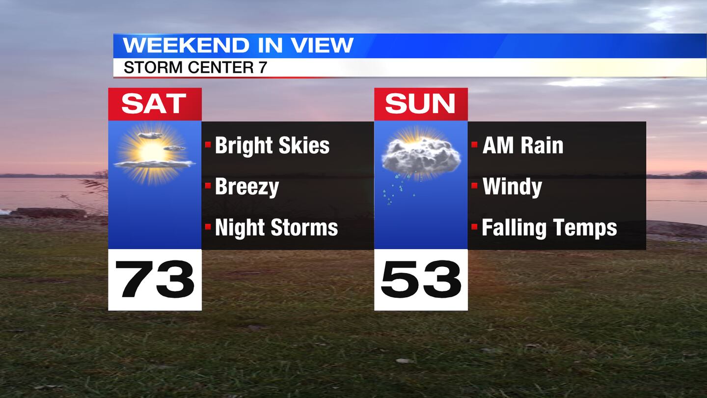
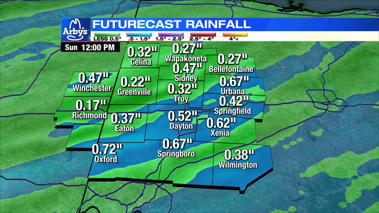
SUNDAY: Showers early, then a mix of clouds and sun. Cooler and breezy with highs in the mid-50s early, dropping into the upper-40s during the afternoon.

MONDAY: Sunny and seasonable. Highs in the upper-50s.
TUESDAY: Partly cloudy. Becoming mostly cloudy later with showers possible overnight. Warmer with highs in the upper-60s.
WEDNESDAY: Cloudy with a few showers early, then a few wet flakes possible in the evening. No accumulation expected. Highs in the upper-40s early, dropping into the 40s/30s through the day.
THURSDAY: A few clouds. Cold and breezy with highs in the mid-40s.
FRIDAY: Mostly sunny. Still cool with highs in the low-50s.
SATURDAY: Partly cloudy and comfortable with highs near 60.
Cox Media Group


