>> Darke County under Level 1 Snow Emergency
QUICK-LOOK FORECAST
- Record low temperatures set Tuesday, Wednesday
- Below normal temperatures this week
- Dry through the weekend
>> First snow of season: How much did you get?
DETAILED FORECAST
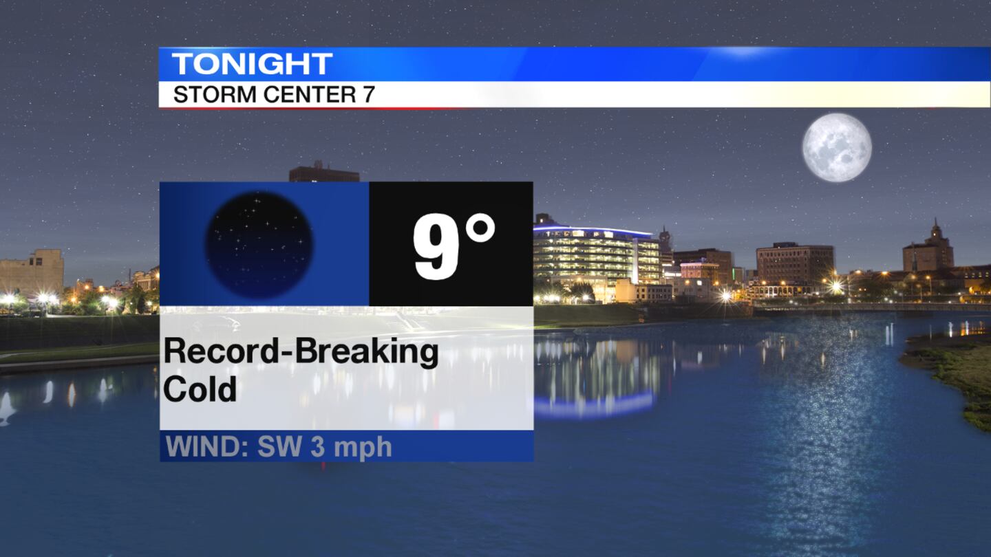
Overnight: A record low temperature of 9 degrees was set Wednesday at the Dayton International Airport, shattering the previous record of 13 degrees set in 1986. The airport also set a record low of 11 degrees for Tuesday, breaking the previous record of 15 degrees set in 1911, according to the National Weather Service. A few isolated slick spots are still possible overnight, mainly on areas left untreated from Monday and Tuesday's snow.
>> Tips and warning signs for frostbite, hypothermia
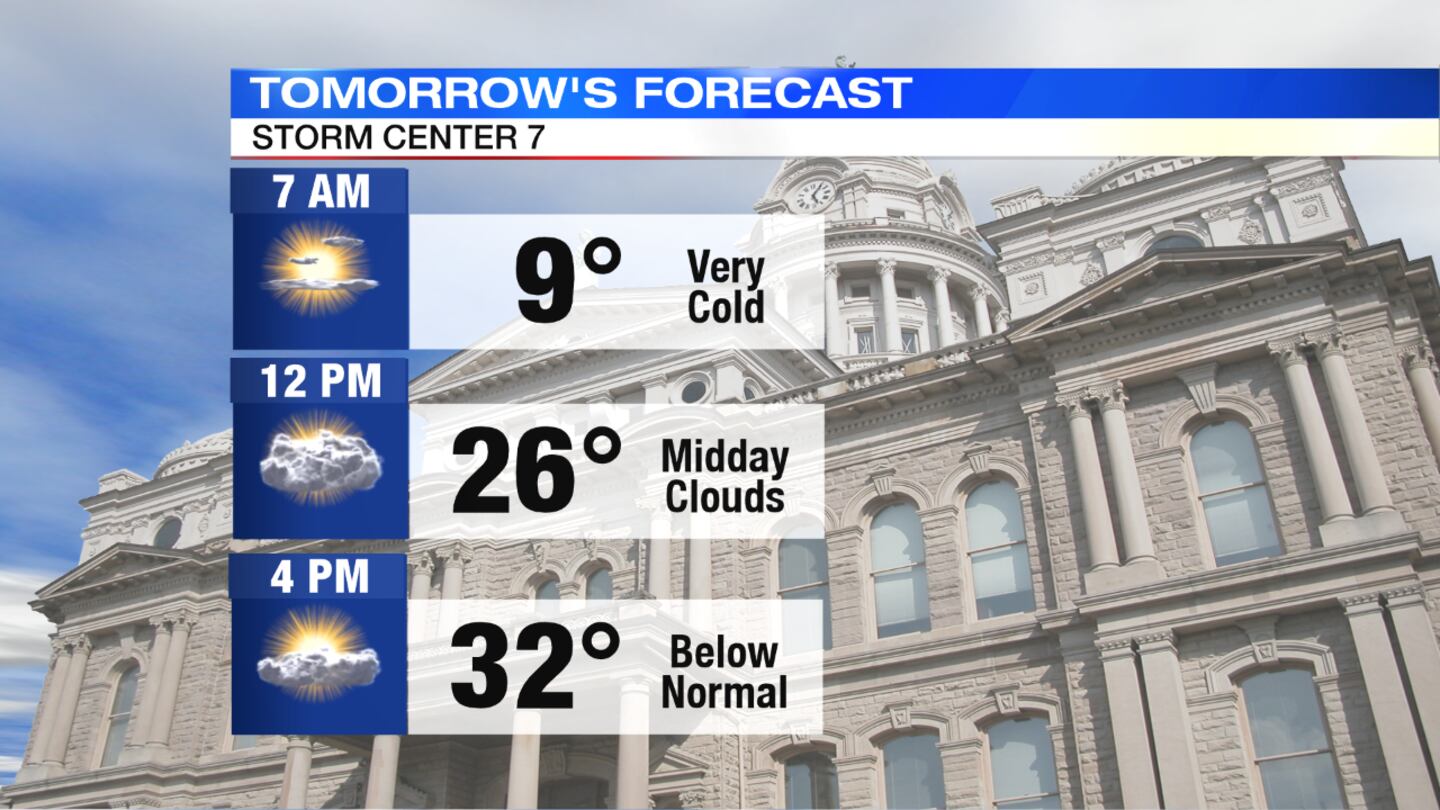
Wednesday: After a bitter start, temperatures will slowly climb through the teens. Watch for a few leftover slick spots on back roads and side streets that were left untreated. Sunshine returns during the day, but temperatures will remain far below normal with highs only expected to reach the lower 30s. Clouds return late day into the night. It won't be as frigid overnight, but still cold in the middle 20s.
>>TRACK THE CONDITIONS: Live Doppler 7 Radar
Thursday: More clouds than sun is expected with a slight chance of a stray flurry north. Highs for the day will reach to around 40 degrees.
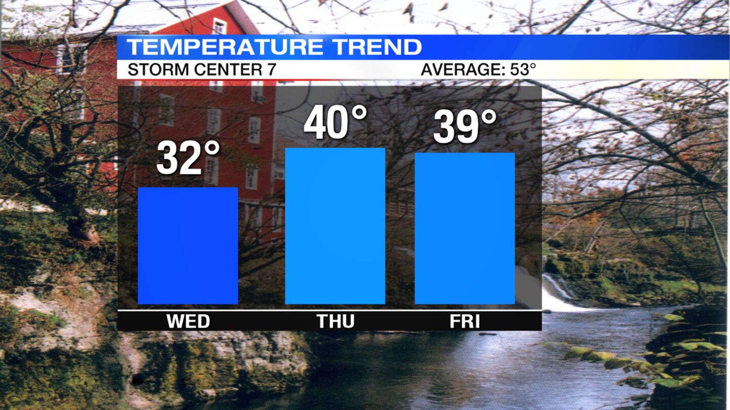
Friday: Mostly sunny skies return and it will look pleasant, but cooler than normal with high temperatures in the upper 30s.
>> Winter Safety Awareness: How does salt help icy roads?
Saturday: It will be a dry weekend, but still cool with highs around 40 degrees.
Sunday: Morning sun will give way to clouds throughout the day, and temperatures rise to the middle 40s for the afternoon.


