
DAYTON — It’s the start of an active pattern with multiple rounds of snow, high winds, and wind chills below zero. Hey it’s Stormcenter 7 Meteorologist Ryan Marando.
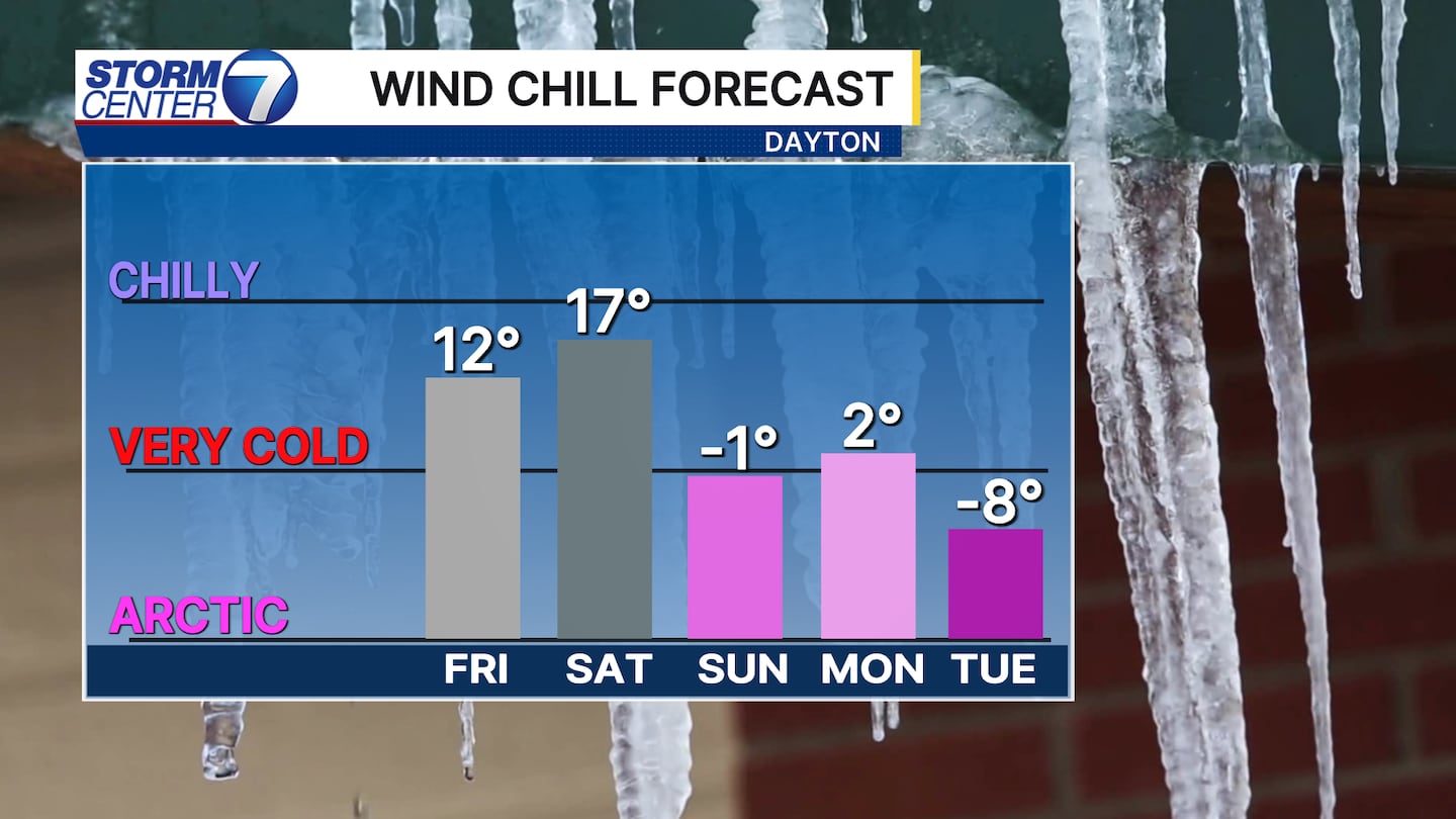
True arctic air with lows in the single digits and highs in the teens are coming next week. With even a slight wind, that’s going to make wind chills early next week drop down below zero!
[DOWNLOAD: Free Storm Center 7 Weather app for alerts as news breaks]
This is happening due to multiple cold fronts swinging in reinforcing the cold air. Each cold front will bring a few snow showers, but nothing too significant.
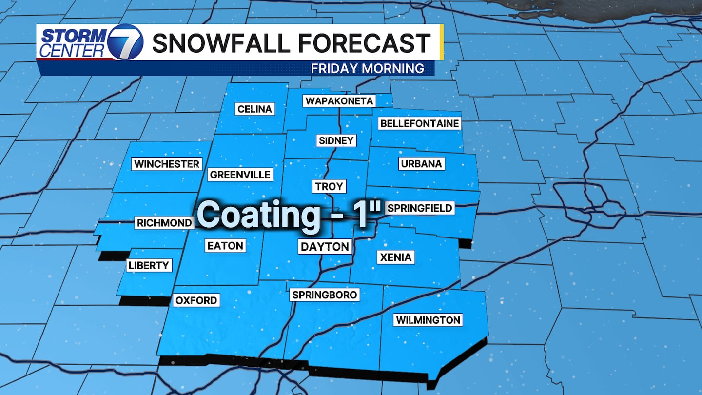
After Wednesday evening’s scattered snow showers, there will be a few more out there Friday morning. Not a big, widespread burst of snow, but instead just a few more scattered snow showers. Accumulations may range from not much at all to an inch at the very most.
[WATCH Storm Center 7 Weather on the following devices]
More snow showers may move in on Saturday and still watching how much of that system may accumulate and we will keep you posted.
©2026 Cox Media Group


