>> Here's what you need to know about heat exhaustion, heat stroke
The Heat Advisory for all counties and the Excessive Heat Warning that's been in effect since Friday has been canceled.
QUICK-LOOK FORECAST
- Storms continue this evening, quiets down slightly overnight
- Significantly cooler Monday
- Sunny stretch begins Tuesday
>> Heat wave brings dangerous conditions

DETAILED FORECAST
>> How hot can summer weather make the inside of a car?
>> Heat Index: What is it? Why does it matter?
Tonight: Lows drop to 70 degrees as a chance for showers and thunderstorms continue into the overnight hours and through the morning. A strong storm is possible before midnight, but most storms will turn to showers throughout the early morning hours.
>> TRACK THE CONDITIONS: Live Doppler 7 HD Interactive Radar
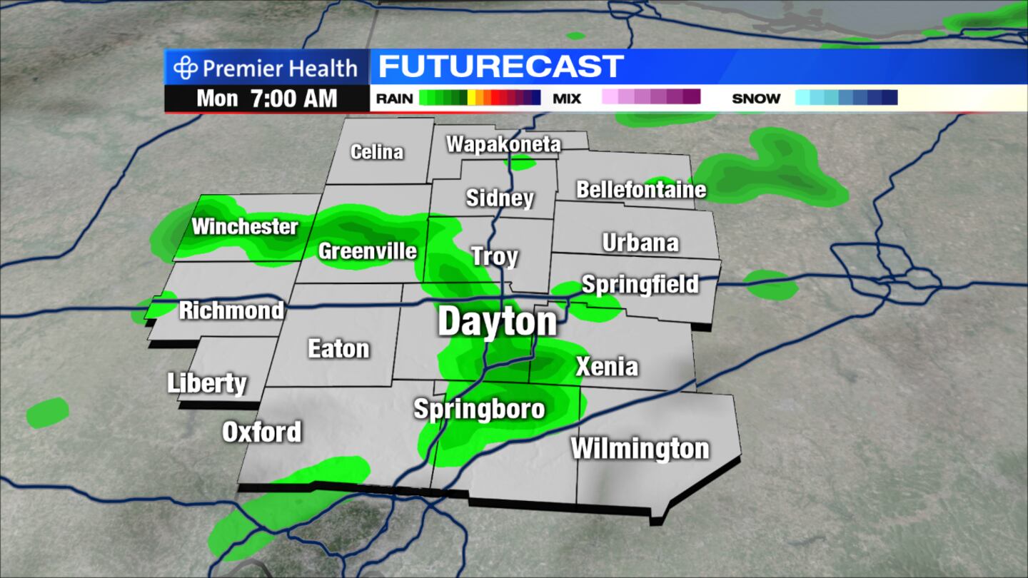
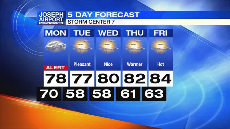
Monday: Conditions will be mostly cloudy and cooler with a chance for showers and storms mainly before noon as highs reach the upper 70s.

Tuesday: It will be mostly sunny and pleasant with highs around 77 degrees and low humidity.
>> YOU NEED THIS: Download the WHIO Weather App
Wednesday: It will be mostly sunny and pleasant. Highs will approach 80 degrees with low humidity.
Thursday: It will be sunny and warm with highs in the lower 80s.

Friday: Conditions will be mostly sunny and a bit warmer as highs climb into the middle 80s with relatively low humidity.