
DAYTON — Good afternoon to you on this Thursday! Meteorologist Nick Dunn here with you on what has been a snowy day! Many of you woke up to a healthy amount of snow thanks to lake effect bands from Lake Michigan. We are not done with snow chances just yet.

For tonight a few flurries linger this evening for some, then we turn mostly cloudy and dry overnight with lows in the teens. Wind chills will be in the single digits for the morning commute. Additionally, more light snow is possible by dawn.
Most spots will not see much where the snow does stick, but even a couple tenths of an inch can cause a few slick spots. It will be cold enough for the snow to stick out there as well.
[DOWNLOAD: Free Storm Center 7 Weather app for alerts as news breaks]

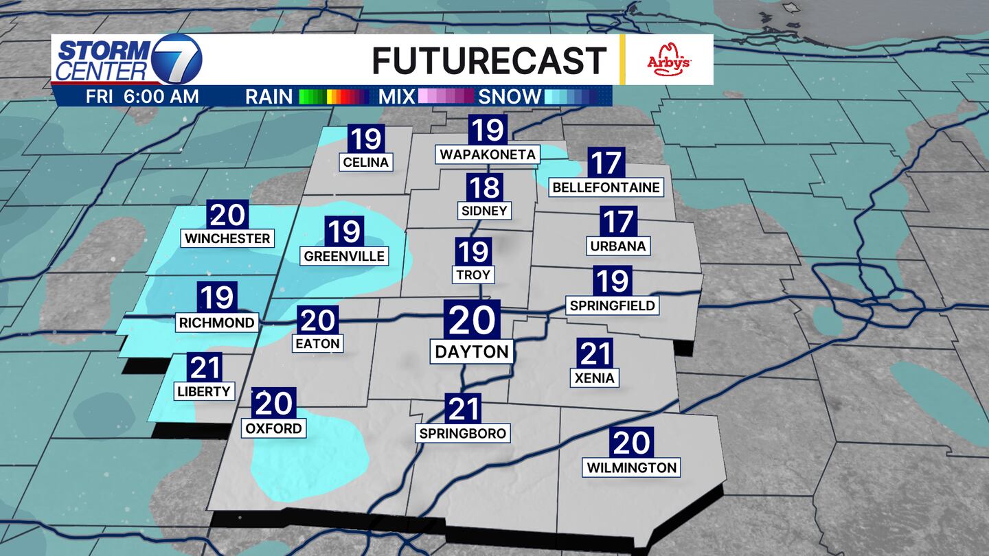
A stronger disturbance will bring snow and possibly some mix showers with rain or graupel Friday evening. As temperatures fall below freezing this will change to snow and a few heavy bursts of snow similar to last night are possible.
The difference here is these will be moving and not meander back and forth like the lake effect snow bands. Light accumulations are possible here to make for slippery roads as well.
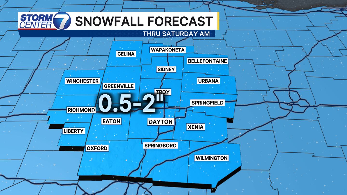
Totals between both rounds of precipitation will not be intense, but they can be impactful. Snow accumulations will vary between 0.5″ and 2″ across the Miami Valley. Snow generally winds down by Saturday morning.
[WATCH Storm Center 7 Weather on the following devices]
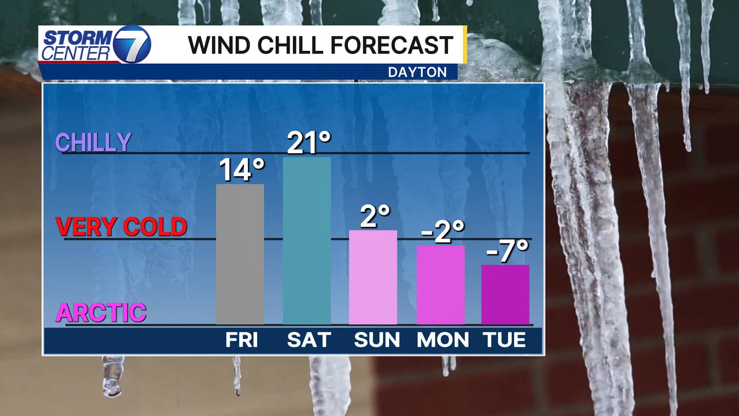
Behind the snow will be some bitterly cold temperatures. This means wind chills below zero are likely for Monday into Tuesday! Some guidance shows wind chills colder than -10 degrees, so we will watch that closely.
©2026 Cox Media Group


