QUICK-LOOK FORECAST:
- Big warm-up this week
- Rain returns by Friday
- Minor flooding possible with rain and snow melt
>> TRACK THE CONDITIONS WITH LIVE DOPPLER 7
DETAILED FORECAST:
TODAY: Clouds will linger through the night and cold. Lows in the upper teens expected. Some isolated slick spots remain from earlier snowfall.
There is a potential for patchy freezing drizzle early tonight. This could lead to additional slick spots.

TUESDAY: A few slick spots again but a dry day with highs back up to the lower 30s! Clouds may break for a bit of sunshine, but most of the day will be overcast. A bit more clearing expected for Tuesday night.
WEDNESDAY: A nice day. Dry with some sun. Highs in the lower to middle 40s. Clouds fill back in Wednesday night.
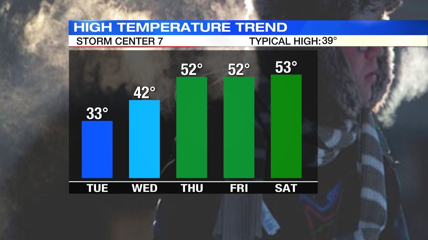
THURSDAY: A big warm-up expected for Thursday with highs pushing to the lower 50s. Clouds increase and breezy during the day. Chance of a few showers at night.
FRIDAY: Scattered rain showers likely for Friday, but still warm and breezy. Highs in the lower 50s again.
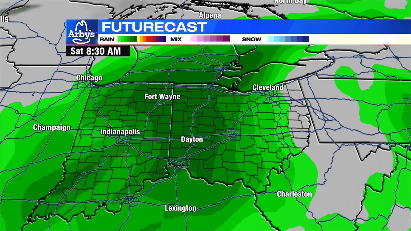
SATURDAY: More rain expected, especially in the morning and could be heavy at times. Some minor flooding will be possible due to snow melt and rainfall. Highs on Saturday will climb to the lower 50s.
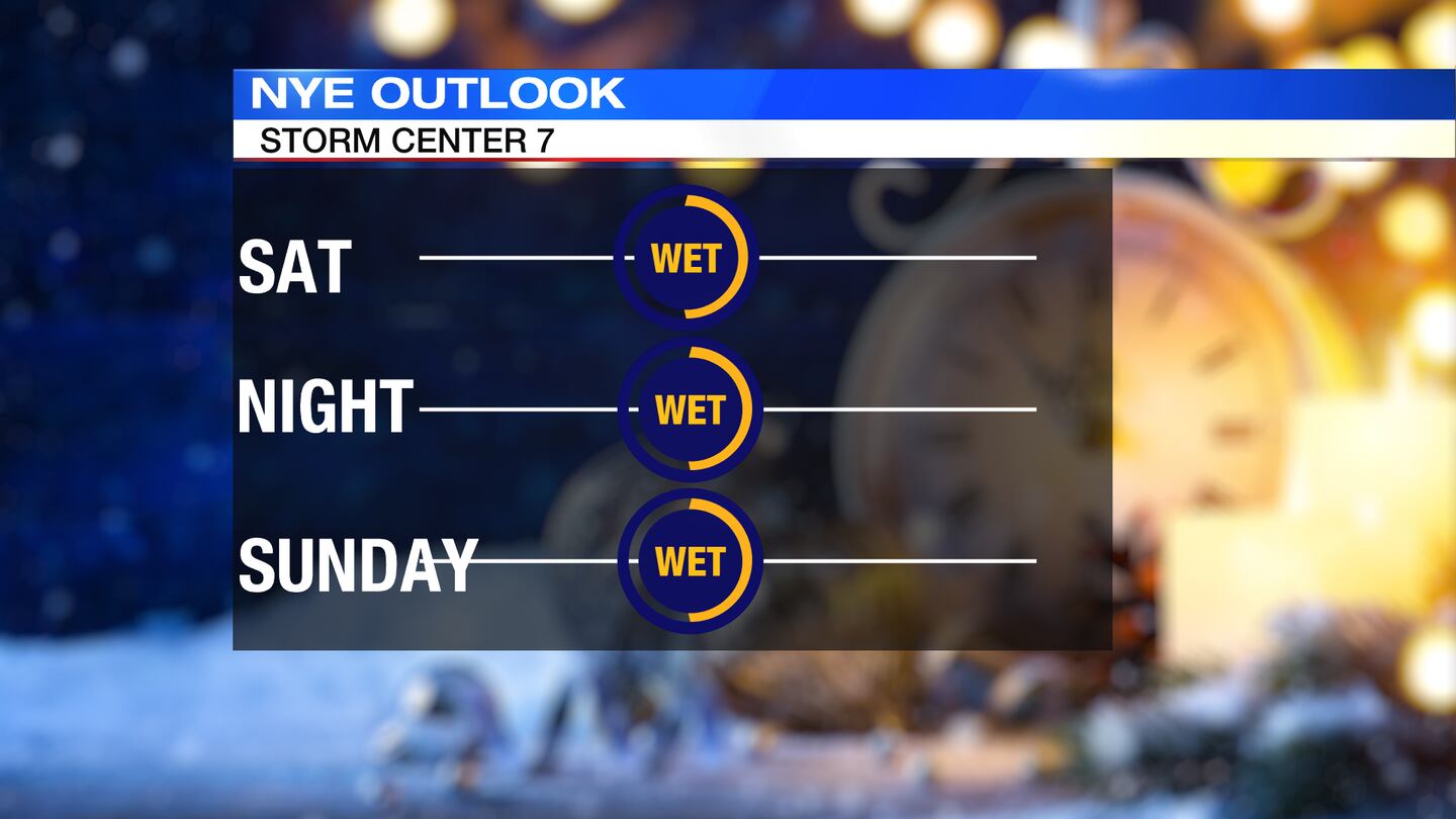
SUNDAY: A few passing showers are still possible on Sunday. Highs in the lower 50s.
MONDAY: Partly sunny and mild. Highs in the middle 50s again.
©2022 Cox Media Group


