
>> LISTEN: Cloudy with a Chance of Podcast: A podcast for weather fans
QUICK-LOOK FORECAST
- Pop-up storms bring brief, but heavy rain
- Flood Advisory issued for Preble County until 2 a.m.
- Cool-down coming this weekend
EXCESSIVE HEAT WATCH ISSUED FOR JULY 4TH from 12pm to 8pm. Counties affected include: Buter, Warren and Clinton. A FLOOD ADVISORY is in effect for Preble County until 2 a.m and south central Wayne until 3 a.m. Tuesday.
DETAILED FORECAST
TODAY: A very warm and muggy evening is expected with temperatures hovering in the 80s, according to Storm Center 7 Chief Meteorologist Eric Elwell.
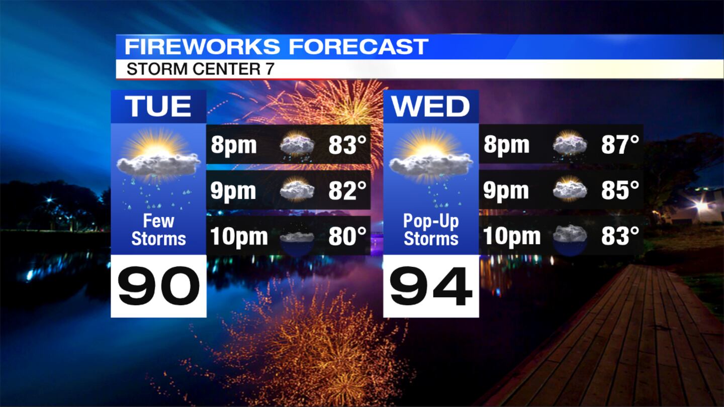
>>Fourth of July forecast: What to expect for the holiday
Passing storms will flare up, then slowly taper off after sunset. It will stay warm and muggy through the night with lows in the lower 70s.
>> LIVE Doppler 7 HD Interactive Radar
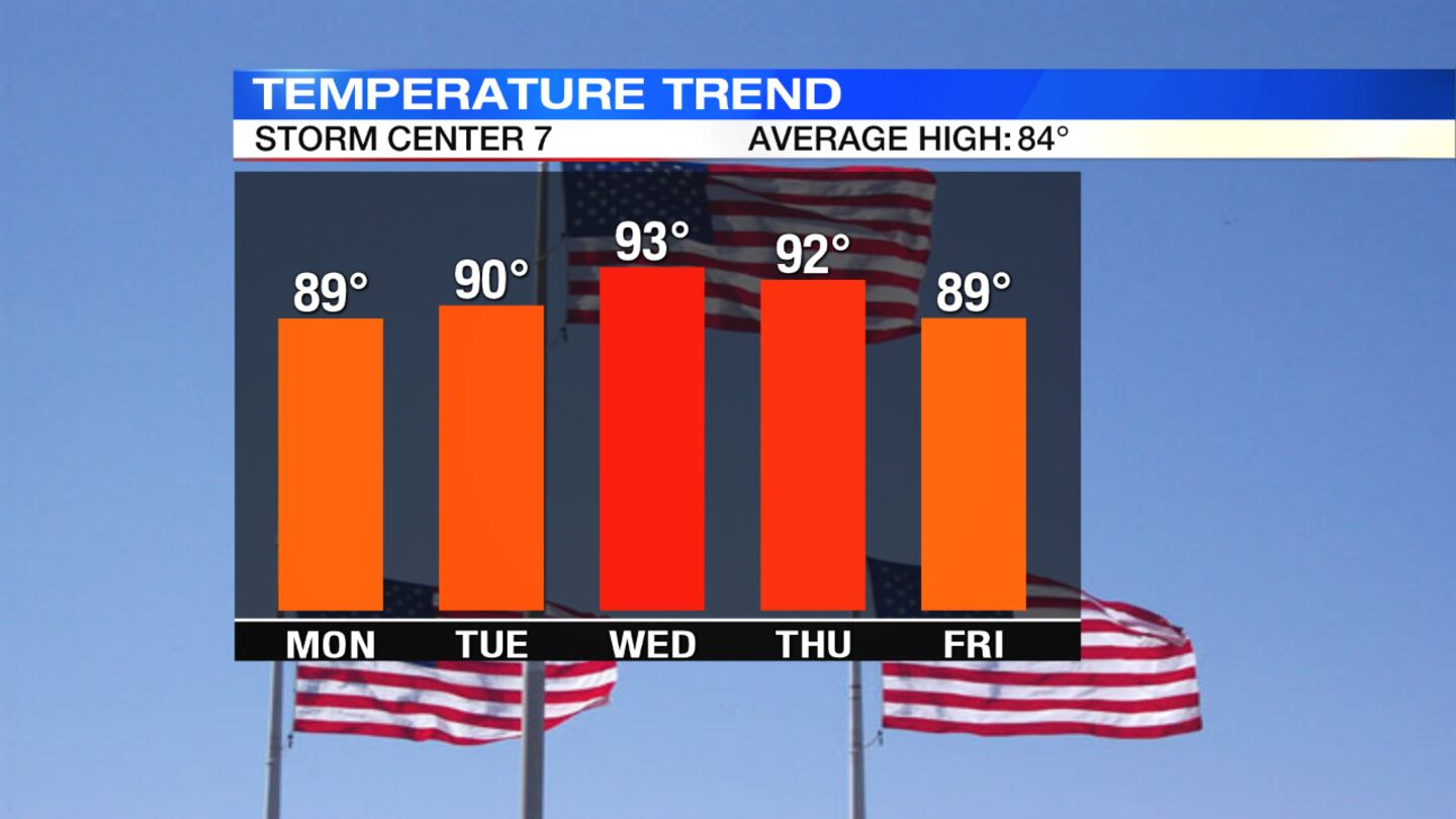
TUESDAY: A mix of sun and clouds through the day with another chance for more passing showers and storms, especially during the afternoon. Temperatures will once again be near 90 degrees.

>> Heat Index: What is it? Why does it matter?
FOURTH OF JULY: Partly cloudy skies are expected, with a slight chance for a pop-up storm late in the day. It will be hot and humid once again with highs reaching the lower to middle 90s.
THURSDAY: The threat for storms will return by the afternoon as a cold front approaches. Outside of storms, temperatures will be in the lower 90s.
FRIDAY: The chance for showers and storms continues, mainly early in the day. Temperatures will not be as hot and the humidity will start to drop. Highs will be in the middle 80s.
SATURDAY: A mostly sunny day is expected with more comfortable conditions to start the weekend. Highs will be in the lower 80s with lower humidity.