
DAYTON — UPDATE @ 1:50 A.M
A Severe Thunderstorm Warning has been canceled for Wayne and Randolph Counties.
UPDATE:
A Flood Warning is in effect for Wayne and Union counties in Indiana until 11 a.m. on Friday.
INITIAL REPORT:
Good afternoon to you on this Thursday. Meteorologist Nick Dunn here on what has been a dry day.
The dry time is much appreciated by those dealing with flooding. However, I have new concerns tonight about torrential rainfall and more flooding.
Parts of the area cannot tolerate rainfall anymore.
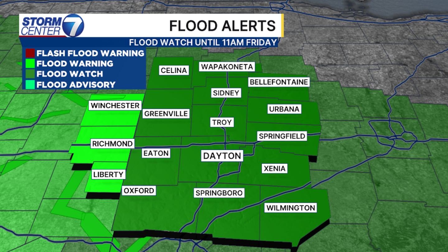
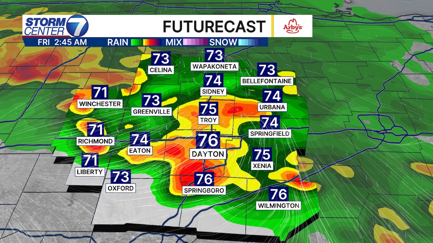
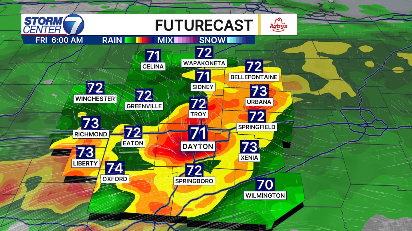
A Flood Watch continues through 11 AM Friday, and this could be extended. Additional rain and storms are forecast to fire up around Midnight and continue into Friday morning.
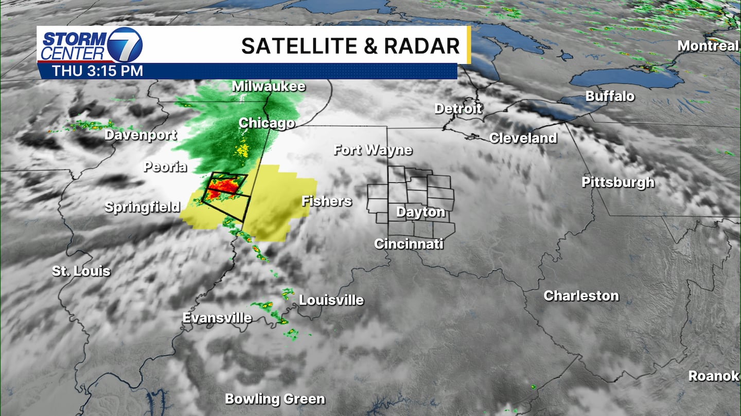
We remain entrenched in a pattern where multiple clusters of storms riding northwest to southeast swing through the region.
One of those could impact the area early this evening, but the concerns rise higher into the overnight and Friday morning.
[DOWNLOAD: Free Storm Center 7 Weather app for alerts as news breaks]
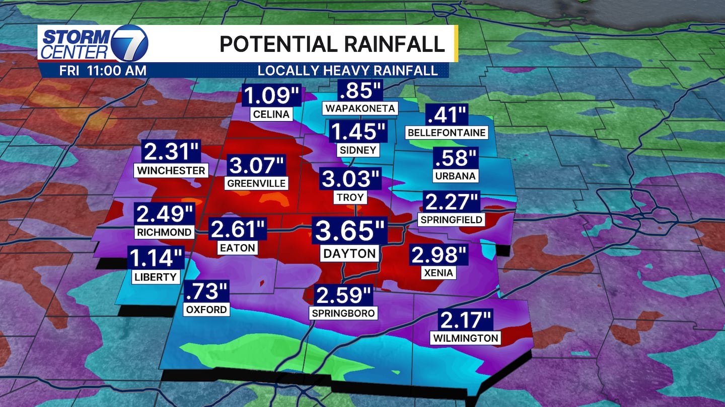
Rainfall rates over 1 inch per hour are possible, and new rainfall totals of 1 to 4 inches are possible into Friday morning, with locally higher totals.
The band of heaviest totals is subject to subtle shifting, but the consensus is clear that heavy rainfall will renew flooding issues.
[WATCH Storm Center 7 Weather on the following devices]
Another concern with this will be driving conditions for the morning commute on Friday.
Some ponding water and even high water spots are probable. I would plan on allowing some extra time for the morning commute.
©2026 Cox Media Group


