QUICK-LOOK FORECAST:
- Few showers or storms tonight
- More rain possible Tuesday - Wednesday morning
- Cooler Temps This Week
>>TRACK THE CONDITIONS: Live Doppler 7 Radar
DETAILED FORECAST:
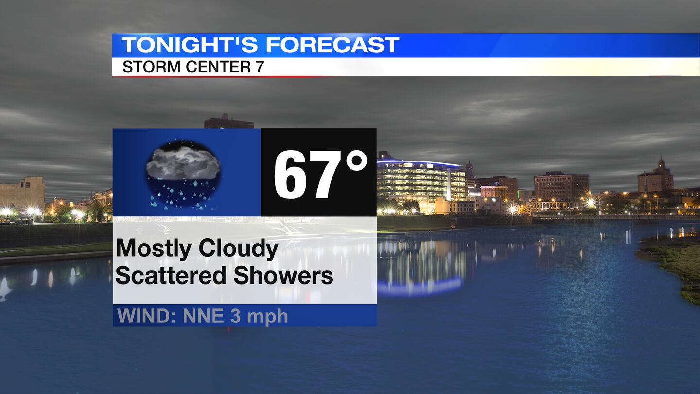
TODAY: Mostly cloudy skies with a few showers or storms around. Best chance for rain will be south of I-70. Mild and muggy. Lows in the upper 60s.
>>Hurricane Ida live updates<<
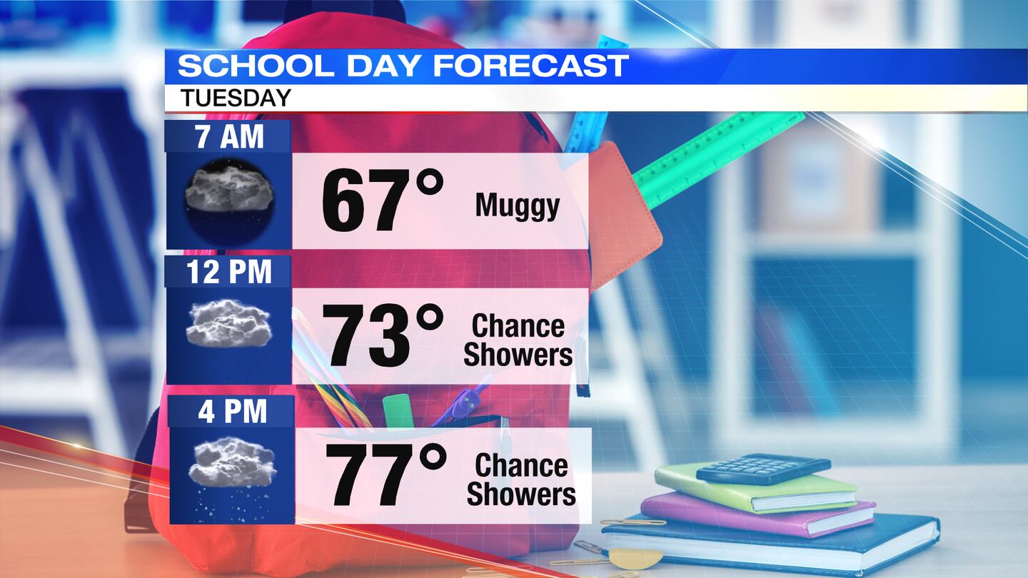
TUESDAY: Mostly cloudy skies with showers at times and perhaps a few storms. Some locally heavy downpours can’t be ruled out.
Cooler again with highs only in the upper 70s. Chances for rain continue Tuesday night into early Wednesday, although models are in poor agreement as to where the axis of heaviest rain will set up.
In general, better chances for heavy rain late Tuesday through early Wednesday will be further south and east.
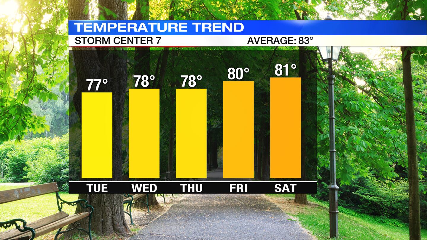
WEDNESDAY: Rain possible in the morning especially across our southeastern areas, then drying out and clearing out during the afternoon. Partly cloudy to wrap up the day. High temperatures only reach the upper 70s.
THURSDAY: Sunny and warm, but not humid. Highs around 80 degrees.
FRIDAY: Mostly sunny with seasonably warm temperatures. Highs around 80 degrees.
SATURDAY: Mostly sunny and warm. Highs in the lower 80s.
SUNDAY: Partly cloudy, seasonably warm, nice with temperatures in the middle 80s.
©2021 Cox Media Group


