
DAYTON — Hello, everyone! Good evening to you on this Saturday. Weather Specialist Nick Dunn here with a look at the forecast. We got a touch warmer than projected today with a high of 72 degrees, but you will not hear any complaints here!
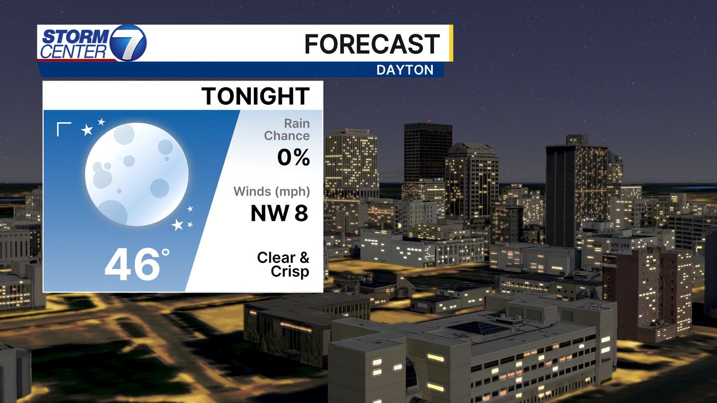
The temperatures will cool quickly after sunset tonight thanks to a clear sky and light winds. Lows will fall into the middle 40s for most, but a few lower 40s are possible as you work away from Dayton in some of our normal cool spots.
[DOWNLOAD: Free Storm Center 7 Weather app for alerts as news breaks]
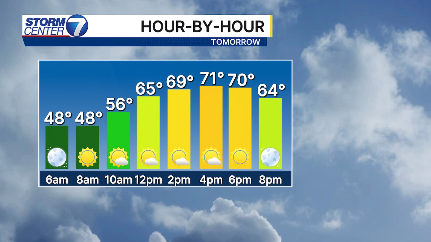
Sunday will live up to its name with sunshine and temperatures a touch above average for the start of mid-October. Highs will climb into the lower 70s. A few clouds may develop or move through in the afternoon, but no threat for rain is in store.
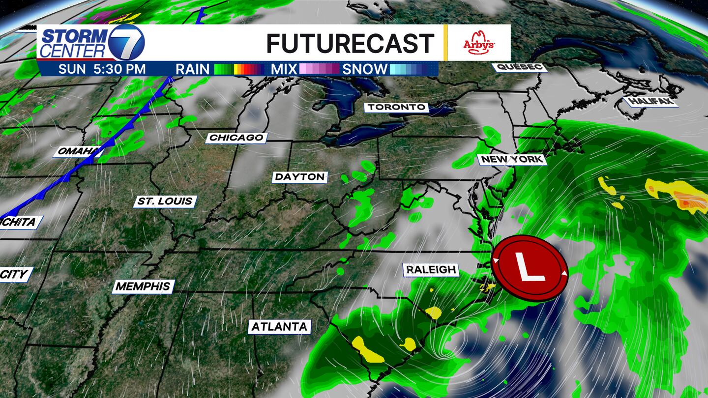
We are “wedged” between a coastal storm to our east and a cold front to the west. This will help to keep us dry and a bit milder than we expect. Highs for Monday will climb into the low to mid 70s and Tuesday looks to be the warmest of the next 7 days with highs in the middle 70s.
[WATCH Storm Center 7 Weather on the following devices]
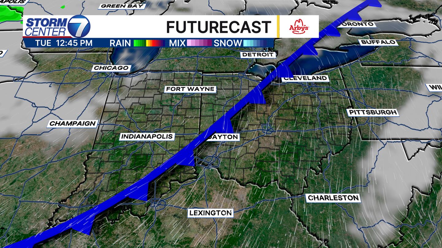
A dry cold front will surge southeast on Tuesday as we transition back to cooler, more seasonable weather for Wednesday. Some moisture behind the front may bring a stray sprinkle Wednesday, but I am not too sold on the chance right now.
Enjoy the rest of your weekend!


