QUICK-LOOK FORECAST:
- Warm and dry for most of the week
- Rain chances arrive later in the week
- Much cooler air to follow
>> TRACK THE LATEST CONDITIONS: Live Doppler 7 Radar
DETAILED FORECAST:
TONIGHT: Quiet clear and cool with temps in the upper 50s.

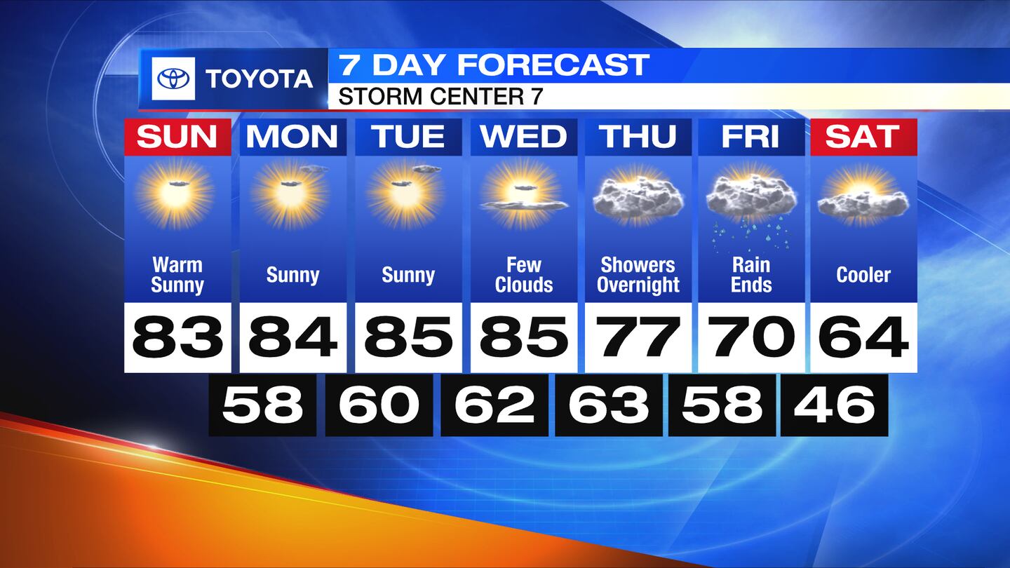
MONDAY: Sunny with highs in the low to mid-80s.
TUESDAY: Sunny and warm again with highs in the low to mid 80s.
WEDNESDAY: A few afternoon clouds, otherwise sunny with highs in the low to mid-80s.
THURSDAY: Mostly cloudy and a bit breezy ahead of the next cold front. Rain chances increase overnight, but not looking substantial as of now. A touch cooler with highs in the upper 70s.
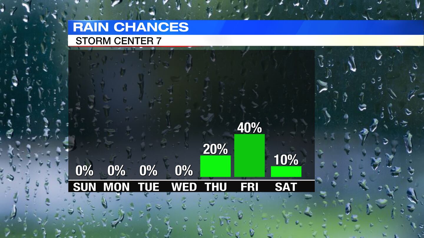
FRIDAY: Mostly cloudy with a chance for showers. Rain chances lower by later in the day into the evening. Cooler with highs around 70.
SATURDAY: Some clouds lingering, otherwise MUCH cooler with highs only in the middle 60s, which will be below typical highs
©2023 Cox Media Group