QUICK-LOOK FORCAST:
- Bitter cold and breezy
- Snow showers Monday evening to Tuesday morning (Light Accumulation)
- Chance of snow Thursday, light accumulation possible
>>TRACK THE CONDITIONS: Live Doppler 7 Radar
DETAILED FORECAST:
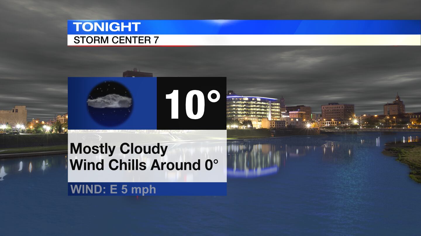
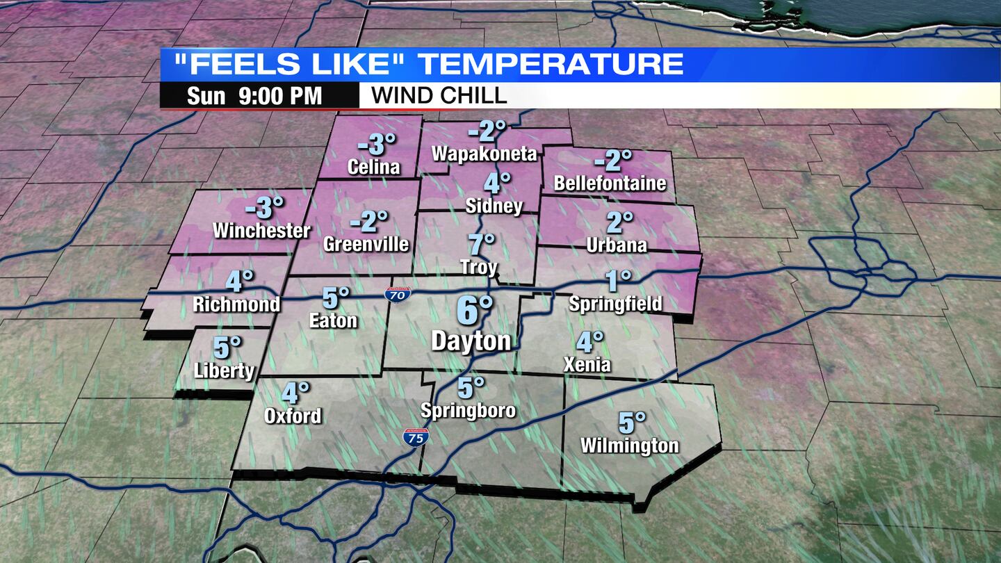
TODAY: Increasing clouds and very cold for Sunday, according to News Center 7 Meteorologist Traci Hale Brown. It will be a windy day, too, so conditions will be frigid. Highs in the teens with wind chills dropping to near 0 degrees.
MONDAY: Another frigid to start with temperatures near zero and wind chills dropping below 0 degrees. Highs climb to near 30 degrees. Snow showers arrive towards the end of the day and into the overnight hours.
TUESDAY: Cloudy and chilly for Tuesday with snow showers mainly in the morning, light accumulation. High near 30 degrees.

WEDNESDAY: Mostly cloudy, snow flurries possible. It will be cold with highs only in the low 20s.
THURSDAY: Snow flurries possible, light accumulation only. More chilly temperatures with highs in the upper 20s and lows in the teens.
FRIDAY: Mostly cloudy and bitterly cold. Temperatures during the day in the 20s, dropping into single digits for the overnight hours.
Cox Media Group