
DAYTON — Good evening, everyone! How is your Saturday going? Meteorologist Nick Dunn here with you on this Saturday to break down the forecast! Anyone missing the record warmth from Friday? We are in for a bigger shift in temperatures tonight into Sunday!
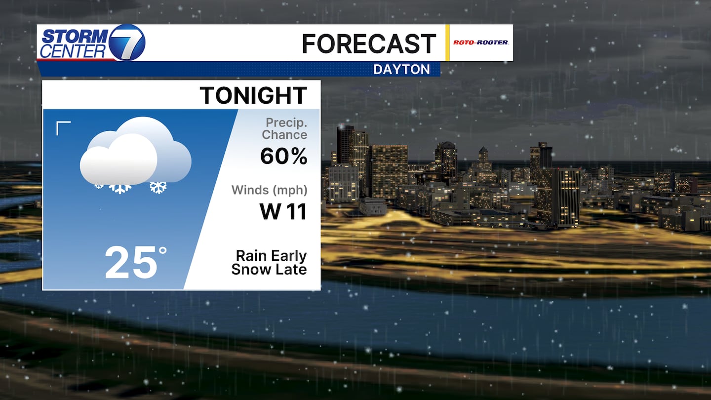
Tonight features falling temperatures and the arrival of snow showers overnight. A few snow showers could contain a potent burst and bring a quick accumulation. Additionally, a couple snow squalls cannot be ruled out.
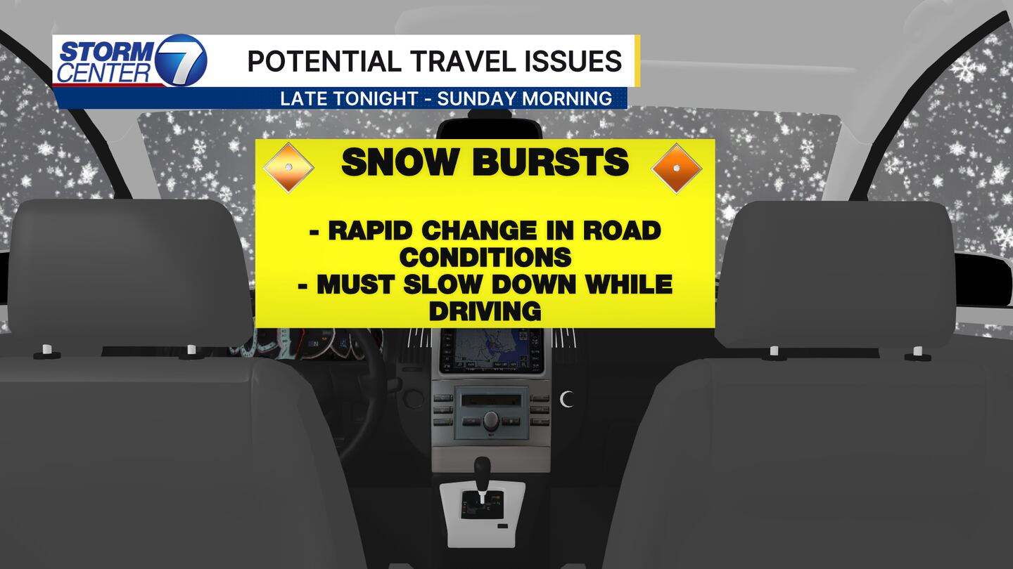
This means if you are out very late tonight into early Sunday you may encounter some rapidly changing road conditions and remember those winter driving practices! The snow totals are not impressive, but the impacts could wind up being more of the issue here.
[DOWNLOAD: Free Storm Center 7 Weather app for alerts as news breaks]
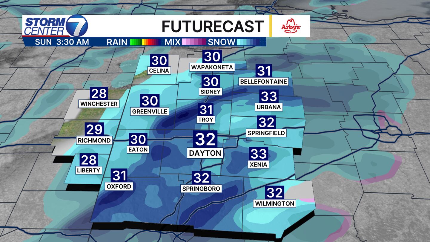
Snow showers arrive after Midnight through daybreak on Sunday. The darker blues there on futurecast highlight that potential for snow to be heavy in spots. Add in falling temperatures, gusty winds, and reduce visibility and you have a recipe for slick spots in some areas!
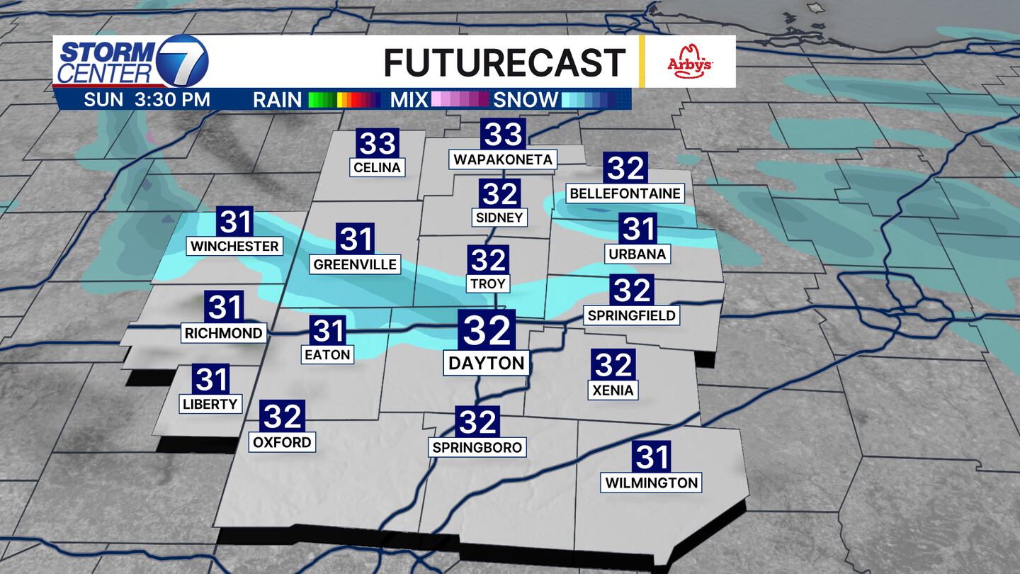
By Sunday afternoon, snow showers will taper to flurries. Wind chills will make a brutal return with a feels like temperature in the teens all day. A big difference from the 60s yesterday, right?
[WATCH Storm Center 7 Weather on the following devices]
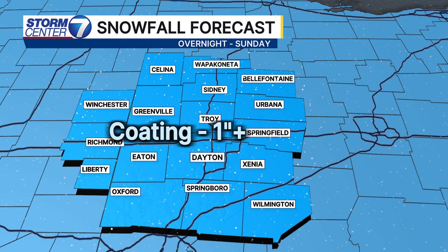
Snowfall totals will generally be 1″ or less in most cases. But, if bursts or squalls of snow are heavier over a particular spot for a longer period of time a few isolated spots over one inch are possible! Stay safe and check back for more updates!
©2026 Cox Media Group


