
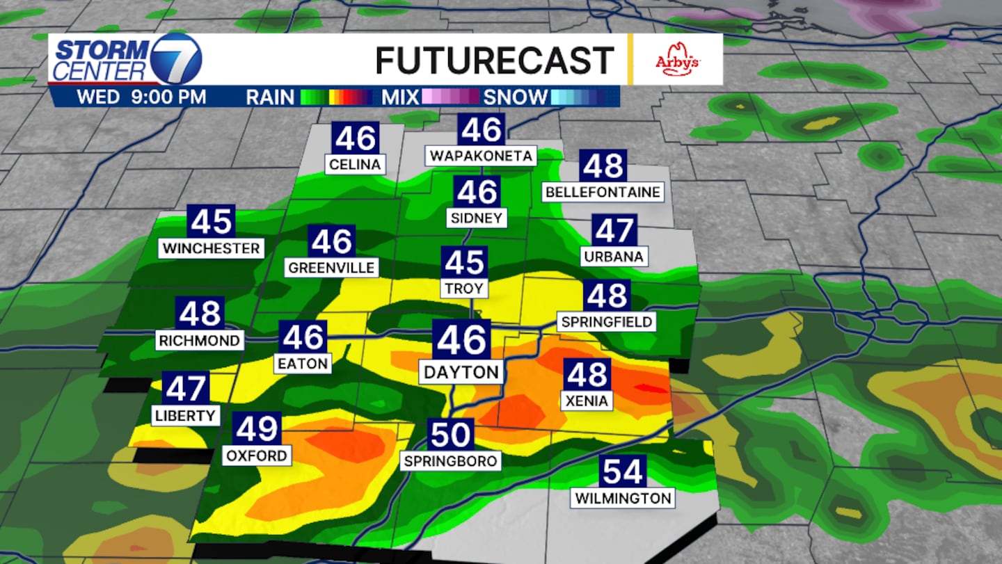
DAYTON — A break in the heavy rain will be a pleasant experience throughout Wednesday afternoon, but heavier and steadier rain is forecasted after 6 p.m.
Unfortunately, this will occur in areas that have already received over two inches of rain over the last 24 hours.
[DOWNLOAD: Free Storm Center 7 Weather app for alerts as news breaks]
A few stronger thunderstorms are possible after 6 p.m. this evening until 10 p.m., with wind becoming the main threat, but small hail is possible.
Rain and thunderstorms are still possible through the weekend. Saturday will bring our next chance for stronger thunderstorms.
At this point, the threats are low but are possible for stronger winds and hail once again.
[WATCH Storm Center 7 Weather on the following devices]
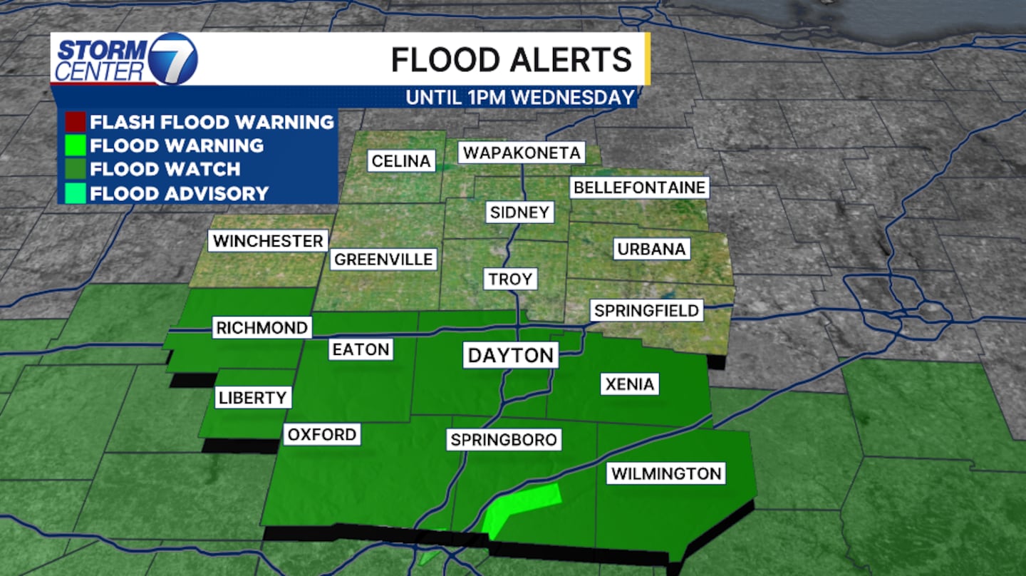
Flooding is our main focus with an additional two to three inches of rain forecast through Sunday.
Once more, Interstate 70 and south are most at risk.
Please remember, “Turn around, don’t drown.”
You don’t know how deep the water is.
©2026 Cox Media Group


