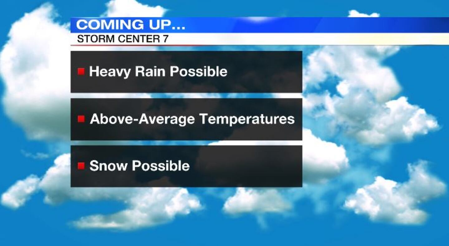
QUICK-LOOK FORECAST:
- Rain returns tonight
- Above-normal temperatures through end of week
- More rain chances early this week
>> TRACK THE CONDITIONS: Live Doppler 7 Radar
DETAILED FORECAST:
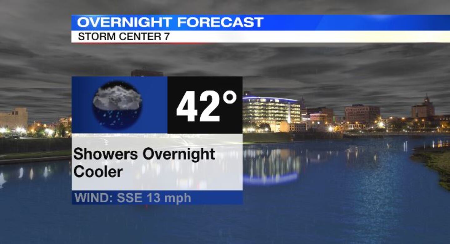
SUNDAY: Cloudy skies with rain likely. A few heavier pockets of rain possible. Overnight low temperatures fall to the lower 40s.
MONDAY: Rain is likely to begin the day. Rain becomes more scattered and eventually clears out by late afternoon. Otherwise, mostly cloudy and warm with highs in the lower 60s. The record high temperature for December 27 is 66 degrees, and we won’t be far off in Dayton at 64 degrees.
TUESDAY: Tuesday starts off cloudy and dry, but rain quickly returns for the afternoon. Some of the rain could be heavy Tuesday. Staying mild with high temperatures in the mid 50s. Total rainfall between now and Tuesday night looks to be around 1.5 inches
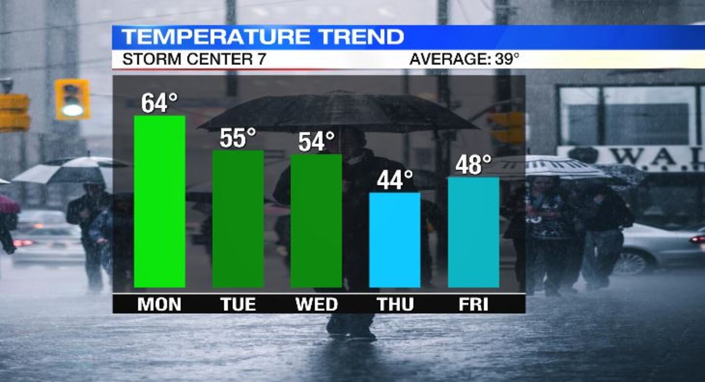
WEDNESDAY: Mostly cloudy with a few lingering showers possible in the morning. Best chance of rain would be south and east of Dayton. Cooler, but still well above average with high temperatures in the lower 50s.
THURSDAY: Mostly cloudy to begin the day with a slight chance of rain or snow showers in the morning. Becoming mostly sunny by the afternoon. High temperatures climb to the lower 40s.
FRIDAY: Partly sunny and cool with highs in the low to mid 40s.
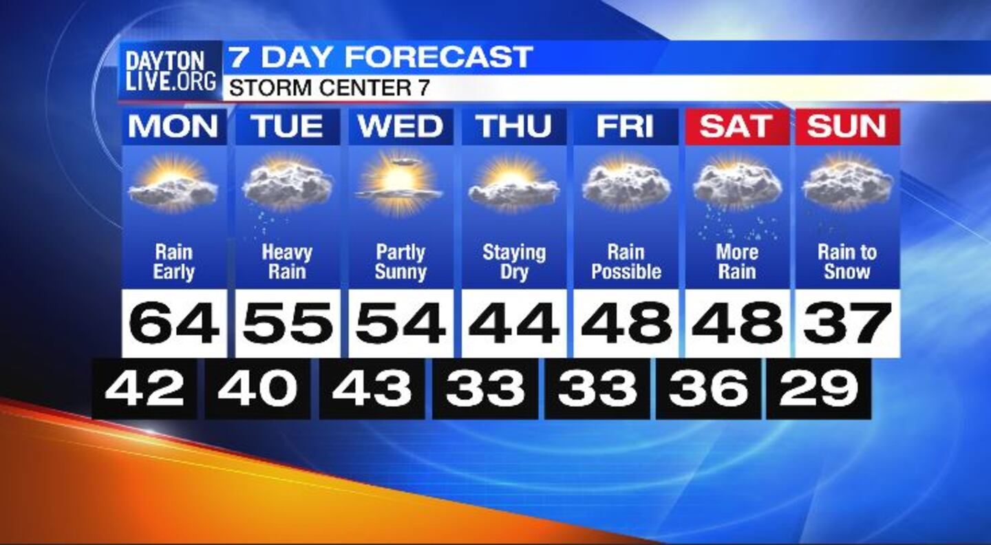
SATURDAY: Mostly cloudy with rain returning later in the day. High temperatures in the mid to upper 40s.
SUNDAY: Mostly cloudy with chance of rain changing to snow. Turning very cold overnight. Highs in the upper 30s in the afternoon falling to low teens overnight.
©2021 Cox Media Group