QUICK-LOOK FORECAST:
- Tracking rain chances Thursday into the weekend
- More sun by Sunday
- Coldest temps of the season so far Sunday night
>>TRACK THE LATEST CONDITIONS: Live Doppler 7 Radar
DETAILED FORECAST:
TONIGHT: Increasing clouds are expected tonight ahead of rain that arrives Thursday, according to Storm Center 7 Chief Meteorologist Austin Chaney.
Temperatures won’t be as chilly tonight thanks to a breeze coming out of the southwest. Lows drop to around 50 degrees by early Thursday morning.
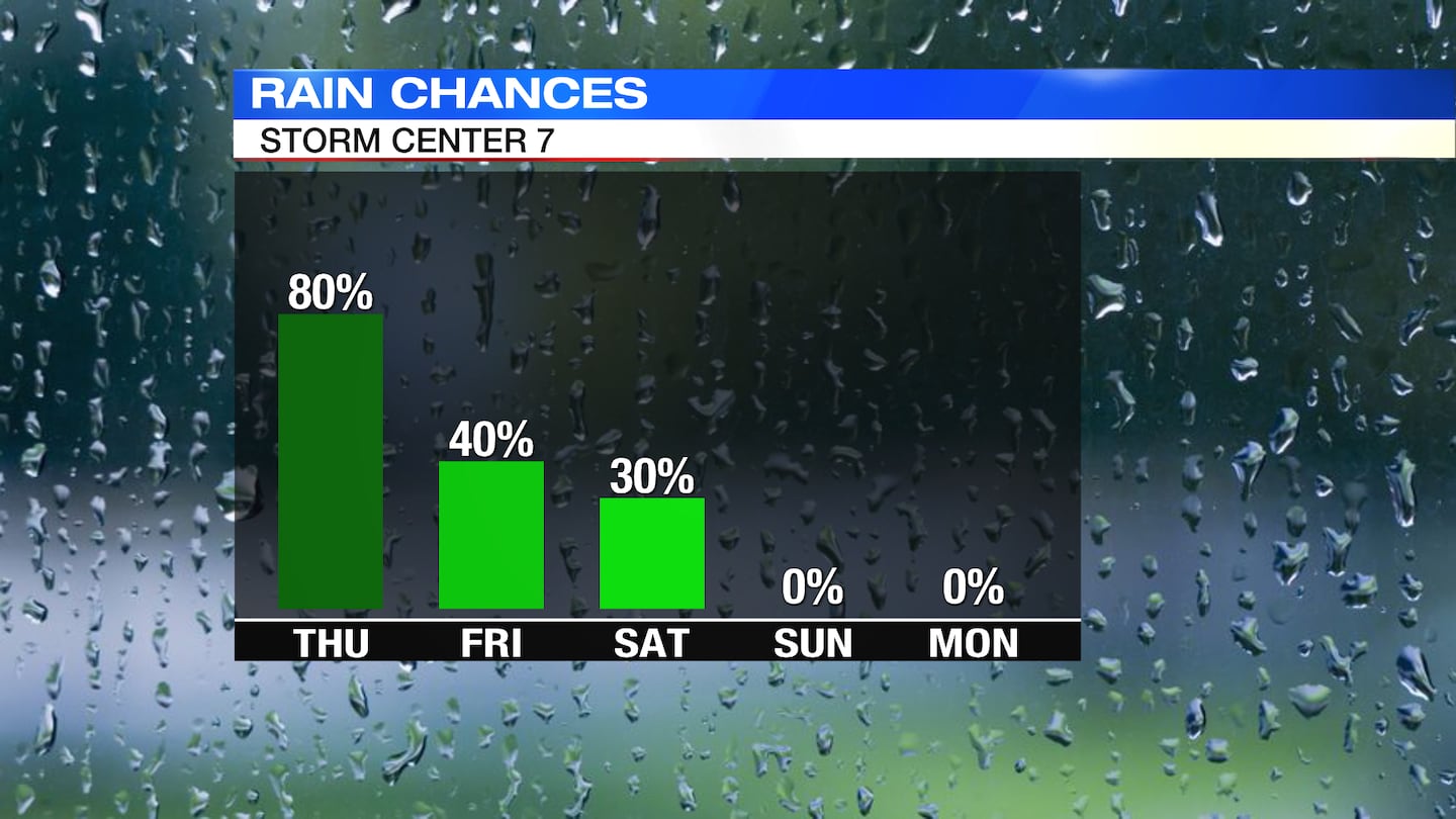
THURSDAY: Scattered showers are expected on and off all day with coverage increasing by the afternoon. When its not raining it will be cloudy and breezy with winds up to 15 mph and gusts up to 25 mph. The winds out of the south will keep temperatures mild with highs in the low to mid 60s.
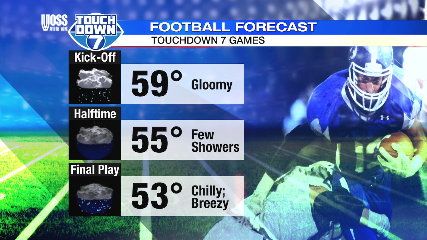
FRIDAY: Mostly cloudy with some on and off light rain showers and steady rain at times. Highs in the lower 60s. Breezy with some gusts to 20 mph.
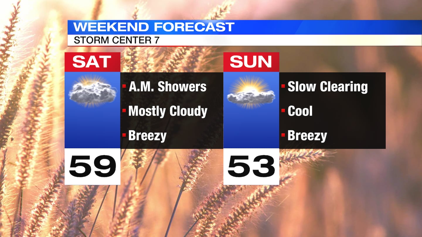
SATURDAY: Mostly cloudy skies with a few showers possible early. Highs near in the upper 50s.
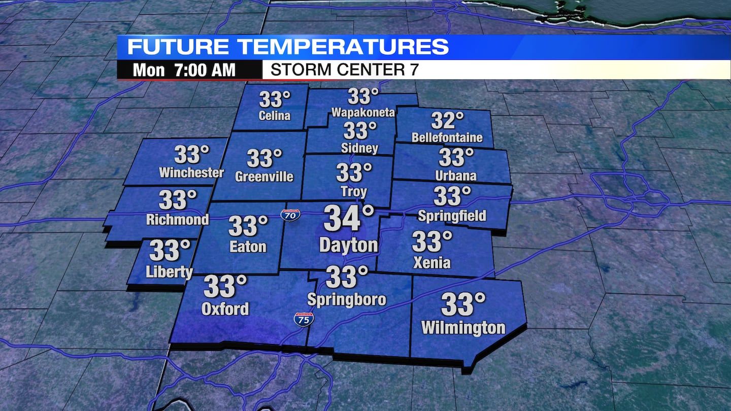
SUNDAY: A gradual clearing trend kicks in Sunday with more sun by Sunday evening. Cool with highs in the mid 50s. Sunday night, the coldest air so far this season settles in with lows dipping into the mid and lower 30s. Frost possible if the winds calm out.
MONDAY: A mix of sun and clouds with highs in the lower 60s.
TUESDAY: Partly cloudy skies. Warmer with highs returning to the upper 60s.
WEDNESDAY: A mix of sun and clouds with highs in the upper 60s.
©2023 Cox Media Group