QUICK-LOOK FORECAST:
- False spring through Saturday
- Rain, isolated thunderstorm Saturday morning
- Rain and snow possible Monday afternoon - Tuesday morning
>> TRACK THE LATEST CONDITIONS: Live Doppler 7 Radar
DETAILED FORECAST:
FRIDAY: Friday now looks dry. Similar to Thursday, mostly cloudy skies are expected. The sun will get through at times. Breezy with gusts in the 20-25 m.p.h. range. Warm again with highs around 60 degrees or a little above.
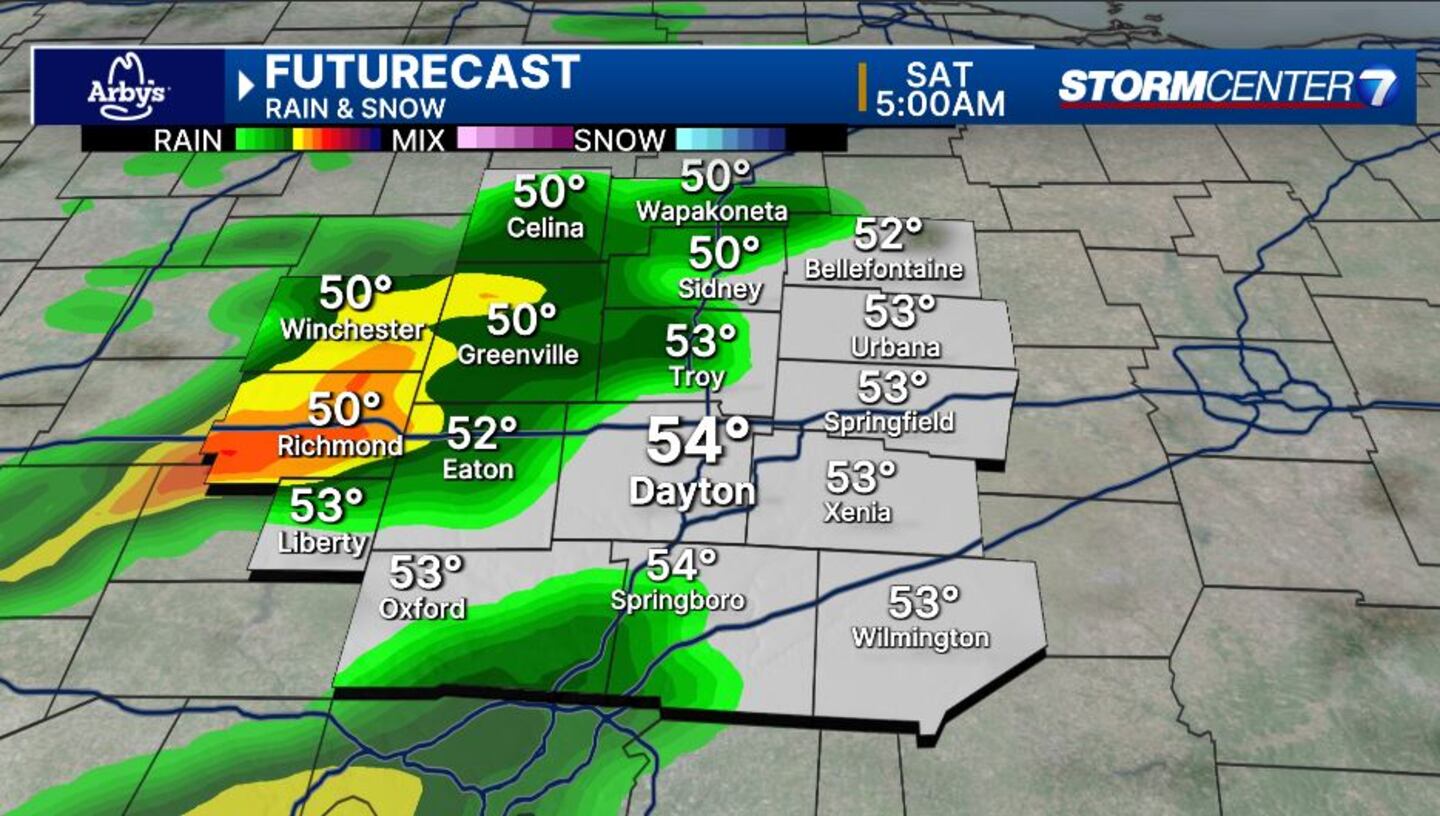
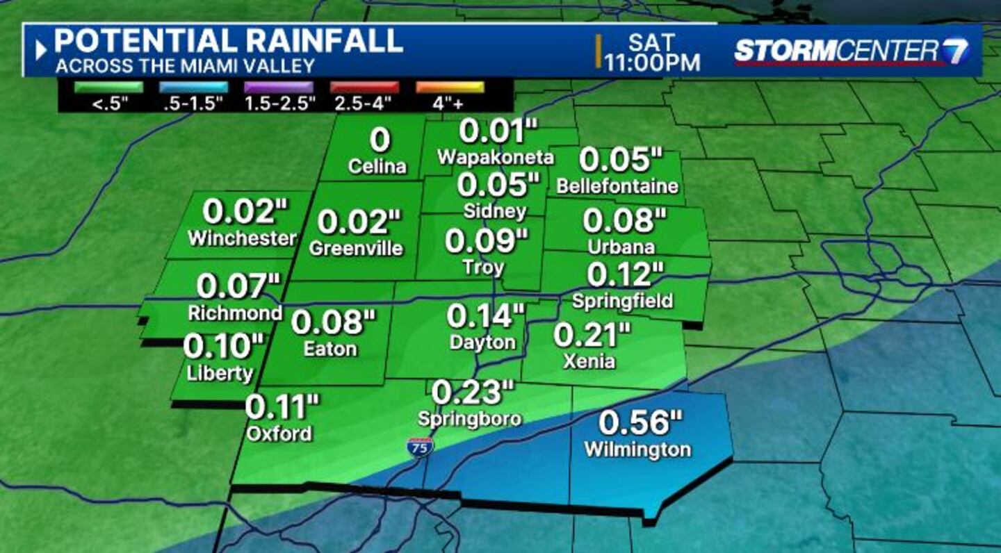
SATURDAY: Rain rolls through early Saturday morning.
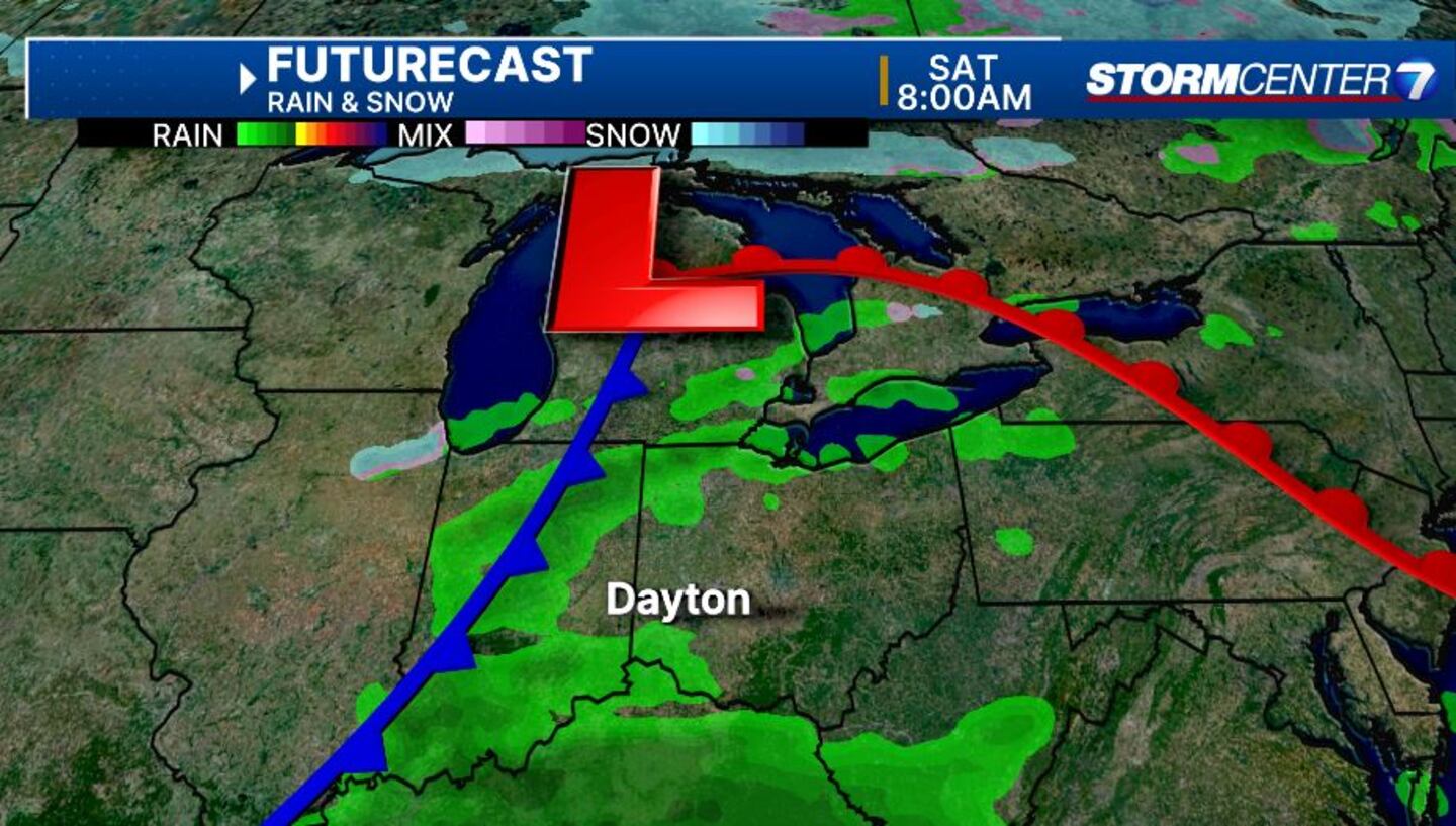
A rumble of thunder here or there can’t be ruled out. Drying out into Saturday afternoon. Mild again with highs in the upper 50s.
SUNDAY: Partly cloudy skies with highs in the mid to upper 40s.
MONDAY: Cloudy with a chance for rain or snow showers arriving late in the day. Highs in the mid-40s. Overnight, there appears to be a reasonable chance for accumulating snow with lows in the upper 20s. We’ll watch this part of the forecast carefully for any changes to the storm track or temperatures, which would impact our chances at wintry weather.
TUESDAY: Snow showers are possible early Tuesday. Drying into the afternoon with highs in the upper 30s to near 40.
WEDNESDAY: Partly cloudy. Seasonable with a high in the low 40s. A weak weather system may bring some rain or snow late Wednesday into Wednesday night.
THURSDAY: Slight chance of rain or snow early Thursday. Dry and partly cloudy for the afternoon with highs in the lower 40s.
©2024 Cox Media Group


