QUICK-LOOK FORECAST:
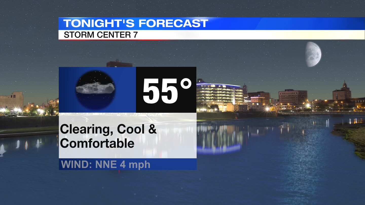
- Clearing and cool tonight
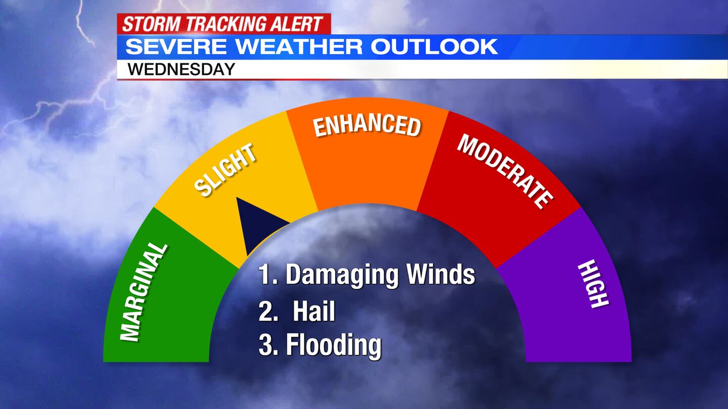
- Strong storms Wednesday Afternoon
- Cooler to end the week
>> TRACK THE LATEST CONDITIONS: Live Doppler 7 Radar
DETAILED FORECAST:
TODAY: Drying out with decreasing clouds tonight. Winds diminish, too. Lows expected in the middle 50s.
WEDNESDAY: Some sun early and warm with temperatures rising from the 60s in the morning to a high around 80 degrees.
Clouds will increase early afternoon with scattered showers and storms arriving by the evening commute.
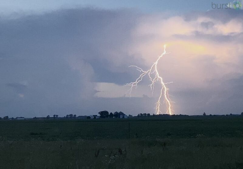
Some storms could be severe with isolated damaging winds, hail, and heavy rain. The best timing of these storms will be between 2pm-8pm. Drying out with decreasing clouds Wednesday night. Lows in the middle 50s.
>> Stay alert: Download the free WHIO Weather App
THURSDAY: Partly sunny and cooler with highs in the upper 70s.

FRIDAY: Partly sunny with a few passing showers, and perhaps an embedded storm during the day. Highs in the middle 70s.
SATURDAY: Mostly cloudy with a chance of a stray shower. It will be a cooler than normal day with highs in the middle 70s.
SUNDAY: Partly to mostly sunny, highs in the middle to upper 70s.
MONDAY: Mostly sunny and warm, highs around 80 degrees.
TUESDAY: Mostly sunny to partly cloudy. Chance of a shower or storm. Highs in the middle 80s.
©2022 Cox Media Group