The latest look at Live Doppler 7 radar. Track it all on the @whiotv weather app: https://t.co/l5pZHCbBdT #whiowx pic.twitter.com/fphJxBMenu
— Storm Center 7 (@StormCenter7) July 1, 2020
QUICK-LOOK FORECAST:
- Drying out overnight
- Isolated thunder shower south for Wednesday
- Hot through the weekend
>> TRACK THE CONDITIONS: Live Doppler 7 Radar
DETAILED FORECAST
THIS EVENING & OVERNIGHT: Heavy rain and storms south of I-70 will decrease into the early evening, Storm Center 7 Chief Meteorologist McCall Vrydaghs said. Areas north will remain dry. It will be warm and muggy with temperatures in the 80s. Because of the amount of moisture in the environment and the nature of these slow moving storms, flash flooding will be a threat. Skies will become mainly clear overnight. Still mild and muggy with lows around 70 degrees.
>> STAY INFORMED: Download the WHIO Weather App
WEDNESDAY: Another muggy start. Highs near 90. Sunshine and a few clouds. Slight chance for an afternoon downpour, mainly southwest of Dayton. Heat index in the low 90s. Clear and warm at night.
>>Heat index values to reach the 90s this week: What does it mean? How is it calculated?
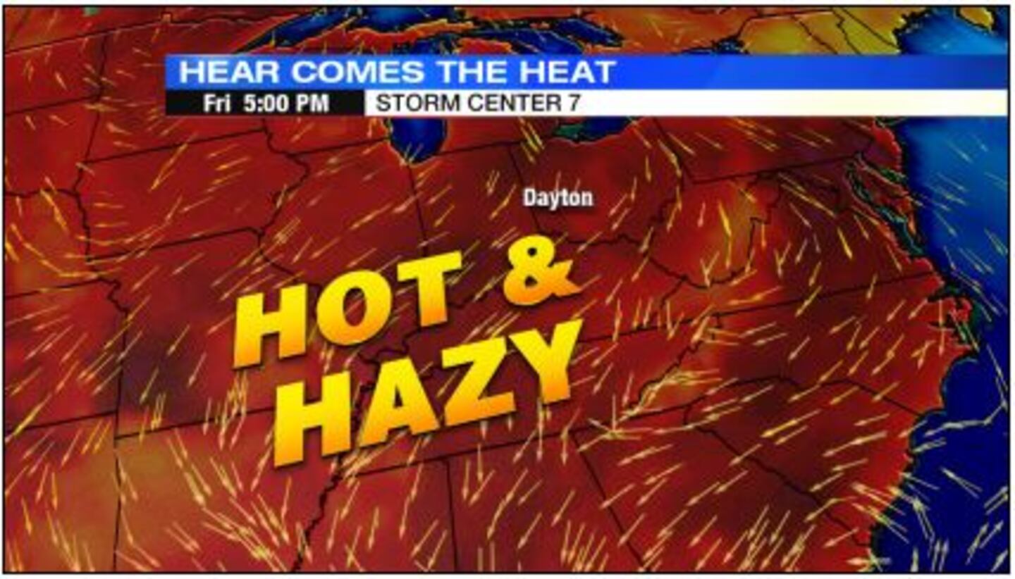
THURSDAY: Hot stretch continues. Lots of sunshine with a very high UV index. Highs climb to 90. Heat index in the low 90s. Looking dry.
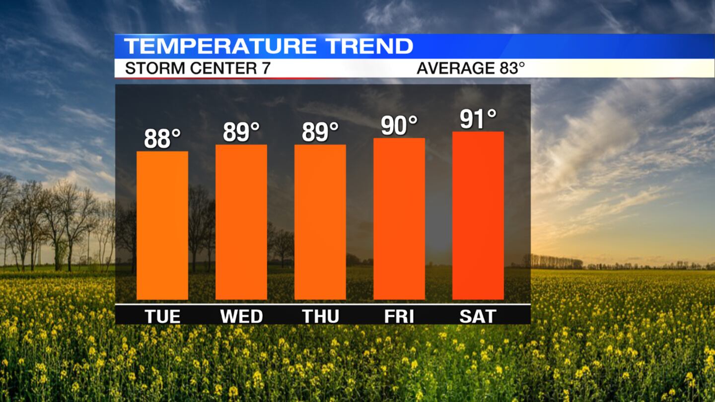
FRIDAY: Dry stretch continues. Highs hit 90 again. Could lead to a heat wave for the holiday weekend if we see three or more consecutive 90-degree days. Sunny and dry.
JULY 4TH: The holiday starts hot and humid. Highs will be in the low 90s with a heat index in the middle 90s. Pop-up storms are possible.
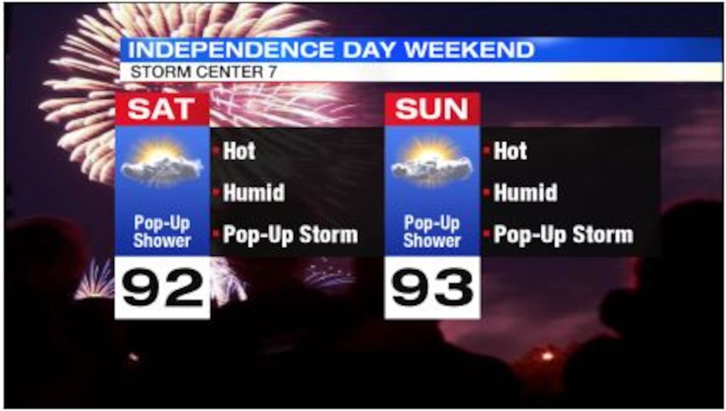
SUNDAY: Another hot and humid day with highs in the lower 90s. Mostly sunny to partly cloudy skies, with the slight chance of an isolated thunder shower.
© 2020 Cox Media Group


