QUICK-LOOK FORECAST:
- Passing sprinkle/showers Friday
- Warming up for the holiday
- Downpours on Christmas
>> TRACK THE CONDITIONS: Live Doppler 7 Radar
DETAILED FORECAST:
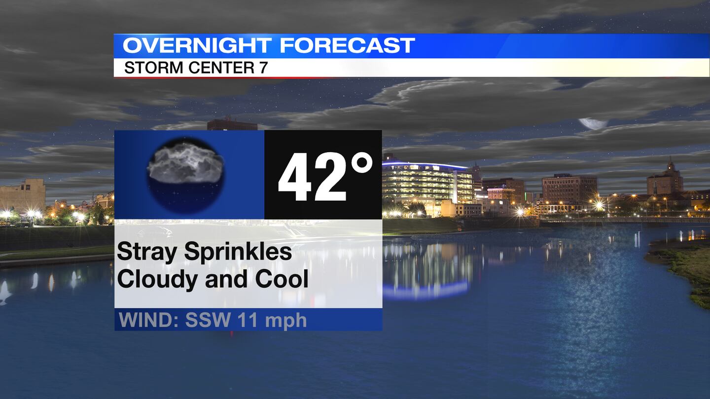
TODAY: Cloudy, breezy, and cool with temperatures in the 40s through the night, Storm Center 7 Chief Meteorologist McCall Vrydaghs said. A few passing sprinkles are possible, too.
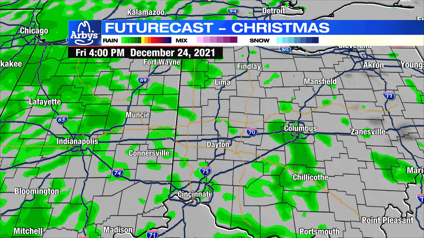
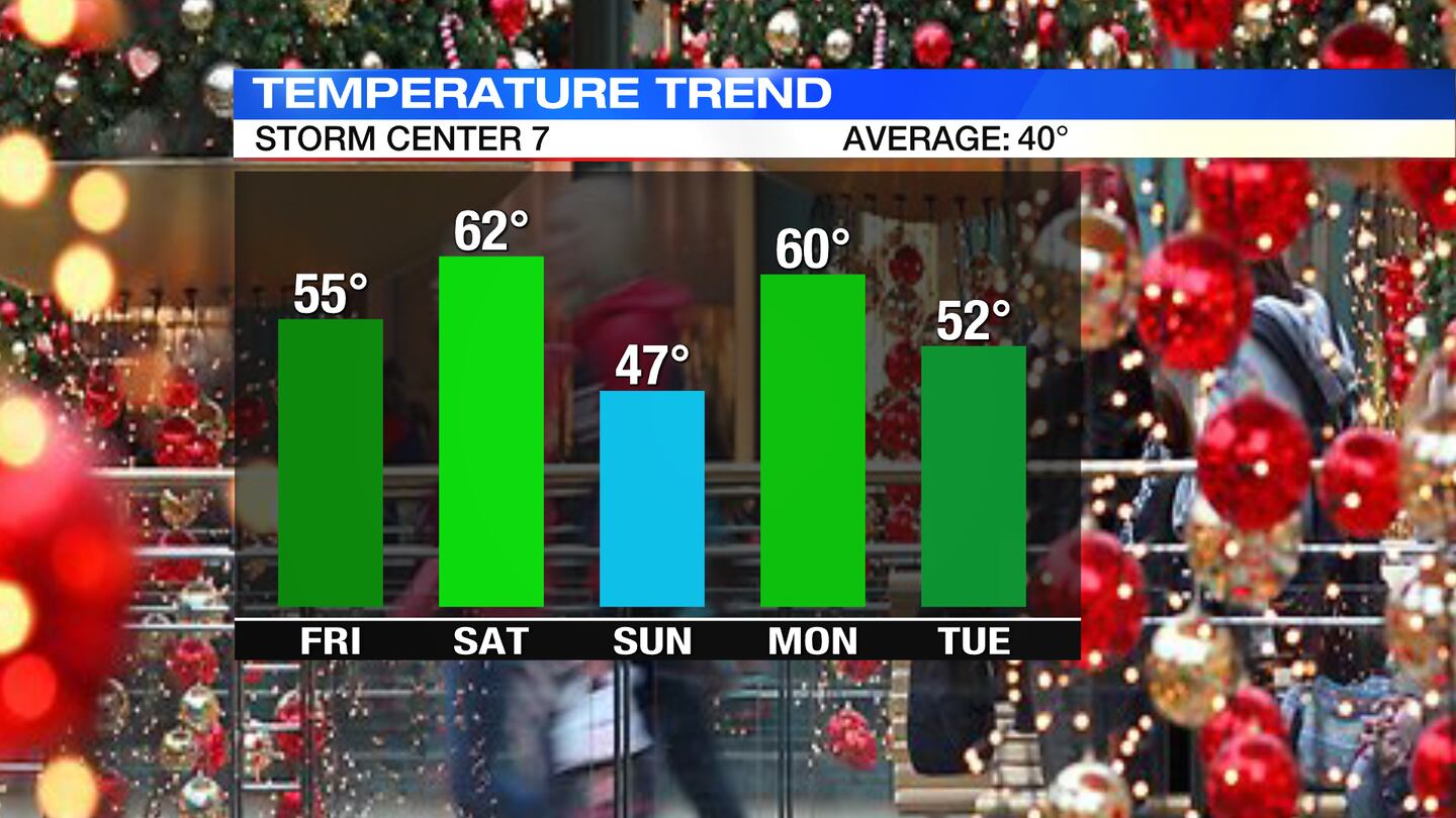
CHRISTMAS EVE: Most of Friday is quiet. It will be a mild afternoon in the lower to middle 50s and temperatures will slowly rise through the night.

A few stray sprinkles or isolated showers will be possible during the day otherwise cloudy skies. A better chance for scattered showers develops at night.
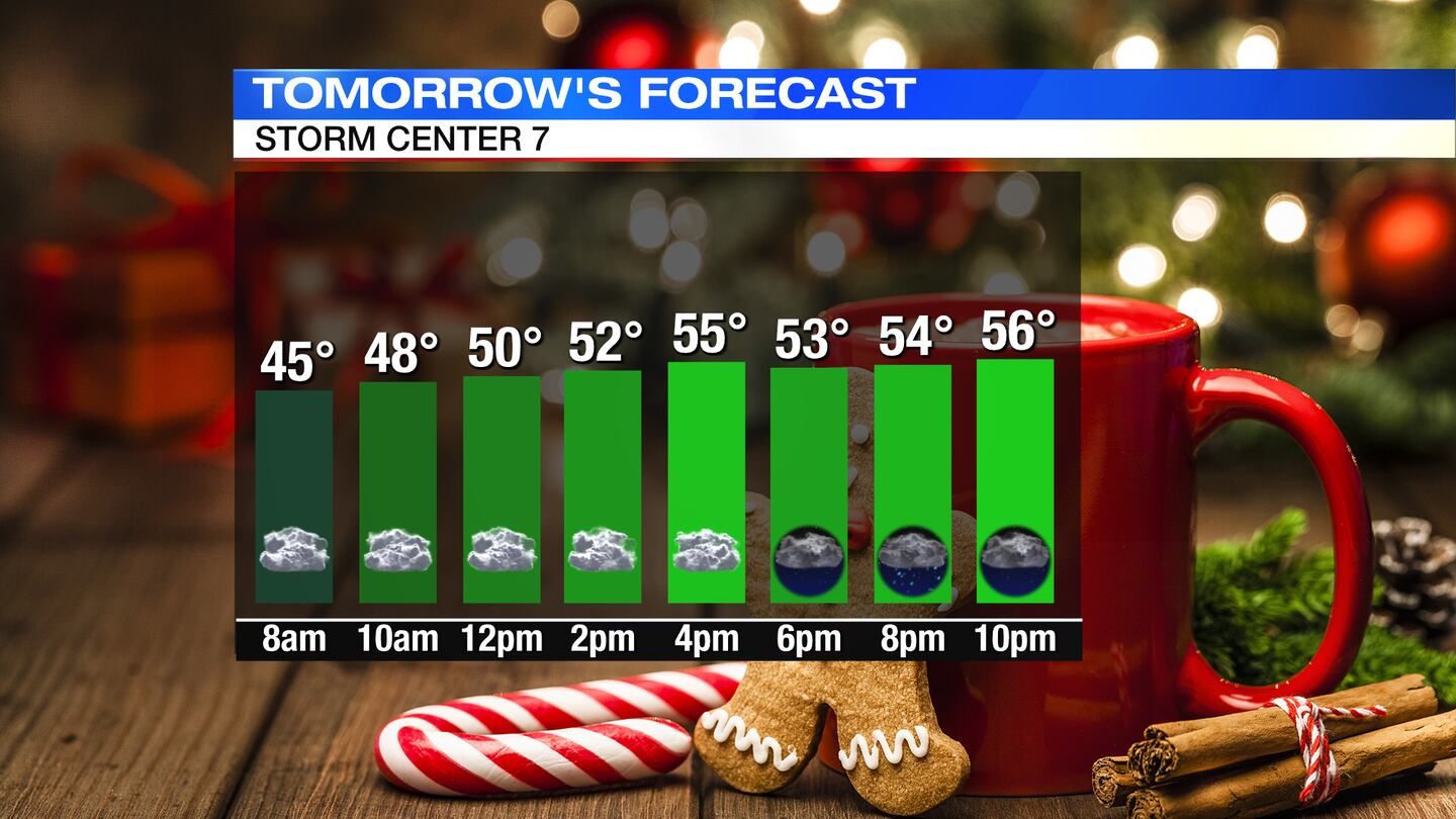
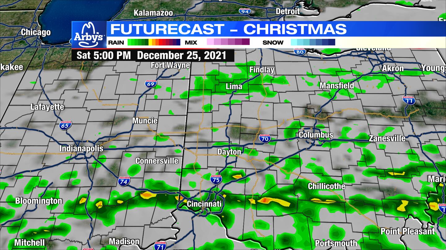
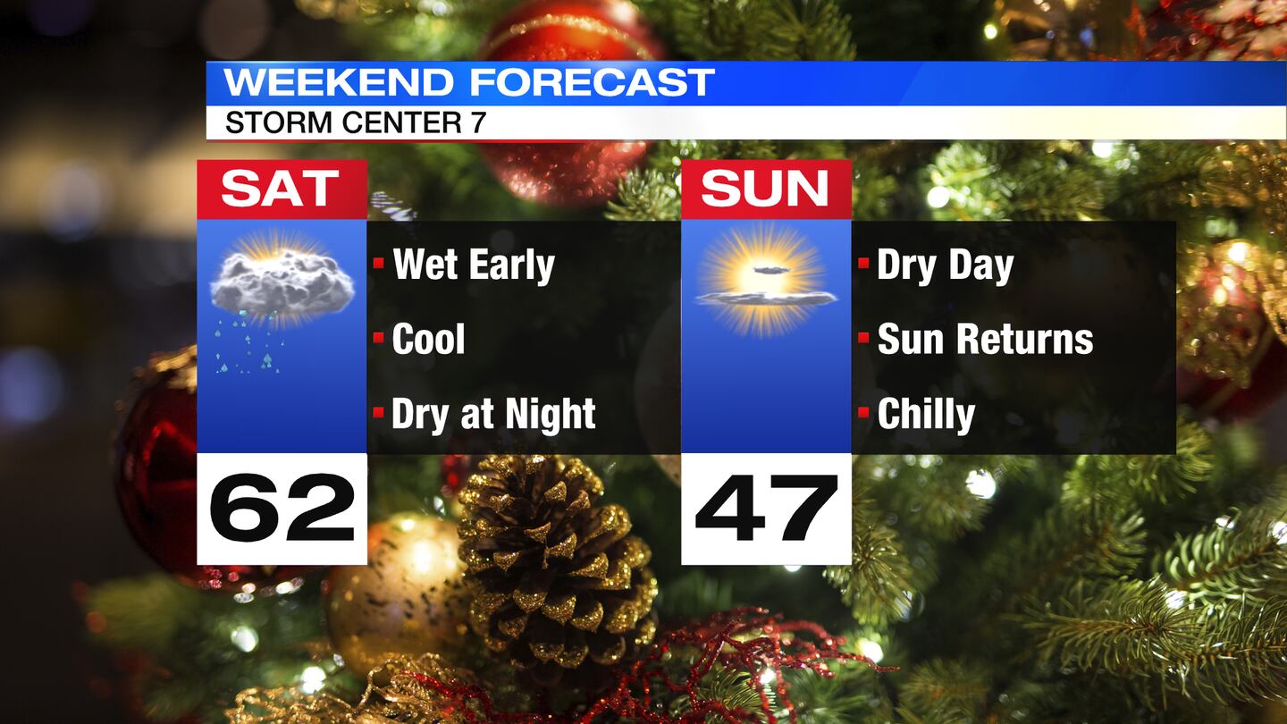
CHRISTMAS DAY: A huge warm-up is expected. We will likely hit 60 early in the afternoon before our cold front passes. There will be some rain showers and downpours in the morning, especially across the northern Miami Valley.
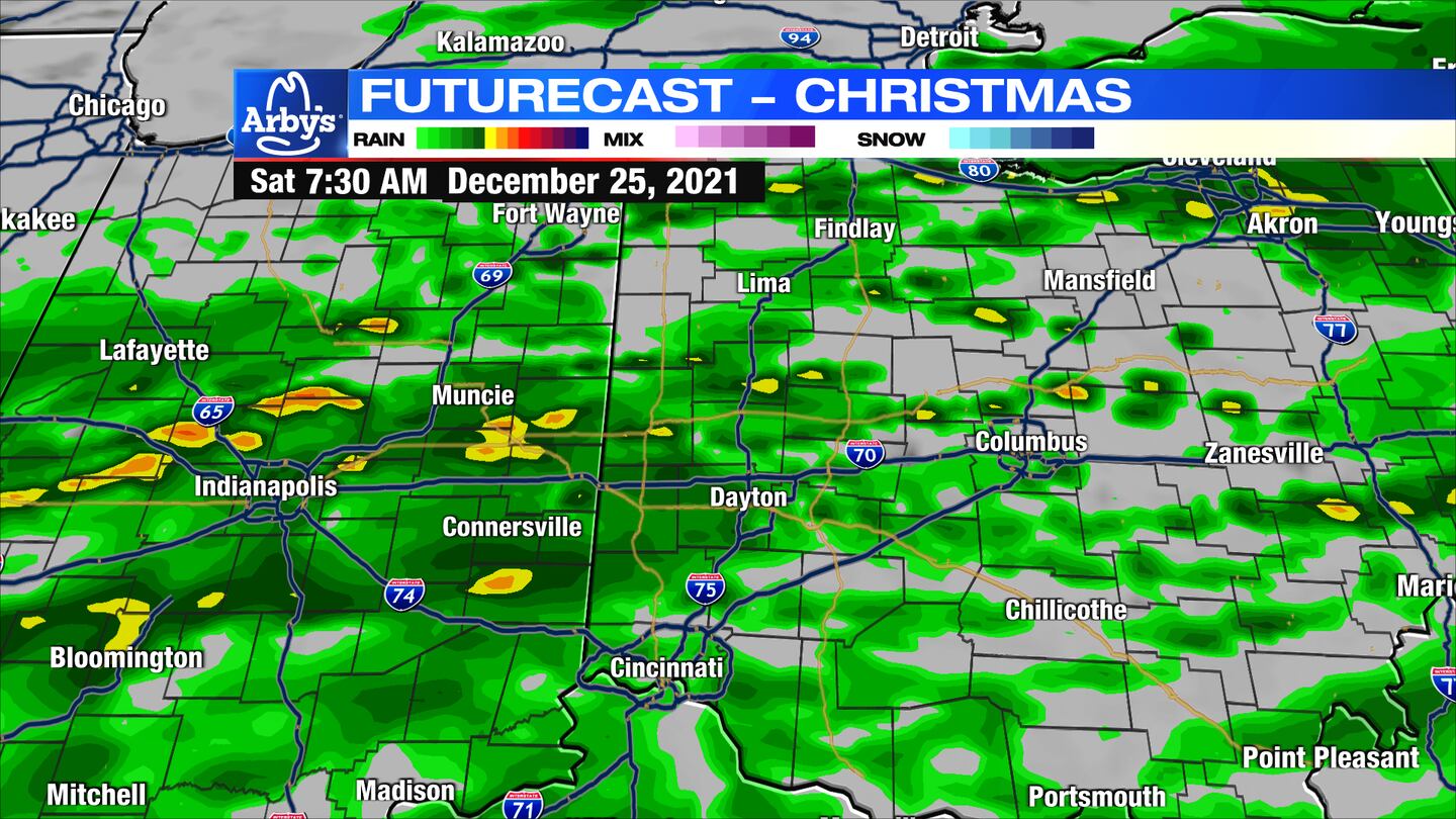
Another quick line of downpours and even a rumble of thunder possible as our front passes into the afternoon. It will be a breezy day, too. Rain comes to an end late Saturday into Saturday night.
SUNDAY: Partly sunny, windy, and cooler with highs in the upper 40s. Chance of a few showers return at night.
MONDAY: Mostly cloudy, breezy, and cool. Chance of a few showers in the morning. Highs around 60 degrees.
TUESDAY: Mostly cloudy with scattered showers returning for the afternoon. Highs in the lower 50s.
WEDNESDAY: Partly sunny to mostly cloudy skies. Chance of a few showers. Breezy and mild. Highs in the lower to middle 50s.
THURSDAY: Partly sunny and cooler, but still above normal. Highs in the upper 40s.
©2021 Cox Media Group


