QUICK-LOOK FORECAST:
- Isolated refreeze possible overnight
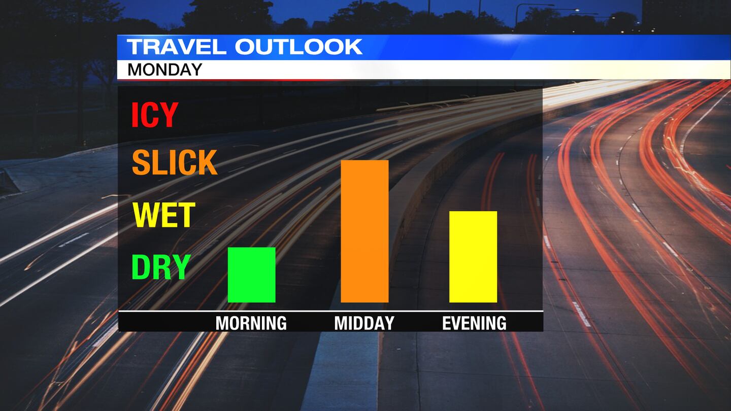
- Another light snow chance Monday
- Cold week ahead
>>TRACK THE CONDITIONS: Live Doppler 7 Radar

DETAILED FORECAST:
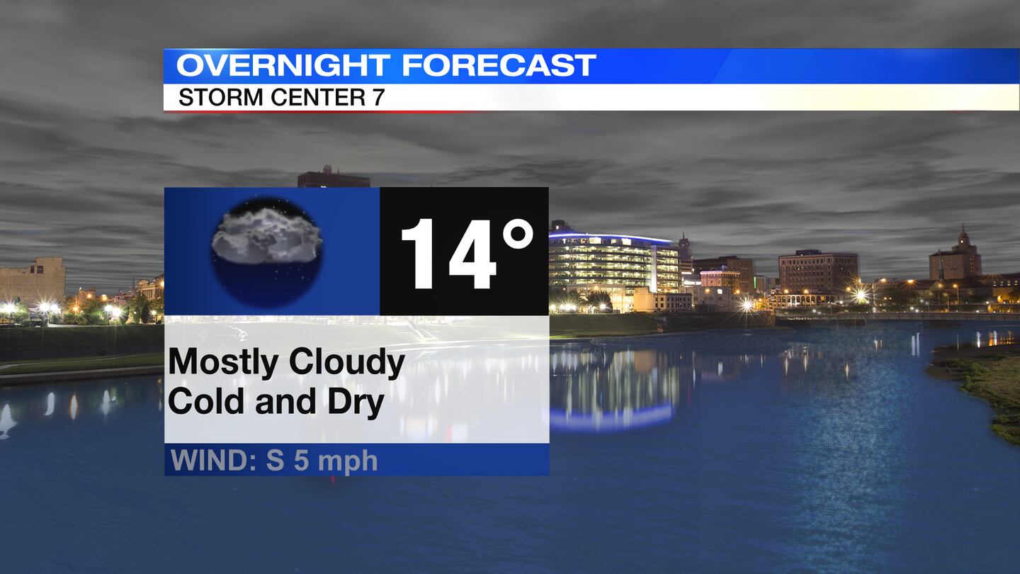
TODAY: Cloudy to mostly cloudy skies expected tonight, according to Storm Center 7 Meteorologist McCall Vrydaghs. Some isolated slick spots may develop in areas that received snow Sunday, especially north of US-36, as temps fall to the middle teens by Monday morning.
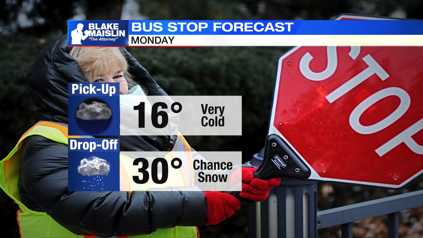
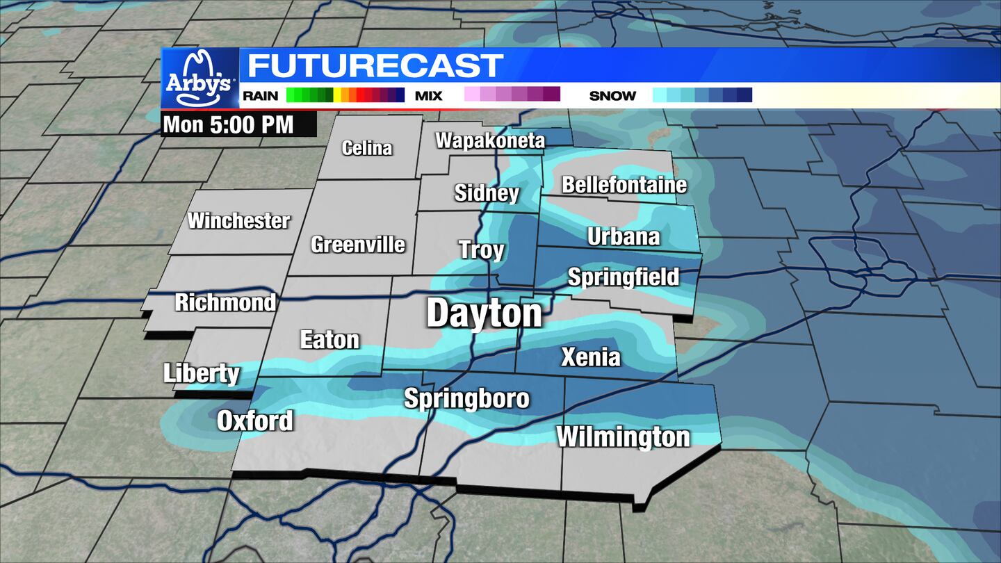
MONDAY: Mostly cloudy and cold with high temperatures reaching the middle 30s. Another weak clipper system will bring the chance for snow showers to the region in the morning that may mix with some rain in the afternoon.
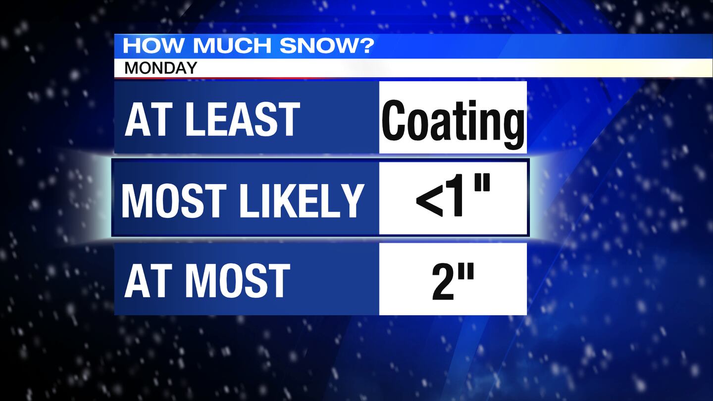
Light accumulations may be possible with this system, primarily north of I-70. An inch at most in those northern counties is possible. Everywhere else will likely not be more than a coating. Refreeze will be possible Monday night with lows in the upper teens.
TUESDAY: Some clouds early will give way to more sunshine by the end of the day. It will be a colder day with highs in the middle 20s. Temperatures will fall into the single digits Tuesday night.
WEDNESDAY: Mostly sunny and very cold. Morning lows in the single digits. Afternoon highs in the low 20s.
THURSDAY: Partly cloudy and cold again. Highs near 30 degrees.
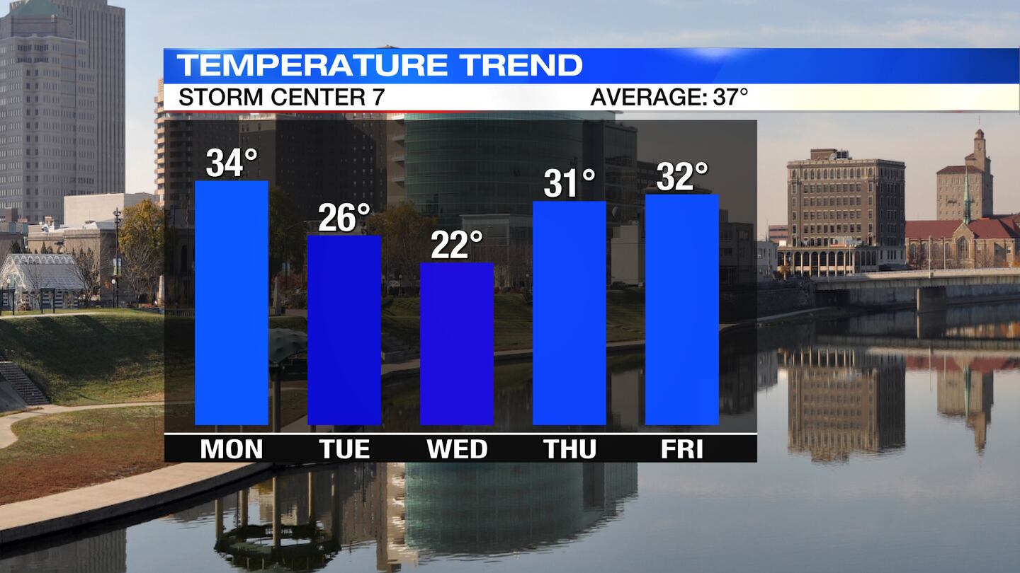
FRIDAY: A few flurries possible early Friday. Otherwise, partly sunny and cold with highs in the lower 30s.
SATURDAY: Partly sunny and cold with highs in the upper 20s.
SUNDAY: Mostly sunny to partly cloudy skies for Sunday. Highs closer to normal in the middle to upper 30s.
©2022 Cox Media Group


