
DAYTON — A Winter Storm Watch goes into effect Saturday morning and lasts until 1 a.m. Monday.
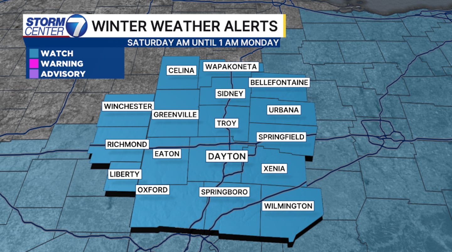
Significant snowfall is forecast for the Miami Valley.
Currently, an area of low pressure is maturing to our southwest. There is still some uncertainty with the track of the low pressure center, but confidence is growing for a more northerly track as models begin to agree with one another.
[DOWNLOAD: Free Storm Center 7 Weather app for alerts as news breaks]
The northerly track brings snow into the Valley beginning around 3 to 4 p.m. on Saturday. The heaviest snow will fall late Saturday through the early morning hours Sunday.
While the snow may begin to slow late Sunday, the challenge then turns to clearing the roads.
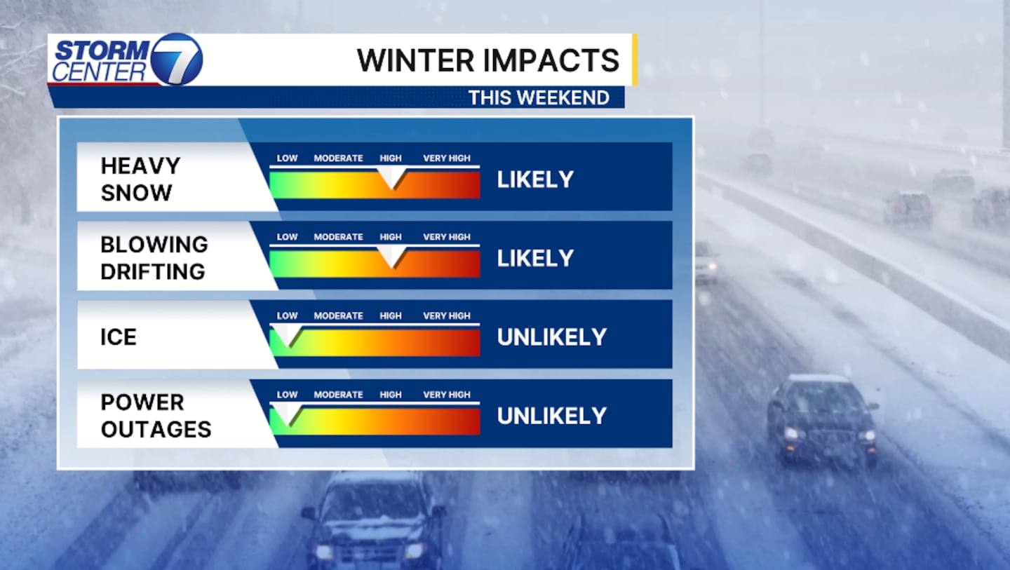
Blowing and drifting snow becomes a major threat, especially in the open fields of the rural areas. This will be an issue through Monday.
[WATCH Storm Center 7 Weather on the following devices]
Snowfall totals can still vary. Here’s what we’ll say at the moment. Confidence is growing for over 8 inches of snow along Interstate 70 and south.
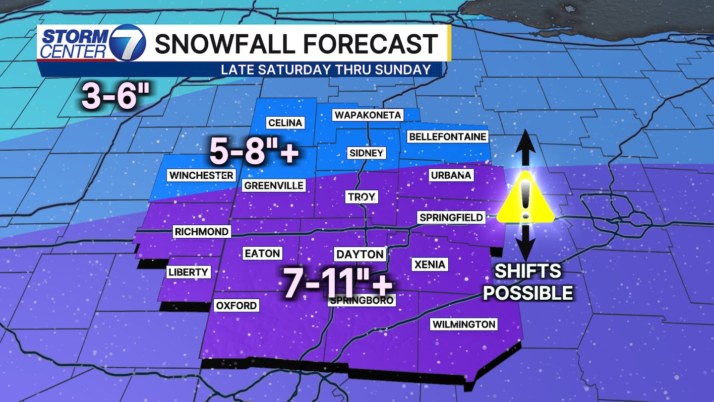
The farther north you are of I-70, the less likely you’ll obtain the higher amounts. A foot of snow is more likely along the Ohio River. However, an isolated 12-inch mark in our southernmost counties is possible.
©2026 Cox Media Group


