
Good evening, everyone. Meteorologist Nick Dunn here with you on what I describe as a tale of two halves today. Many of us started out mild this morning, but now we have cooled off significantly with a stationary front stalling just to our south. This brought some rain this morning to the area.
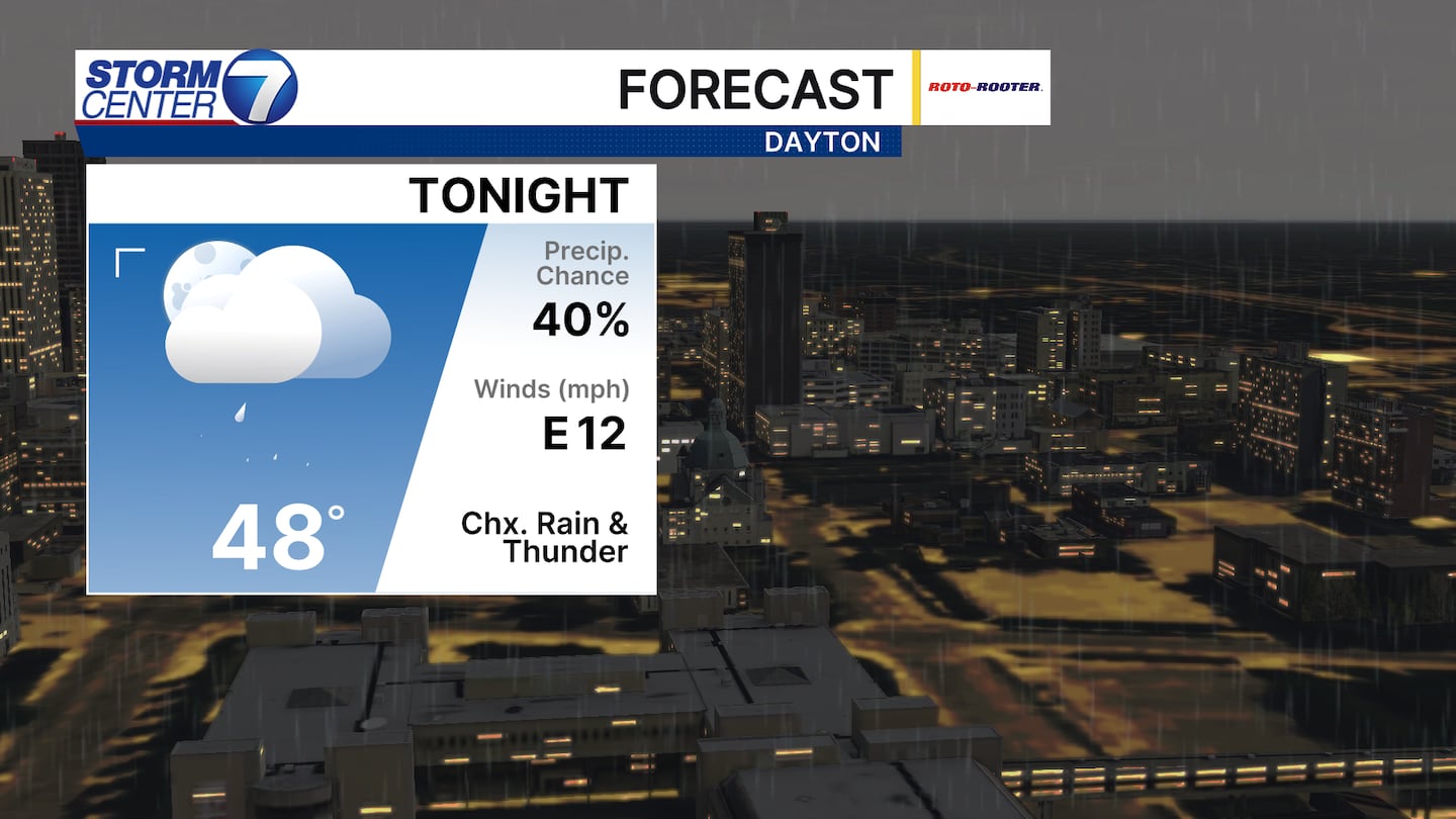
That same front will eventually work a bit north tonight and provide some stability in temperatures. Most of us should be in the upper 40s as you wake up tomorrow morning. Those to the north likely are a bit cooler than that.
[DOWNLOAD: Free Storm Center 7 Weather app for alerts as news breaks]
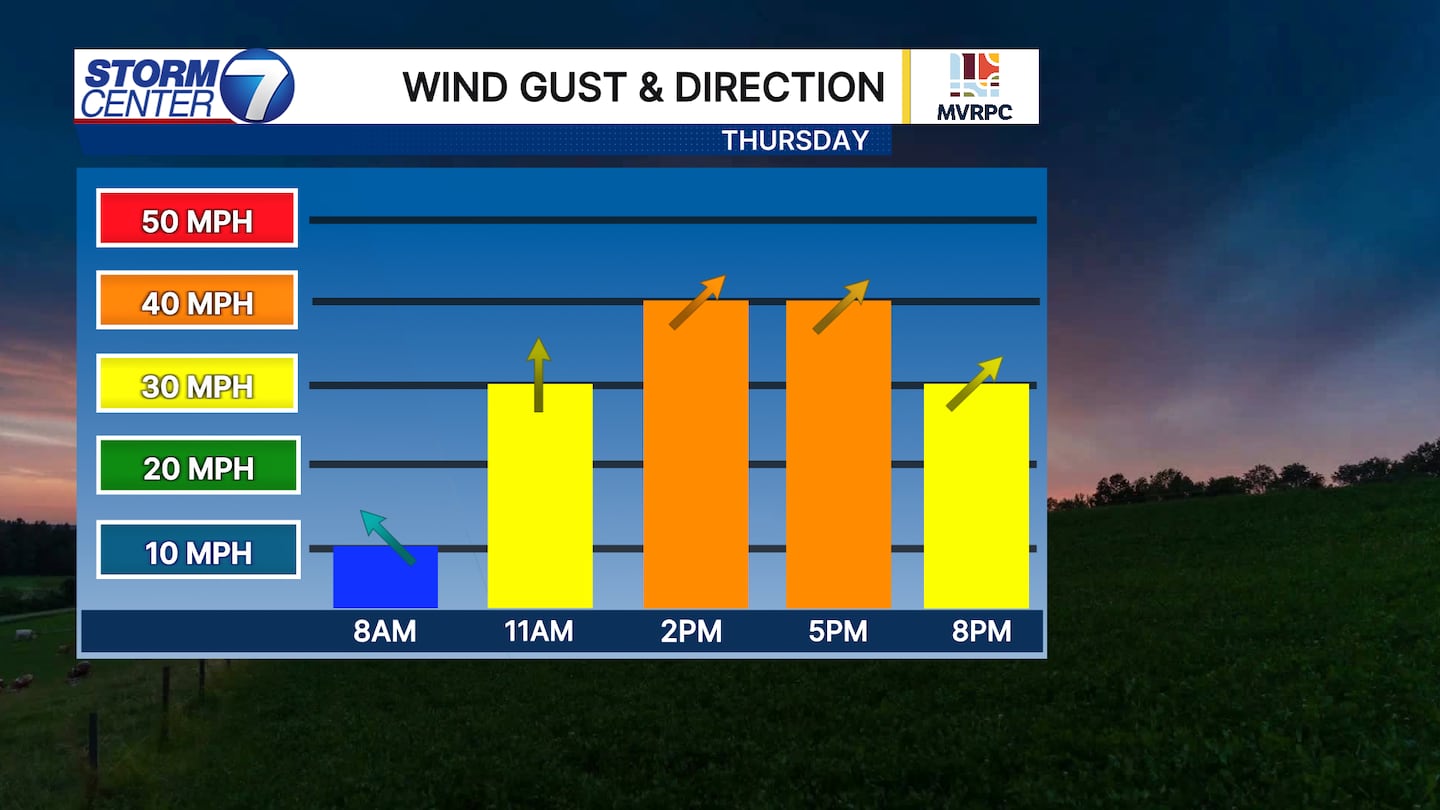
Winds will be on the increase as the front works northward through the morning on Thursday. Wind gusts of 30 miles per hour or greater are expected. this can blow loose items around, so be sure to secure them before tomorrow.
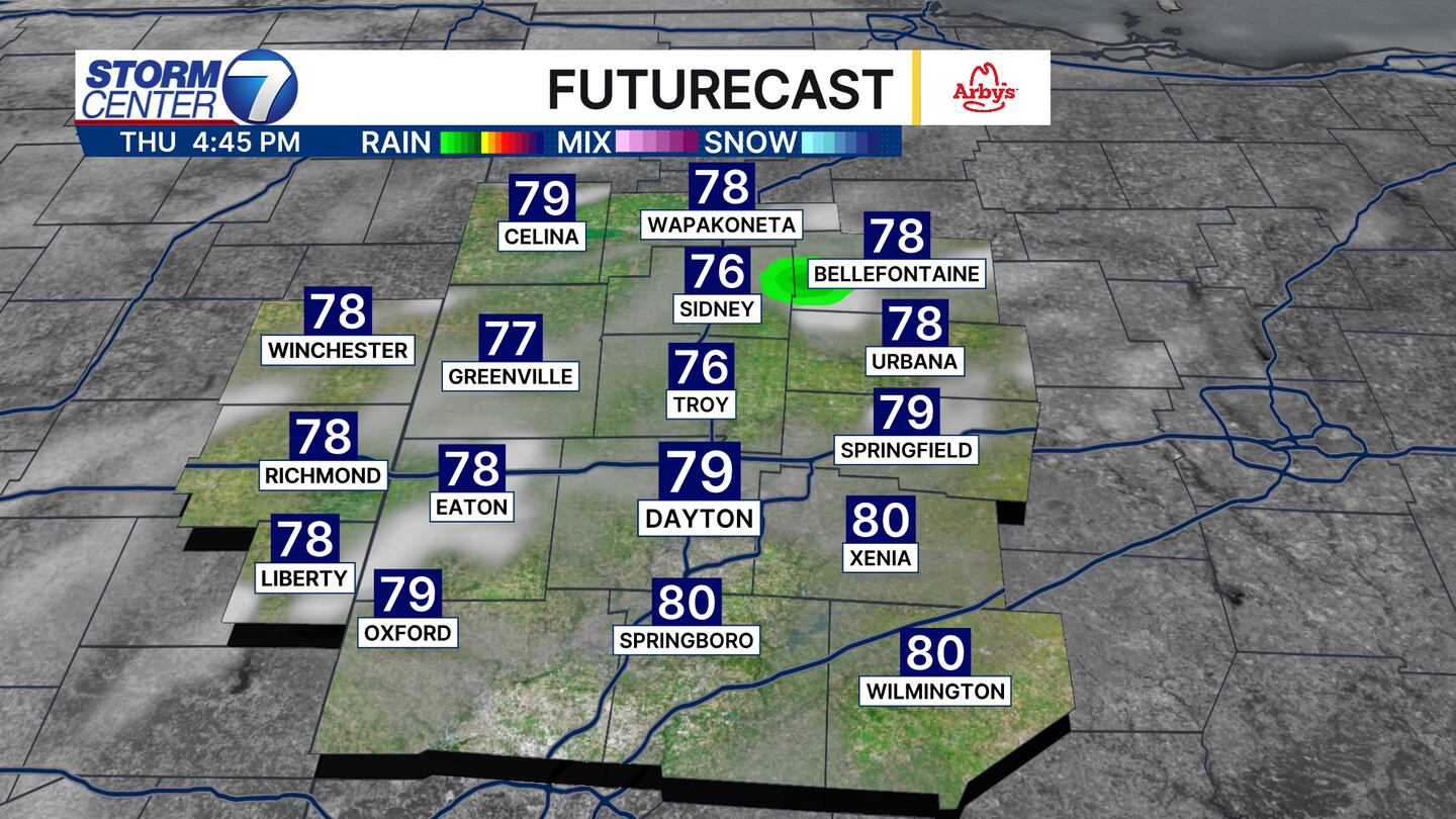
High temperatures warm up significantly by the afternoon. We will reach the upper 70s to around 80 degrees. A stray shower is possible, but odds are you stay dry.
[WATCH Storm Center 7 Weather on the following devices]
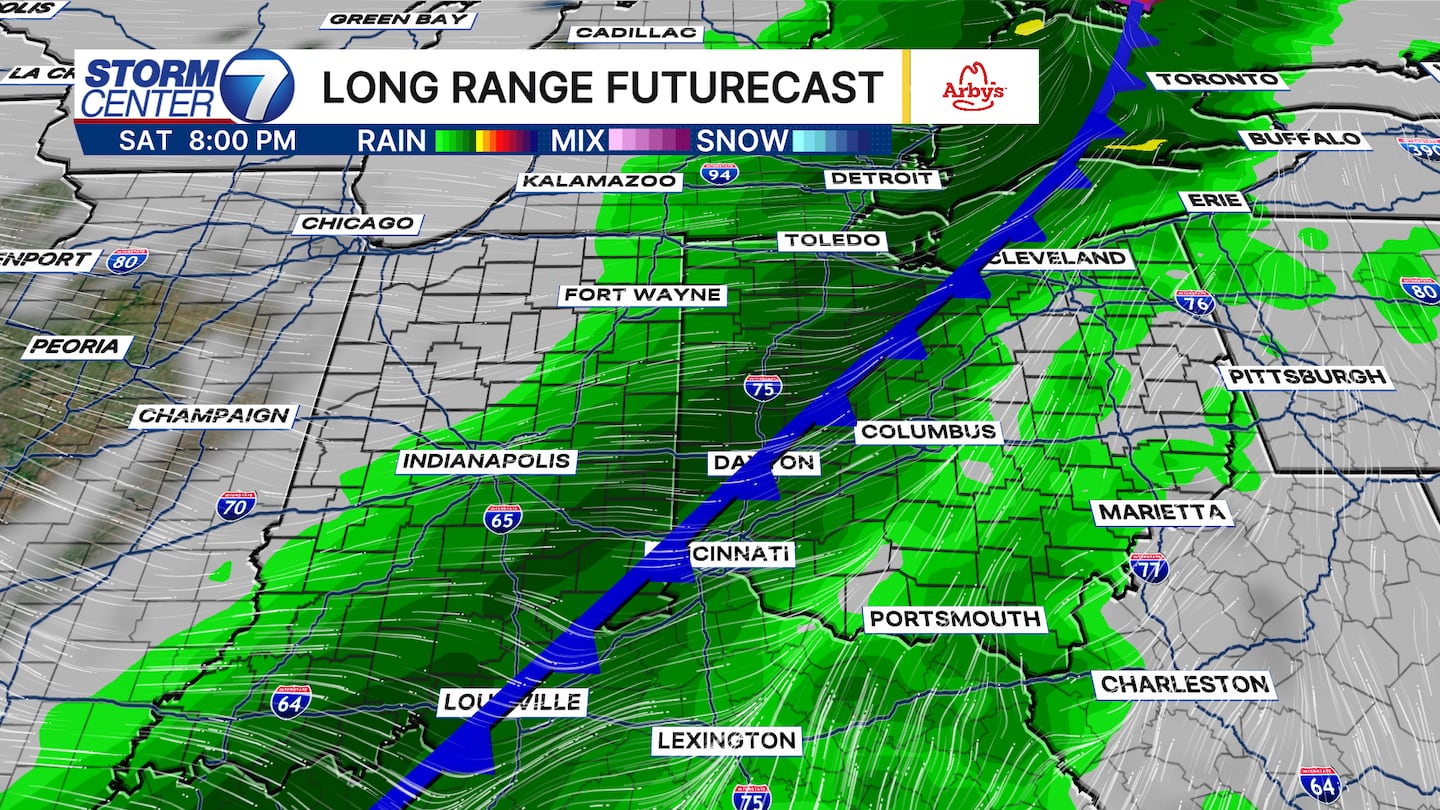
The next big item we are watching is a cold front to sweep through late Saturday with more chances of showers and storms. After highs in the 70s for Friday and Saturday, Easter Sunday will be sharply cooler with afternoon temperatures only in the lower 50s.
©2026 Cox Media Group


