
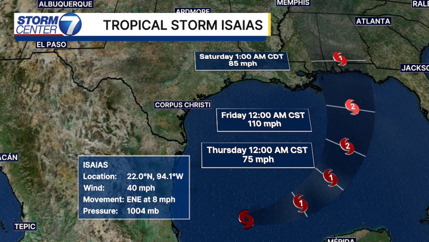
DAYTON — This storm will strengthen, moving slowly toward the east-northeast.
Isaias will become the first hurricane of the 2026 Atlantic hurricane season.
Potentially becoming a Category 2 storm, with winds maxing out at the center of the low of 110 mph just before landfall.
Landfall is forecast sometime late Friday and early Saturday.
[DOWNLOAD: Free Storm Center 7 Weather app for alerts as news breaks]
Something to note about October and Gulf storms: these storms have a tendency to overperform.
So don’t let your guard down.
If you know anyone on the Alabama or Florida panhandle coastline, give them a call and make sure they are ready.
High surf, damaging strong winds, heavy flooding rains, and devastating storm surge will be a major concern in the upcoming days for these areas.
What does it mean for us here in the Miami Valley?
[WATCH Storm Center 7 Weather on the following devices]
This same storm will push north and hit the land causing friction and leading to its significant weakening.
This will be a remnant low heading into the Ohio Valley Sunday.
Timing will shift, and amounts of rain will shift until Isaias makes landfall.
Any little wobble of the center of the low plays major impacts to many.
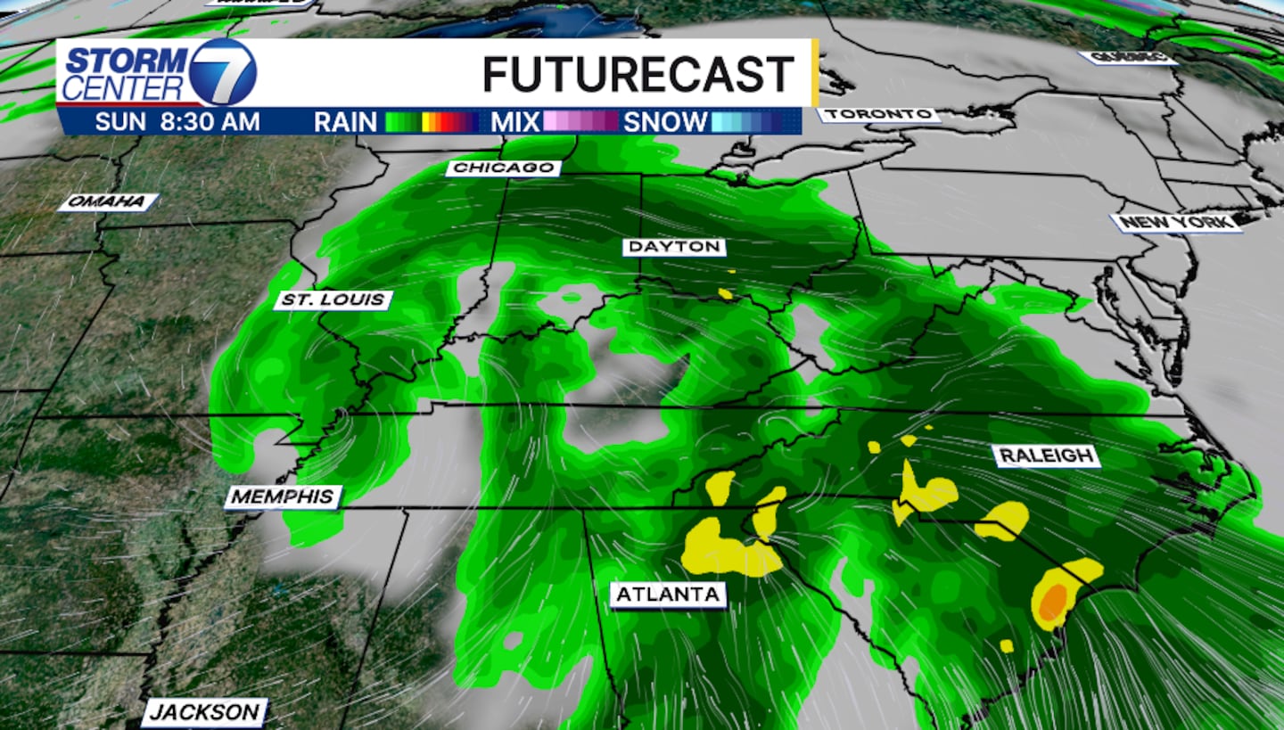
Rainfall totals for us here in the Miami Valley will amount to roughly a half inch to an inch through Monday morning.
Isolated higher amounts are possible.
Winds will blow at 20 to 25 mph, but gusts can reach nearly 30 mph at times.
©2026 Cox Media Group


