
DAYTON — We have had a brilliant first full day of spring here in the Miami Valley. Good evening to you. Meteorologist Nick Dunn here to check in with you about the risk of severe storms to end the weekend.

The current timing for storms on Sunday looks to be from 6PM to Midnight for the best chance of any severe weather. The main concern is for large hail greater than one inch in diameter. A bit unusual to see hail as the main risk, but that is what is on deck for us.
Some strong winds and lightning are also possible from any storms that develop. The best chance for severe storms may end up being after a cold front passes by thanks to elevated instability aloft.
[DOWNLOAD: Free Storm Center 7 Weather app for alerts as news breaks]
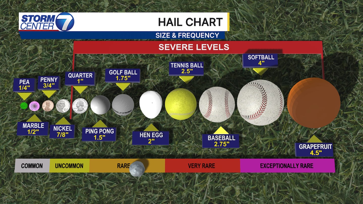
Given that hail is the main threat, here is a handy hail size chart and frequency to help you estimate hail sizes. This also shows you the frequency of hail we see here in the Miami Valley.

The greatest risk for severe storms looks to be near and south of a Richmond to Urbana line. This is where the SPC has a Level 2 (Slight) risk of severe storms. This means that scattered severe storms are possible, but not everyone gets them. A level 1 (Marginal) risk is in place for the rest of the area, meaning a lower chance of severe storms.
[WATCH Storm Center 7 Weather on the following devices]
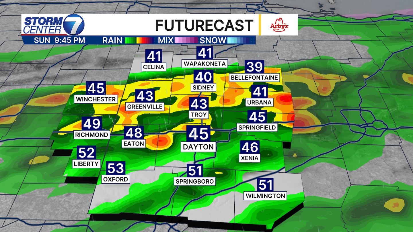
Futurecast shows scattered strong storms behind the cold front on Sunday night. Elevated instability aloft behind the initial cold front can be a focal point for storms to be efficient hail producers. So, we will watch that closely. Stay tuned for updates through the weekend.
©2026 Cox Media Group