>>TRACK THE CONDITIONS: Live Doppler 7 Radar<<
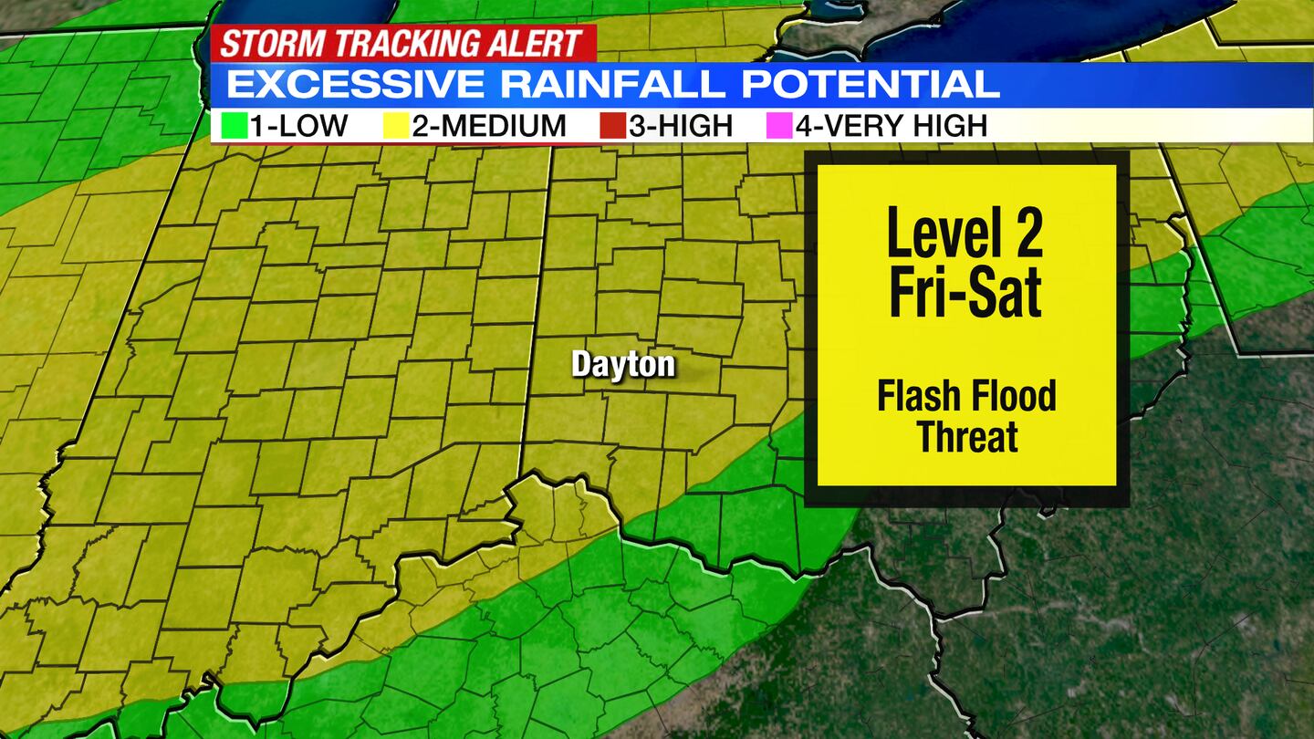
A Flash Flood Watch is in effect through 2 p.m. Saturday for Auglaize, Butler, Champaign, Clark, Clinton, Darke, Greene, Logan, Mercer, Miami, Montgomery, Preble, Shelby, and Warren counties in Ohio and Union and Wayne counties in Indiana.
QUICK-LOOK FORECAST:
- Rain & Storms This Evening
- Some strong, possible flooding
- Drier on Sunday
DETAILED FORECAST:
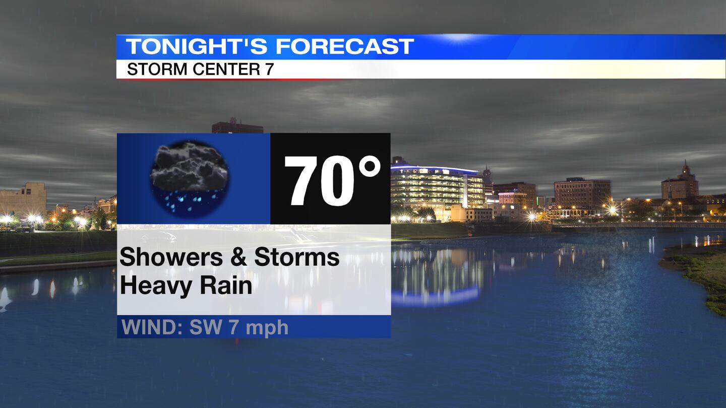
TODAY: More showers and storms will develop in the evening with damaging wind gusts and widespread rain totals of 1 to 3 inches possible and some higher totals possible.
Flash flooding will be possible, which has prompted a Flash Flood Watch to be issued through Saturday afternoon. Storms will continue into the overnight hours.
Temperatures will be in the 70s this evening and lower 70s overnight.
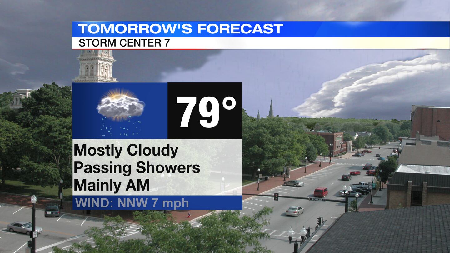
SATURDAY: A few showers and storms will push south tomorrow. Most of the afternoon should remain dry with a small chances for an occasional shower or two. Highs around 80, so a little cooler than normal.
SUNDAY: Partly cloudy with a chance of an isolated thunderstorm, mainly south of I-70. Staying warm and muggy with temperatures in the lower 80s.
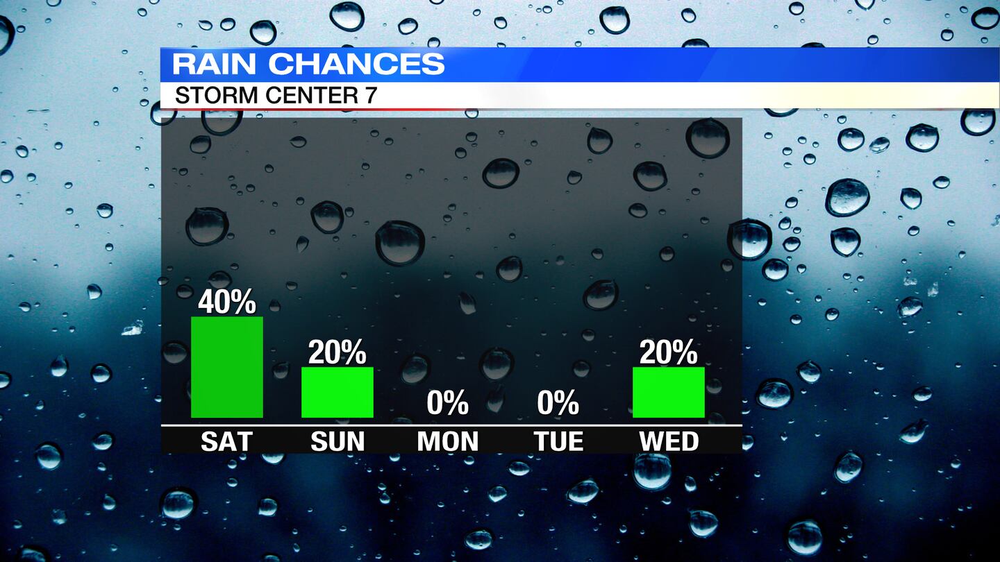
MONDAY: Partly to mostly sunny skies. Another warm and muggy day with temperatures in the middle 80s.
TUESDAY: Mostly sunny, warm and muggy. Highs in the middle to upper 80s.
WEDNESDAY: Partly cloudy, warm, and muggy with an isolated shower chance with highs in the middle 80s.
THURSDAY: Partly cloudy, warm, and muggy with an isolated shower chance with highs in the middle 80s.
©2021 Cox Media Group


