MIAMI VALLEY — QUICK-LOOK FORECAST
- Uncomfortably hot next few days
- Heat index 100+ Wednesday
- Better storm chances late this week
FULL FORECAST
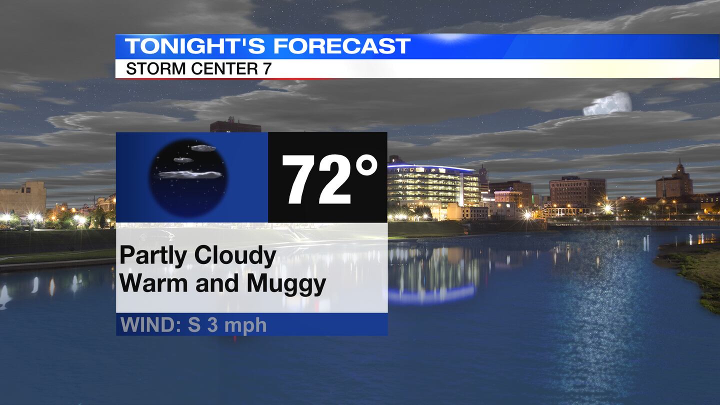
TODAY: An air quality alert will be in effect for Butler and Warren counties until midnight. Hot and and muggy through the evening with temperatures falling through into the 80s. A few isolated downpours or storms are possible through sunset. Partly cloudy and warm overnight with a low temperature in the lower 70s.
TOMORROW: Another hot and humid day with a few passing showers or storms possible in the afternoon and evening. Wednesday looks to be the hottest day this week. Highs in the low to mid 90s. Heat index climbing to the upper 90s to lower triple digits. Storms should end early Wednesday night then partly cloudy with a low in the lower 70s.
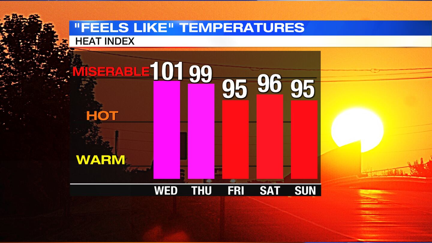
THURSDAY: Partly cloudy, hot and muggy on Thursday with highs around 90 degrees. Heat index in the upper 90s to near 100. A few passing showers and storms are possible during the day, especially in the afternoon.
FRIDAY: Partly to mostly cloudy with a chance for a few passing showers and thunderstorms. Still quite hot with highs in the lower 90s and heat index values in the mid 90s.
SATURDAY: Mix of sun and clouds, a stray shower or thunderstorm is possible, but most spots will remain dry. Temperatures stay hot and humid, around 90 degrees.
SUNDAY: Mix of sun and clouds, a few passing showers or thunderstorms. Temperatures stay hot and humid, around 90 degrees.
MONDAY: Mostly cloudy with a better chance for scattered showers and thunderstorms. Warm and muggy with highs in the middle 80s.
©2021 Cox Media Group