QUICK-LOOK FORECAST:
- Summer-like heat through Tuesday
- Rain and storms by Tuesday night / Wednesday
- Above average temps again after Wednesday
>> TRACK THE CONDITIONS: Live Doppler 7 Radar
DETAILED FORECAST:

TODAY: Warm and muggy through the evening with temperatures falling through the 80s. Also, a little breezy at times, too. A few more clouds arrive overnight but staying dry. Lows around 70 degrees.
TUESDAY: Scattered clouds expected on Tuesday. Warm and muggy again in the upper 80s. An isolated shower possible in the afternoon/evening and a bit breezy. Better chance of scattered showers and storms overnight Tuesday.
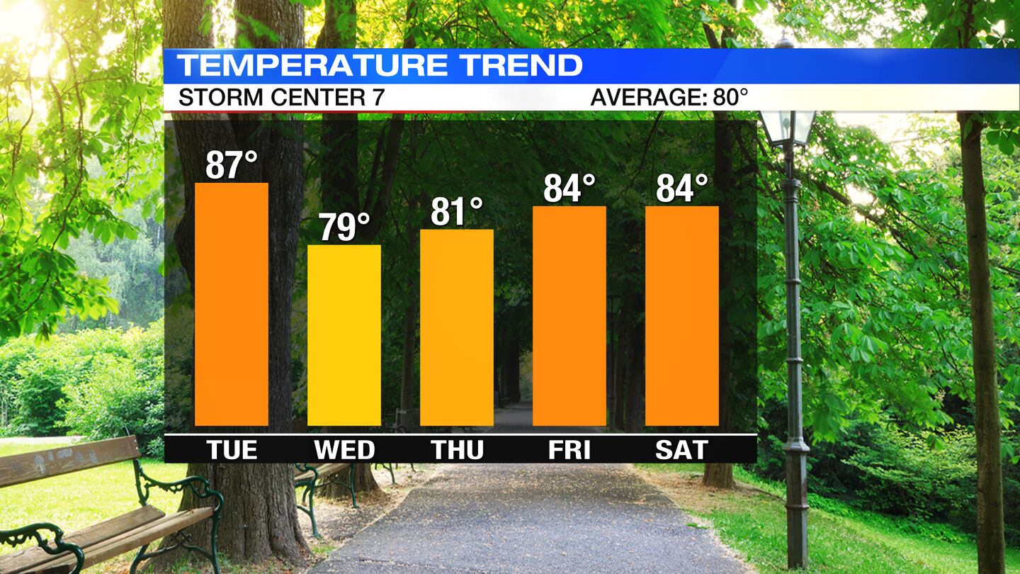
WEDNESDAY: Mostly cloudy with scattered showers and storms. Still breezy. Not as warm, but seasonable with highs in the upper 70s to lower 80s.
THURSDAY: Partly cloudy skies. A chance of a few more showers and isolated afternoon storms. Temperatures are staying warm, in the lower 80s.
FRIDAY: Partly cloudy and warm for Friday. A stray shower or thunderstorm is possible. Highs climbing to the middle 80s.
SATURDAY: Partly cloudy skies. Can’t rule out a storm or two during the afternoon. Warm again with highs in the mid 80s.
SUNDAY: Partly cloudy skies with an isolated passing shower or two with temperatures staying warm, in the middle to upper 80s.
©2021 Cox Media Group


