
DAYTON — A cold front up to our north will eventually help to break down the ridge of high pressure that has controlled our temperatures over the last weeks.
[DOWNLOAD: Free Storm Center 7 Weather app for alerts as news breaks]
Cooler air will set in behind the front, with high temperatures forecast in the low 80s and low temperatures Monday morning in the 50s.
However, we must wait for this treasure.
Ahead of the front, there is still warm, moist air that will dominate and fuel the potential for isolated severe storms late Thursday afternoon and early Friday.
And again late Friday into Saturday until the front passes through.
[WATCH Storm Center 7 Weather on the following devices]
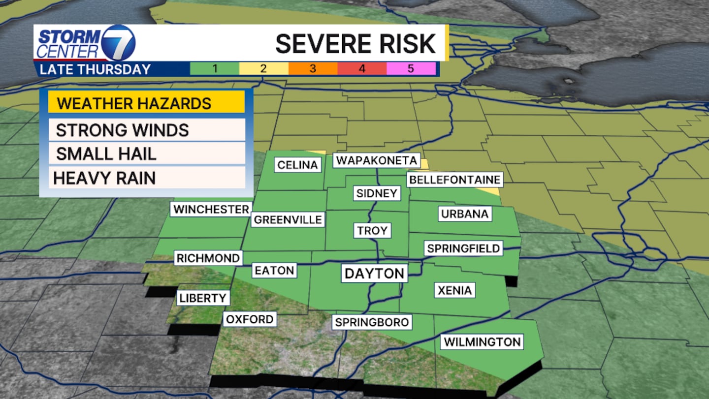
Not everyone will get a storm.
In fact, most will stay dry.
Any storm that develops has the potential to bring damaging winds and small hail.
The Storm Prediction Center has shifted the slight risk farther north, leaving most of the Miami Valley under a marginal risk.
This means less of a severe weather risk.
However, this doesn’t mean we’re out of the woods.
©2026 Cox Media Group


