UPDATE @ 10:20 p.m.: A Flood Advisory has been issued for Butler County until 12:45 a.m.
UPDATE @ 9:43 p.m.: Winds of 60 mph have been reported at the Miami University Airport in Oxford, Butler County.
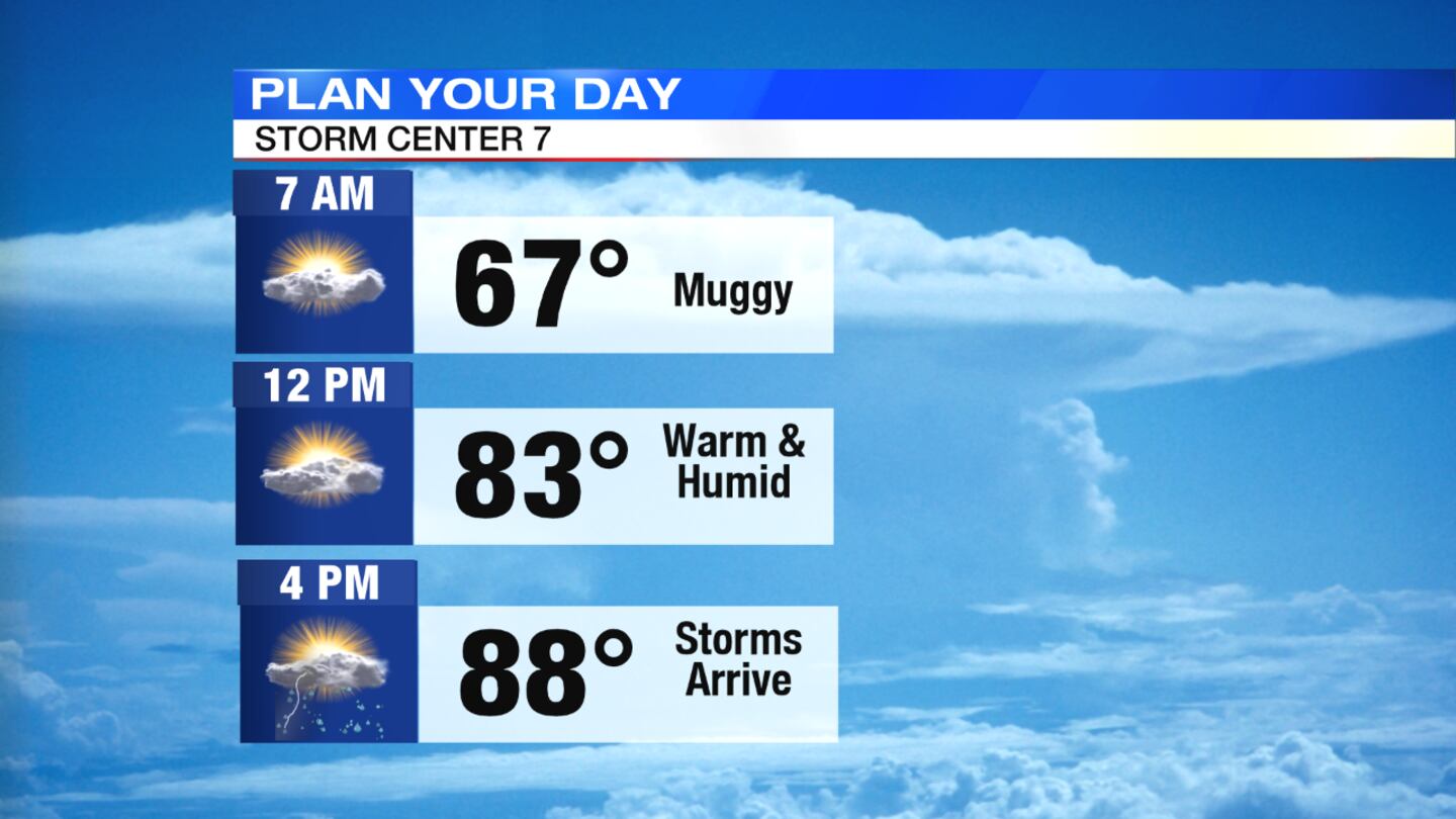
QUICK-LOOK FORECAST:
- Strong storms this evening and tonight
- Hot, humid and stormy end to week
- Sunny, less humid, cooler weekend.
>> TRACK THE CONDITIONS: Live Doppler 7 Radar

DETAILED FORECAST:
THIS EVENING AND OVERNIGHT: We’ll see a mix of sun and clouds into the evening with breezy to windy conditions and temperatures in the 80s and muggy, according to News Center 7 Meteorologist Dontae Jones. Storms will develop late afternoon and into the evening. A few storms could become severe with damaging wind and large hail the main threats. Localized flooding is also possible as storms can move slowly and over the same areas. Another round of storms are possible into the overnight hours. Temperatures overnight will be warm and muggy, in the mid 60s.
>> STAY INFORMED: Download the WHIO Weather App
THURSDAY: A few passing showers is possible in the morning then a chance of pop up showers and thunderstorms in the afternoon and evening. There is some dry time but skies will be variably cloudy. Temperatures will be warm and muggy, in the mid 80s.
FRIDAY: Conditions will remain warm and muggy with temperatures in the upper 80s. It will be partly cloudy with the chance for an isolated storm in the afternoon.
SATURDAY: Clouds are expected to decrease for more sunshine. Conditions will still be mild but not as muggy. Highs will be in the low 80s.
SUNDAY: It will be a nice end to the weekend with sunshine and highs around 80.
MONDAY: Expect a nice start to the work week with sunshine but warmer and a little muggier. Highs in the mid 80s
© 2020 Cox Media Group