QUICK-LOOK FORECAST
- Winter Weather Advisory in effect through 7 a.m. Monday
- Accumulating snow expected; ice possible
- Colder air returns midweek
>> STAY INFORMED: School and business closings
>> Track the conditions with Live Doppler 7 Radar
DETAILED FORECAST
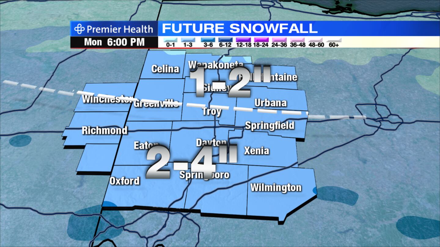
Overnight: Snow accumulations up to 4 inches are expected for areas along and south of Interstate 70. Areas north of I-70 will accumulate 1 to 2 inches of snow. Snow will switch to a wintry mix, possibly containing freezing rain, after midnight. A thin glaze of ice is most probable between I-70 and south to the Ohio River. Temperatures will hover around 32 degrees overnight with light winds.
>> Winter Weather Awareness: Are you prepared?
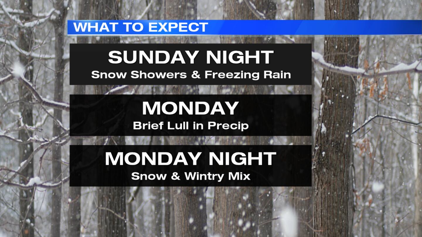
Monday: A dicey morning commute is likely following the overnight accumulating snow and ice. A scattered wintry mix is possible throughout the day, but activity looks to significantly diminish until dinner time. After the daytime lull, another round of light snow will begin in the evening and overnight, with 1 or 2 inches of snow possible.
>> Download the WHIO app to stay updated on weather alerts
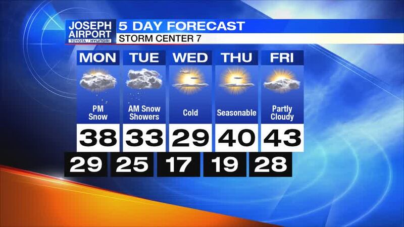
Tuesday: A few lingering morning snow showers are possible to the south and east of Dayton. It will be a blustery, cold day with highs in the low 30s. Wind chills could be in the 20s or upper teens.
Wednesday: Sunshine will return but temperatures will remain low. Morning temperatures will be in the teens and only reach the mid-20s. The day will be breezy, so wind chills will likely range from the single digits to the teens.
>> How does salt help icy roads?
Thursday: There will be plenty of sunshine with seasonable temperatures. Highs will climb to nearly 40 degrees.
Friday: Expect partly cloud skies with highs climbing into the middle 40s.