
DAYTON — A winter storm continues to pummel the Miami Valley with potentially record-breaking snowfall.
Sunday may be the most amount of snowfall Dayton has ever received in a single day in its recorded history! Hey, it’s Storm Center 7 Meteorologist Ryan Marando.
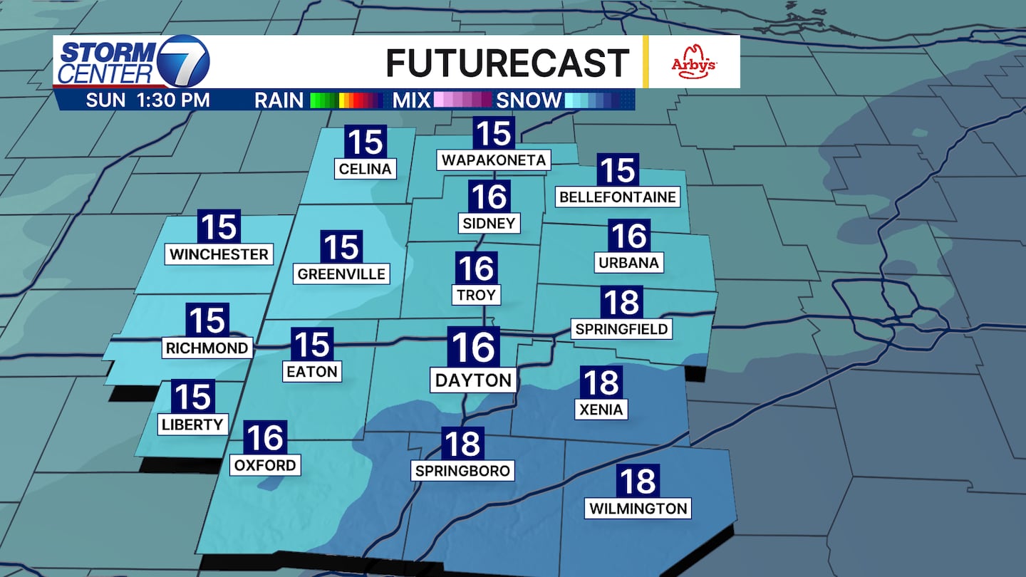
Some areas this morning are already nearing a foot of snow, and more will be falling through the afternoon. If more than 12.2 inches of snow accumulates at the Dayton International Airport, it will be its snowiest day on record. And that’s beating the previous record from the blizzard of 1978.
[DOWNLOAD: Free Storm Center 7 Weather app for alerts as news breaks]
More bands of moderate to heavy snow will continue through the afternoon hours. So this means snow will continue to accumulate, especially southeast of Dayton. The snow should be ending this evening around 5 to 7 p.m.
[WATCH Storm Center 7 Weather on the following devices]
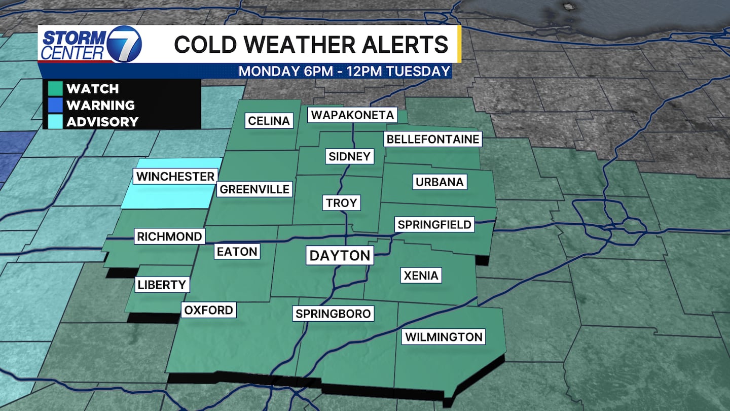
Then we turn to the dangerous cold from Monday into Tuesday and next week. Air temperatures Tuesday through Friday morning will drop below zero.
This means wind chills could be approaching -20 by Tuesday morning. A cold weather watch has been posted for wind chills potentially dropping that low. This is a dangerous cold; frostbite could set in as soon as 15 minutes.
©2026 Cox Media Group


