QUICK-LOOK FORECAST:
- Showers/Storms Tonight
- Isolated Storms Strong/Severe this Evening
- Dry, Sunny but Cool Weekend
>>TRACK THE CONDITIONS: Live Doppler 7 Radar
DETAILED FORECAST:
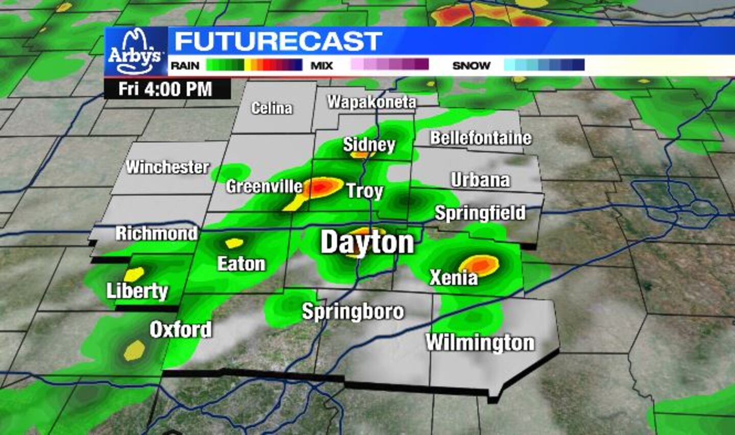
TODAY: A line of showers and storms will pass through this evening from northwest to southeast.
A few isolated strong to severe storms may develop with damaging winds the primary threat, but an isolated tornado or localized flash flooding cannot be ruled out.
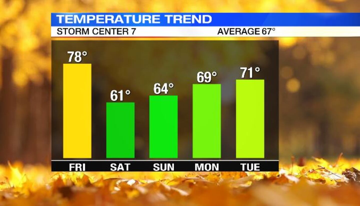
Temperatures will remain on the warmer side with falling into the 60s.
>> You need this: Download the FREE WHIO Weather App and stay weather aware
Scattered showers continue into the night, but the threat for severe weather will diminish past 9pm. Overnight lows fall to the lower 50s
SATURDAY: A few showers early Saturday then clouds break for some sunshine through the afternoon. It will be a cool and breezy day with highs in the lower 60s.
SUNDAY: A sunny, fall day! Highs in the middle 60s.
MONDAY: Sunny and cool again with highs in the upper 60s.
TUESDAY: Mostly sunny skies again on Tuesday. Highs in the lower 70s for the afternoon.
WEDNESDAY: Mostly sunny and mild for Wednesday with highs in the lower 70s.
THURSDAY: Mostly cloudy with a few showers possible. Highs in the upper 60s.
FRIDAY: Mostly cloudy with a stray shower possible. Most spots will remain dry. A little breezy, too. Also, a cooler day with highs in the lower 60s.
©2021 Cox Media Group


