QUICK-LOOK FORECAST
- Cool but calm tonight
- Rain and snow showers Saturday
- Cooler weekend
>> Tips to prepare your home for winter weather
>> TRACK THE CONDITIONS: Live Doppler 7 Radar
DETAILED FORECAST
Overnight: It will be mainly clear to start, then clouds increase towards morning with overnight lows falling to the upper 20s, Storm Center 7 Chief Meteorologist McCall Vrydaghs said.
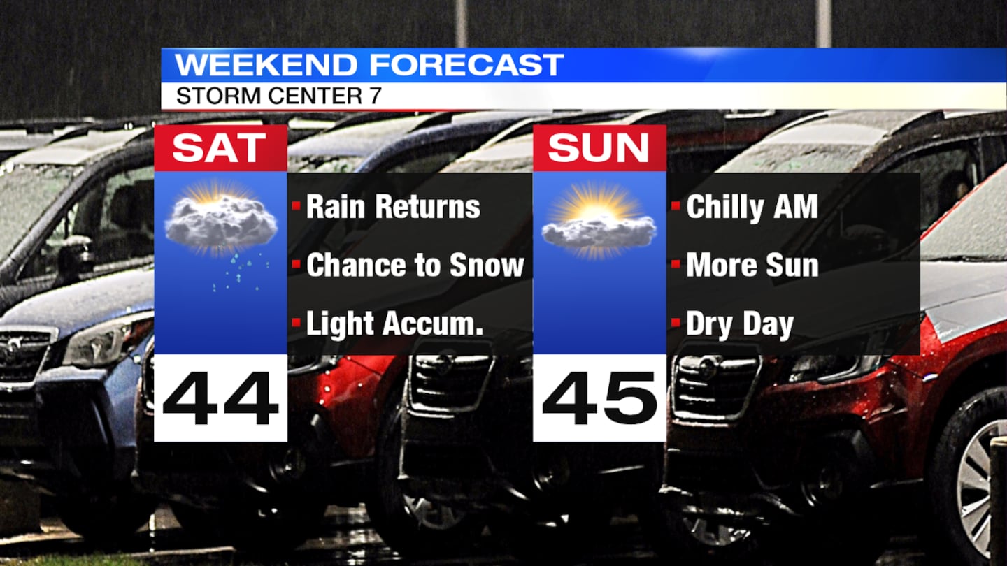
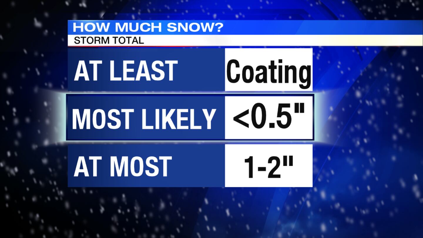
Saturday: After a dry start, clouds increase quickly. The next system will bring a chilly rain late morning into the afternoon with highs in the lower to middle 40s. Cold air moves in towards the evening, bringing a transition to light snow showers. Accumulation of a coating up to a half inch is likely, but some spots, especially northest, may see between 1 and 2 inches. Grassy and elevated surfaces is where most snow would collect. Temperatures drop quickly into the 20s overnight, which may lead to slick spots.
Sunday: The day will be dry, but there is a possibility of slicks spots in the morning since temperatures will be below freezing. There will be a mix of sun and clouds for the afternoon. High temperatures will be in the middle 40s.
>> Cloudy with a Chance of Podcast: Walking the Path of the Storm
Monday: The week will begin quietly with slightly warmer temperatures. Highs will be in the low 50s. There will be sunshine and a few clouds.
Tuesday: The day will start off dry and become breezy. Highs will be in the mid-50s. At night, rain showers and gusty winds return.
Wednesday: It will be cloudy and cold to start with a few flurries possible. It also still be a bit windy as clouds break into the afternoon with highs in the upper 40s.


