
DAYTON — Isaias is now the first hurricane of the 2026 Atlantic season, and the latest first hurricane in the Atlantic in over 120 years.
Isaias has intensified overnight, with max winds as of the 5 AM advisory from the National Hurricane Center of 80 MPH.
This storm is forecast to become a CAT 2 late Thursday with winds at its strongest of 110 MPH.
Landfall is forecast late Friday.
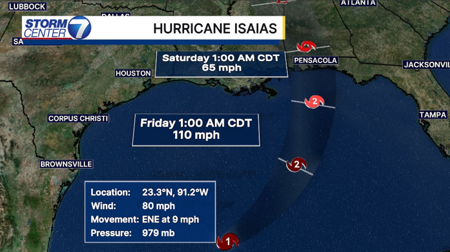
These Gulf storms typically overperform.
What I’m saying is, the forecast calls for a strong CAT 2, but a CAT 3 is possible.
[DOWNLOAD: Free Storm Center 7 Weather app for alerts as news breaks]
Record warm Gulf waters are helping to fuel Isaias at the moment.
But wind shear- strong upper-level winds.
They play an even bigger role in whether this storm builds or breaks.
While wind shear is typically bad for a tropical system, in some instances it can help build up or strengthen the storm.
The question then becomes, “How strong can the warm waters hold the storm before the shear takes over?”
IF Isaias holds strong, then the upper-level winds can help build up the storm for a short amount of time.
IF Isaias is too weak, then the wind shear will tear the storm down. This is more likely at this point in time.
Regardless, storm surge over 7 feet, flooding rains reaching nearly a foot of rain, winds gusting over 60 mph, and numerous tornadoes are likely as the outer bands make their way onto the Gulf shore.
The Gulf Coast, Mississippi, Alabama, and Florida Panhandle coastline will begin to feel the effects late Thursday and into Friday.
Early Friday, the outer bands are now making their way onshore.
[WATCH Storm Center 7 Weather on the following devices]
What does this mean for the Ohio Valley?
The remnants of Isaias, a generic area of low pressure, slide north, increasing our rain chances as early as late Saturday into the overnight hours.
Heavier, steadier rains are expected most of the day Sunday, lingering into early Monday.
Rainfall totals will amount to 1 to 2 inches.
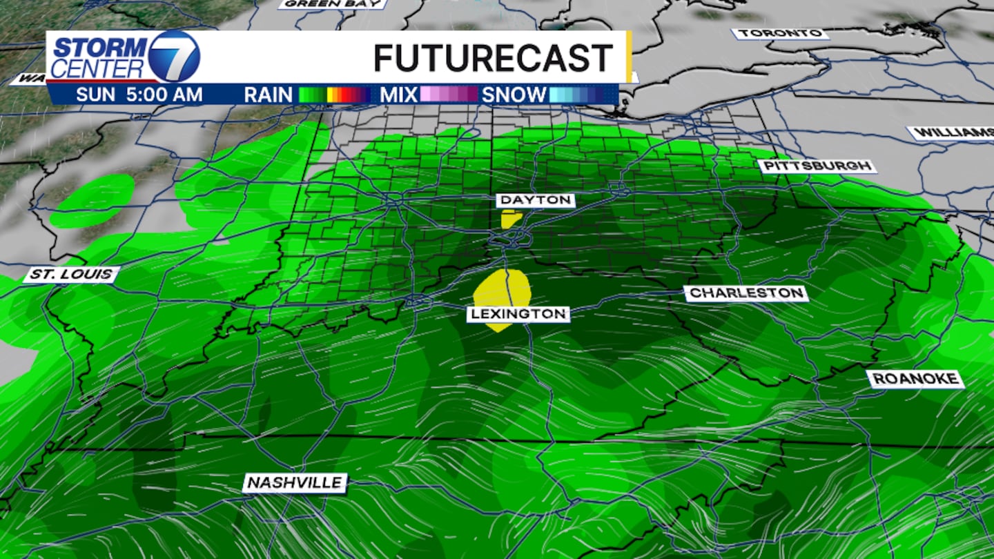
Strong winds are also likely.
Wind gusts will reach nearly 30 MPH.
This will be short-lived.
The system is forecast to push out by Monday afternoon.
©2026 Cox Media Group


